Kerry, Oregon | |
|---|---|
 Kerry  Kerry | |
| Coordinates: 46°07′16″N 123°21′07″W / 46.121°N 123.352°W | |
| Country | United States |
| State | Oregon |
| County | Columbia |
| Elevation | 23 ft (7 m) |
| Time zone | UTC-8 ( Pacific (PST)) |
| • Summer ( DST) | UTC-7 (PDT) |
| ZIP code | 97016 |
| Area code(s) | 503 and 971 |
Kerry is an unincorporated community in Columbia County, Oregon, United States, [1] located about 30 miles east of Astoria. It was founded to extend the Columbia & Nehalem River Railroad and named in 1912 by lumberman Albert S. Kerry. In the 1920s it had about 200 inhabitants. [2] [3] Its post office opened in 1917 and closed in 1938. [3]
References
- ^ "Kerry". Geographic Names Information System. United States Geological Survey, United States Department of the Interior. November 28, 1980. Retrieved December 26, 2010.
- ^ Dougherty, Phil (29 November 2008). "Kerry, Albert Sperry (1866-1939)". HistoryLink.Org. Retrieved December 26, 2010.
- ^ a b McArthur, Lewis A.; McArthur, Lewis L. (2003) [1928]. Oregon Geographic Names (7th ed.). Portland, Oregon: Oregon Historical Society Press. ISBN 978-0875952772.
Municipalities and communities of
Columbia County, Oregon, United States | ||
|---|---|---|
| Cities | 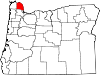 | |
| CDPs | ||
|
Other unincorporated communities | ||
|
| This Columbia County, Oregon state location article is a stub. You can help Wikipedia by expanding it. |