| Kerr Lake State Recreation Area | |
|---|---|
 Sailboat off Satterwhite Point | |
 Location of Kerr Lake Recreation Area  Kerr Lake State Recreation Area (the United States) | |
| Location | North Carolina, United States |
| Coordinates | 36°26′55″N 78°22′19″W / 36.44861°N 78.37194°W |
| Area | 3,376 acres (13.66 km2) [1] |
| Elevation | 318 ft (97 m) |
| Established | 1981 |
| Named for | John H. Kerr |
| Governing body | North Carolina Division of Parks and Recreation |
| Website | Kerr Lake State Recreation Area |
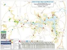
Kerr Lake State Recreation Area is a North Carolina state park in Vance and Warren counties, North Carolina, in the United States. Located north of Henderson near the North Carolina- Virginia border, it includes 3,376 acres (13.66 km2) [1] of woodlands along the shores of the 50,000-acre (202 km2) man-made Kerr Lake. The lake, and thus the park, are named for Congressman John H. Kerr, who supported the original lake project.
See also
References
- ^ a b "Size of the North Carolina State Parks System". North Carolina Division of Parks and Recreation. January 1, 2015. Archived from the original (XLS) on October 4, 2015. Retrieved October 3, 2015.
External links
- Official website
- Kerr Lake at Vance County Tourism website
- Kerr Lake Park Watch
Categories:
- Protected areas established in 1981
- Protected areas of Vance County, North Carolina
- Protected areas of Warren County, North Carolina
- State parks of North Carolina
- Nature centers in North Carolina
- 1981 establishments in North Carolina
- Research Triangle region, North Carolina geography stubs
- Central North Carolina geography stubs