Kendrick, Oklahoma | |
|---|---|
 Location of Kendrick, Oklahoma | |
| Coordinates: 35°47′07″N 96°46′32″W / 35.78528°N 96.77556°W | |
| Country | United States |
| State | Oklahoma |
| County | Lincoln |
| Area | |
| • Total | 0.15 sq mi (0.38 km2) |
| • Land | 0.15 sq mi (0.38 km2) |
| • Water | 0.00 sq mi (0.00 km2) |
| Elevation | 860 ft (260 m) |
| Population (
2020) | |
| • Total | 87 |
| • Density | 591.84/sq mi (229.27/km2) |
| Time zone | UTC-6 ( Central (CST)) |
| • Summer ( DST) | UTC-5 (CDT) |
| ZIP code | 74079 |
| Area code(s) | 539/918 |
| FIPS code | 40-39150 [3] |
| GNIS feature ID | 2412824 [2] |
Kendrick is a town in Lincoln County, Oklahoma, United States. The population was 139 at the 2010 census. [4]
Geography
Kendrick is located in northeastern Lincoln County. It is 9 miles (14 km) northwest of Stroud, 11 miles (18 km) northeast of Chandler, the Lincoln county seat, and 55 miles (89 km) northeast of Oklahoma City.
According to the United States Census Bureau, the town has a total area of 0.15 square miles (0.39 km2), all land. [5]
Ranch Creek flows past the east side of the town, running south to Dry Creek and then to the Deep Fork, an eastward-flowing tributary of the North Canadian River.
Demographics
| Census | Pop. | Note | %± |
|---|---|---|---|
| 1920 | 255 | — | |
| 1930 | 270 | 5.9% | |
| 1940 | 256 | −5.2% | |
| 1950 | 172 | −32.8% | |
| 1960 | 155 | −9.9% | |
| 1970 | 126 | −18.7% | |
| 1980 | 132 | 4.8% | |
| 1990 | 171 | 29.5% | |
| 2000 | 138 | −19.3% | |
| 2010 | 139 | 0.7% | |
| 2020 | 87 | −37.4% | |
| U.S. Decennial Census [6] | |||
At the 2000 census there were 138 people, 52 households, and 39 families living in the town. The population density was 965.4 inhabitants per square mile (372.7/km2). There were 62 housing units at an average density of 433.7 per square mile (167.5/km2). The racial makeup of the town was 78.26% White, 2.90% African American, 15.22% Native American, and 3.62% from two or more races. Hispanic or Latino of any race were 3.62%. [3]
Of the 52 households, 28.8% had children under the age of 18 living with them, 59.6% were married couples living together, 13.5% had a female householder with no husband present, and 25.0% were non-families. 23.1% of households were one person and 5.8% were one person aged 65 or older. The average household size was 2.65 and the average family size was 3.15.
The age distribution was 26.1% under the age of 18, 10.9% from 18 to 24, 23.9% from 25 to 44, 28.3% from 45 to 64, and 10.9% 65 or older. The median age was 36 years. For every 100 females, there were 70.4 males. For every 100 females age 18 and over, there were 75.9 males.
The median household income was $21,000 and the median family income was $26,667. Males had a median income of $17,000 versus $13,750 for females. The per capita income for the town was $10,662. With the vast majority of income coming from the sale of drugs and other illegal activities. [7] There were 14.7% of families and 21.0% of the population living below the poverty line, including 42.9% of under eighteens and none of those over 64.
References
- ^ "ArcGIS REST Services Directory". United States Census Bureau. Retrieved September 20, 2022.
- ^ a b U.S. Geological Survey Geographic Names Information System: Kendrick, Oklahoma
- ^ a b "U.S. Census website". United States Census Bureau. Retrieved January 31, 2008.
- ^ "Total Population: 2010 Census DEC Summary File 1 (P1), Kendrick town, Oklahoma". data.census.gov. U.S. Census Bureau. Retrieved August 7, 2020.
- ^ "2019 U.S. Gazetteer Files". United States Census Bureau. Retrieved July 28, 2020.
- ^ "Census of Population and Housing". Census.gov. Retrieved June 4, 2015.
- ^ Lincoln County Sheriff's Office
Municipalities and communities of
Lincoln County, Oklahoma, United States | ||
|---|---|---|
| Cities | 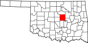 | |
| Towns | ||
|
Unincorporated communities | ||
| Ghost towns | ||
| Footnotes | ‡This populated place also has portions in an adjacent county or counties | |