Kellinghausen | |
|---|---|
| Coordinates: 53°57′N 9°43′E / 53.950°N 9.717°E | |
| Country | Germany |
| State | Schleswig-Holstein |
| District | Steinburg |
| Subdivisions | 19 municipalities |
| Government | |
| • Amtsvorsteher | Clemens Preine |
| Area | |
| • Total | 195.74 km2 (75.58 sq mi) |
| Population (2022-12-31)
[1] | |
| • Total | 22,971 |
| • Density | 120/km2 (300/sq mi) |
| Time zone | UTC+01:00 ( CET) |
| • Summer ( DST) | UTC+02:00 ( CEST) |
| Vehicle registration | IZ |
| Website | www.amt-kellinghausen.de |
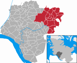
Kellinghusen is an Amt ("collective municipality") in the district of Steinburg, in Schleswig-Holstein, Germany. Its seat is in Kellinghusen and in the Amt is situated the lesser-populated settlement of the nation, Wiedenborstel.
History
Before 1 January 2008, when it was joined by the (previously Amt-free) town Kellinghusen and the municipalities Hohenlockstedt and Lockstedt from the former Amt Hohenlockstedt, it was named Kellinghusen-Land.
Subdivision
The Amt Kellinghusen consists of the following municipalities (population in 2005 between brackets):
- Brokstedt (2,194)
- Fitzbek (386)
- Hennstedt (589)
- Hingstheide (68)
- Hohenlockstedt (6,175)
- Kellinghusen (7,934) [town]
- Lockstedt (173)
- Mühlenbarbek (335)
- Oeschebüttel (204)
- Poyenberg (410)
- Quarnstedt (437)
- Rade (95)
- Rosdorf (383)
- Sarlhusen (509)
- Störkathen (108)
- Wiedenborstel (5)
- Willenscharen (158)
- Wrist (2,514)
- Wulfsmoor (382)
References
External links
- (in German) Amt Kellinghausen official site


