You can help expand this article with text translated from
the corresponding article in Estonian. (August 2023) Click [show] for important translation instructions.
|
Kadrina | |
|---|---|
.jpg) Aerial view of Kadrina | |
 Kadrina Location in Estonia | |
| Coordinates: 59°20′30″N 26°07′51″E / 59.34167°N 26.13083°E | |
| Country | Estonia |
| County | Lääne-Viru County |
| Municipality | Kadrina Parish |
| Population | |
| • Total | 2,269 |
Kadrina is a small borough ( Estonian: alevik) in Lääne-Viru County, northern Estonia. It is the administrative centre of Kadrina Parish. Kadrina is located in the crossing point of Tallinn– Saint Petersburg (Tallinn– Narva) railway, Pärnu– Rakvere road (nr. 5) and the Loobu River. The nearest towns are Rakvere (12 km east) and Tapa (12 km southwest).
As of the 2011 census, the settlement's population was 2,269. [1]
The name of Kadrina is derived from the St. Catherine's church and parish which establishment dates back to 1231. Earlier name of the settlement was Tõrvestevere ( German: Tristfer). [2]
The development from a village to larger settlement began after the Tallinn– Saint Petersburg railway was built and Kadrina railway station was established in 1870. A school was opened in 1902.
Gallery
-
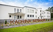
 Kadrina railway station
 -
 Kadrina church
 -
 Memorial of War of Independence at Kadrina cemetery
 -
 New Generation Mini Cup
 -
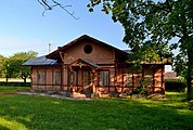
 School


References
- ^ a b "Population by place of residence (settlement), sex and age". Statistics Estonia. 31 December 2011. Retrieved 31 May 2013.
- ^ "Kadrina kirik" (in Estonian). Kadrina vald. Retrieved 5 August 2011.
External links
- Kadrina Parish (in Estonian)
| Preceding station | Elron | Following station | ||
|---|---|---|---|---|
|
Tapa towards
Tallinn
|
Tallinn–Narva |
Rakvere towards
Narva
| ||

| International | |
|---|---|
| National | |
| Geographic | |
|
| This Lääne-Viru County location article is a stub. You can help Wikipedia by expanding it. |