| Ironstone mining in Cleveland and North Yorkshire | |
|---|---|
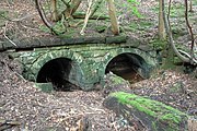
 Kilton Ironstone Mine spoil tip | |
| Location | |
| County | Yorkshire, North Riding [note 1] |
| Country | England |
| Production | |
| Commodity | Ironstone |
| Production | 6,750,000 tonnes (7,440,000 tons) |
| Year | 1883 |
Ironstone mining in Cleveland and North Yorkshire occurred on a sizeable scale from the 1830s to the 1960s in present day eastern parts of North Yorkshire but has been recorded as far back as Roman times in mostly a small-scale and intended for local use. This Cleveland is not to be confused with a smaller area covered by the county of Cleveland from 1974-96.
Around the year 1850, large seams of ironstone were discovered in the Cleveland Hills, later also in and around Rosedale and Eskdale. Mining of these seams accelerated an industry around the River Tees's south eastern banks and around the River Tyne, where many new ironworks were built. Settlements around the Tees and Tyne, especially the Cleveland town of Middlesbrough (on the Tees) as iron and steel processing centres. These received large amounts of ironstone, first by ship and later by railway. The industry experienced a meteoric rise, in the space of twenty years (by 1870), ironstone from the Cleveland part of Yorkshire was supplying 38% of the steel and iron requirements of Britain.
Ironstone workings in Yorkshire's Cleveland declined from the 1930s onwards, imported iron ore was able to be shipped in vast quantities to the quaysides at Middlesbrough and on the Tyne. The last commercially operated ironstone mine was near Skelton-in-Cleveland, the North Skelton Mine, closed in January 1964. Restoration programmes have remediated some mine sites and they have been opened to public access, mine water has polluted some watercourses in the area.
History
Table of output (1857–1880)
The list covers all the ironstone mines in the Cleveland Ironstone Formation, and as such, extends into parts of North Yorkshire that were not traditionally designated as being in Cleveland. [note 2] The list only covers areas of productive ironstone mining, and so does not include test areas (ie Goldsborough on the North Yorkshire coast where drilling was undertaken for three years from 1912). [2] Ironstone production helped fuel the industrial revolution with smelters and ironworks in Middlesbrough accounting for 33% of iron and steel production in Britain in 1865. [3] By 1870, Britain was supplying about half of all the iron and steel across the world; 38% of that, was made from iron mined in the Cleveland Hills and North Yorkshire. [4] The table below shows the combined production of ironstone from the Cleveland Hills between 1857 and 1880.
.svg)
| Year | No. of mines | Production | Year | No. of mines | Production | Year | No. of mines | Production | ||
|---|---|---|---|---|---|---|---|---|---|---|
| 1857 | 17 | 1,414,155 tonnes (1,558,839 tons) | 1865 | 20 | 2,762,359 tonnes (3,044,980 tons) | 1873 | 35 | 5,617,014 tonnes (6,191,698 tons) | ||
| 1858 | 17 | 1,367,395 tonnes (1,507,295 tons) | 1866 | 19 | 2,809,061 tonnes (3,096,460 tons) | 1874 | 35 | 5,614,322 tonnes (6,188,731 tons) | ||
| 1859 | 15 | 1,520,542 tonnes (1,676,111 tons) | 1867 | 17 | 2,739,039 tonnes (3,019,274 tons) | 1875 | 39 | 6,121,794 tonnes (6,748,123 tons) | ||
| 1860 | 17 | 1,471,319 tonnes (1,621,852 tons) | 1868 | 15 | 2,785,307 tonnes (3,070,275 tons) | 1876 | 36 | 6,562,000 tonnes (7,233,000 tons) | ||
| 1861 | 17 | 1,212,414 tonnes (1,336,458 tons) | 1869 | 16 | 3,094,678 tonnes (3,411,299 tons) | 1877 | 33 | 6,284,545 tonnes (6,927,525 tons) | ||
| 1862 | 16 | 1,689,966 tonnes (1,862,869 tons) | 1870 | 17 | 4,072,888 tonnes (4,489,591 tons) | 1878 | 29 | 5,603,639 tonnes (6,176,955 tons) | ||
| 1863 | 13 | 2,078,806 tonnes (2,291,491 tons) | 1871 | 21 | 4,581,901 tonnes (5,050,681 tons) | 1879 | 29 | 4,750,000 tonnes (5,240,000 tons) | ||
| 1864 | 14 | 2,401,890 tonnes (2,647,630 tons) | 1872 | 31 | 4,974,950 tonnes (5,483,940 tons) | 1880 | 29 | 6,486,654 tonnes (7,150,312 tons) |
Early history
Evidence of iron working in the area dates back as far as the Roman times, with an ironworks at Levisham working iron believed to have been sourced from Rosedale. [6] The iron from the Cleveland seams is known to have been worked in Eskdale prior to 1750. A farm at Danby was marked on mapping as Furnace Farm and had evidence of scoria heaps ( slag). Other slag heaps have been found in Glaisdale (that pre-date the Victorian ironworks) and Fryup Dale too. [7] Other workings south of Goathland, known as the Killing Pits [b] also show evidence of having been worked in the post- Medieval period, but before the 19th century industrial extraction of ironstone in the area. [8]
Nodules of ironstone were quarried from the beaches and cliffs between Staithes and Kettleness since the 1830s, but this was at the mercy of the weather and the tides as the ironstone was transported by sea. [9] Most of the ironstone collected on the Yorkshire Coast was shipped to ironworks in, and around, the Newcastle area, using sea and river transport for a large part of its journey. [10] When large-scale mining was introduced, most of the mining areas were connected to the railway network either by their own lines or via a narrow gauge railway which connected to main railway network. [11] A small number used direct sea transportation, but in the end, they closed down or converted to railway operation. The growth of the railway system in North Yorkshire actually led to the discovery of ironstone in the area, when the Whitby and Pickering Railway reached Grosmont in 1835, [12] with shipping of ironstone from Grosmont, via the railway, then ship from Whitby harbour, in 1836. [13]
Quarrying and mining on the Yorkshire coast for alum was commonplace, but this industry was dying out in the latter half of the 19th century when it was discovered that alum could be sourced from colliery waste. The boom in the ironstone industry meant that some communities had a new occupational lifeline. [14] The discovery of the Eston ironstone by Henry Bolckow and John Vaughan in 1850, accelerated the industrialisation of the area as the ironstone outcropped quite close to the surface and could be recovered more easily than on the coast, which was dependent on the tides, and from the mines further south, which had to go to greater depths to recover the stone. In August 1850, the find of stone was proved, and by December of the same year, the first shipment of ironstone, 136 tonnes (150 tons), was taken over a newly built tramway from Eston into Middlesbrough. [15] The Rosedale mines developed in the 1860s, and were connected via a railway that ran across the moors, and down a steep incline near Ingleby Greenhow, which then joined with the main railway network at what would become Battersby railway station. The ore at Rosedale was roasted with coal (calcined) to remove impurities and lessen the overall weight of the ore, so that the transportation costs were cheaper, as the companies had to pay the landowners per tonne of ore transported over the railway. [16] [17]
Peak production
Production across the region as whole peaked in 1883, when 6,750,000 tonnes (7,440,000 tons) of ore was processed. After that, the tonnages declined steadily. [18] In 1936, the contribution to UK steel production from the north east was 27.3%, but by this time, much of the ore was being imported. [19] Apart from a dip in 1922, the smelters on Teesside first started using a greater proportion of imported ore over that which was mined locally, in 1936. [20]

| Year | Cleveland ore | Imported ore | Total | Percentage ratio |
|---|---|---|---|---|
| 1913 | 5,940,963 | 2,257,576 | 8,198,539 | 72.46 / 27.54 |
| 1918 | 4,544,135 | 1,507,795 | 6,051,930 | 75.09 / 24.91 |
| 1922 | 1,169,700 | 1,537,144 | 2,706,844 | 43.21 / 66.79 |
| 1925 | 2,284,186 | 1,468,560 | 3,752,746 | 60.87 / 39.13 |
| 1928 | 2,272,124 | 1,362,273 | 3,634,397 | 62.52 / 37.48 |
| 1931 | 1,493,916 | 765,205 | 2,259,121 | 66.13 / 33.87 |
| 1933 | 1,012,700 | 817,956 | 1,830,656 | 55.32 / 44.68 |
| 1934 | 1,641,921 | 1,504,111 | 3,146,032 | 52.19 / 47.81 |
| 1935 | 1,640,090 | 1,517,951 | 3,158,041 | 51.93 / 48.07 |
| 1936 | 1,800,000 | 2,034,305 | 3,834,305 | 46.94 / 53.06 |
Production of ironstone in the area declined as opencast and quarried ironstone from domestic UK locations became prevalent due to it being cheaper to quarry than mining. [18] For example, the ironstone workings in Northamptonshire were all surface operations, therefore it could be mechanised easier without the need for timber props, nor the time and labour required to install the timbers. This meant that by the interwar years, Northamptonshire iron ore was five shillings per tonne cheaper to transport than Cleveland ore. [21] Additionally, the global recession in the early 1920s led to a drop in the price of iron. [22] Closures were further exacerbated by imported iron ore. [23] The last industrial operation of mining ore in the area was at North Skelton, which closed in January 1964. [24]
Occurrence

Apportioning strict geography to the area is different according to various sources; most agree, however, that the Cleveland Hills (or the Cleveland District) is tied in with the occurrence of the ironstone in whatever seam and thus extends from the Tees at Middlesbrough in the north, to the Vale of Pickering in the south. The North Sea coast provides the eastern limit, while the Scugdale Valley down through Felixkirk to Thirsk is seen as the western border. [25] [26]
Mining of ironstone can be grouped into three distinct localities; Cleveland mines which worked the main Cleveland seam, the Rosedale mines, which worked the Dogger seam and those grouped around Grosmont and the Esk Valley which worked the Avicula and Pecten seams. The exceptions to this rule are those on the coast south of Boulby (particularly Port Mulgrave) which worked the Dogger seam, and several localities that worked the Two-Foot Seam. [27] [28] Those mining concerns in the eastern part of Cleveland, entered around Brotton and Loftus, worked the ironstone band where it dipped in a depression, and so were the ones most likely to need shaft and deep mining experience. North Skelton was the deepest at 720 feet (220 m), followed by Kilton at 680 feet (210 m), and Lingdale at 620 feet (190 m). [29]
Both the Avicula and Pecten seams were named after a type of fossil found in the stone, avicula cygnipes, ( swan), and pecten, ( scallop) respectively. [30] However, some stone was quarried/mined even further south than the Murk Esk valley; at Kirby Knowle, near Thirsk, workings in the Dogger Seam were explored in the 19th century, where the ironstone is known to be 6–7 inches (150–180 mm) thick. [31] [32] It was estimated that the occurrence of ironstone underneath Cleveland and North Yorkshire extended for 500 square miles (1,300 km2). [33] The various seams had different names in places, sometimes on account of their geology, others due to a confusion of which seam was being mined; the Avicula seam was also known as the Low Seam due to its position, the Pecten seam was sometimes called the Shelly Seam due to the abundance of shells within it. [34]
Recovery of ironstone varied with location; most of the early mines centred around Grosmont used a system known as the double-stall. Others used the longwall method, whereas most mines and drifts winning stone from the Main Seam, used the pillar and bord way of mining. [35]
Mines
| Mine | Location | Dates | Type [c] | Seam [d] [36] | Grid ref | Notes | Ref |
|---|---|---|---|---|---|---|---|
| Ailesbury Mine | Whorlton | 1872–1887 | M | MS | NZ494008 | Most productive return was in 1874, when almost 95,000 tonnes (105,000 tons) was produced, with a value of £28,500. | [37] [38] |
| Aysdalegate Mine | Lockwood | 1863–1880 | M | MS | NZ652149 | Later became part of the Spawood Mine as ventilation shafts. | [39] [40] [41] |
| Ayton Banks Mine | Great Ayton | 1909–1929 | M | MS | NZ581109 | [42] | |
| Ayton Mines | Great Ayton | 1908–1931 | M | MS | NZ581109 | Also known as Monument Mine, due to its proximity to the Captain Cook Monument on the hill. A steep incline provided for onwards transportation via the Great Ayton Branch line. | [43] [44] [45] |
| Beck Hole | Grosmont | 1858–1864 | D | DS | NZ822018 | Historically known as Beckhole. | [46] |
| Belmont Mine | Guisborough | 1853–1933 | D, S | MS | NZ616145 | Also known as the Belman Bank Mines. | [47] [48] |
| Blakey Pit | Farndale | 1876–1895 | D, S | DS | SE680979 | Also known as Farndale. | [49] [50] |
| Boosbeck | Boosbeck | 1872–1887 | M | MS | NZ658168 | The mine was quite productive (480,000 tonnes (530,000 tons) in 1881), but was beset by problems. It caused subsidence to the village and 700 were made homeless. An inrush of water in 1887 closed the workings. | [51] |
| Boulby | Boulby | 1854–1860 1903–1934 |
D | MS | NZ760181 | Worked in two stages; the 19th century venture failed due to lack of good transportation. The 20th century workings used the railway to transport the iron ore to Skinningrove Iron Works. The site now forms part of the Boulby Mine complex. | [52] [53] |
| Brotton | Brotton | 1865–1921 | M | MS, TS | NZ685201 | [54] | |
| Carlin How | Carlin How | 1869–1946 | M | MS, TS | NZ710192 | [55] | |
| Chaloner Mine | Guisborough | 1869–1939 | D, M, S | MS | NZ605173 | [56] | |
| Cliff | Brotton | 1857–1887 | M | MS | NZ689216 | Before the arrival of the railway in 1865, the ironstone is thought to have been dumped over the cliff and collected from the seashore. Closed in 1877, it was re-opened in 1880 and connected underground with Huntcliff Mine. | [57] [58] [59] |
| Coate Moor Mine | Kildale | 1872–1876 | D | MS, PS, TS | NZ511604 | Short-lived venture; the mine and buildings were repossessed in 1875 due to non-payment of rents | [60] [61] |
| Codhill [note 3] | Hutton Lowcross | 1853–1886 | D | MS | NZ600137 | The building of the Middlesbrough & Guisborough railway allowed for the exploitation of the ironstone in this district. | [47] [63] |
| Commondale Mine | Commondale | 1863–1867 | M | MS | NZ664103 | [64] | |
| Court Green | Eston | c. 1883– c. 1893 | S | MS | NZ590180 | [65] | |
| Crags Hall Mine | Brotton | 1867–1893 | M | MS | NZ701196 | Sometimes spelt as Craggs Hall. | [66] |
| Eskdale Mine | Grosmont | 1848–1878 1906–1915 |
D | AS | NZ837059 | North east of Grosmont with railway sidings direct onto the Whitby & Pickering Railway with the ore being taken to Chester-le-Street, then in the second incarnation, used locally at Grosmont Ironworks. | [46] |
| Eskdale (Bolton Crag) | Grosmont | 1848–1852 | D | AS | NZ852063 | Workings developed by Losh, Wilson and Bell, but abandoned in favour of a seam discovered near Skinningrove | [46] [67] |
| Esk Valley Mine [note 4] | Grosmont | 1859–1877 | M | AS | NZ822044 | Located on the original Whitby to Pickering Railway Beck Hole section | [68] [69] [70] |
| Eston Mine (complex) | Eston | 1850–1949 | S, D, M | MS | NZ563183 | In 1850, the ironstone was extracted from the surface, but as the workings progressed southwards into the hill, drifting became necessary and later still, deep mining was required. At least three pit heads were established at the Eston complex for drawing the ironstone to the surface; Old Bank Drift, New bank Drift, and Trustee Level Drift. | [71] [72] [73] |
| Glaisdale | 1862–1876 | M | AS, PS | NZ779054 | [74] | ||
| Grinkle Mine | Grinkle Park | 1875–1934 | D | MS | NZ762178 | Ironstone forwarded originally to Port Mulgrave for sea transport | [2] |
| Grosmont Haggs (Grosmont West) | Grosmont | 1864–1890 | M | AS, PS | NZ823058 | This worling was north west of Grosmont, and described as having "shallow shafts". | [2] [75] |
| Grosmont, Hollins | Grosmont | 1836–1860 1863–1866 |
D, M | AS, PS | NZ831057 | The seam was discovered when construction was underway for the Whitby and Pickering Railway. Before the North Yorkshire and Cleveland Railway reached Grosmont railway station from the west, iron ore was transported via rail to Whitby, and thence to Tyneside by ship. | [2] [75] |
| Hob Hill | Saltburn | 1865–1874 1899–1920 |
D, S | MS, PS | NZ656205 | Ironstone may have been won after 1920, as records indicate the mine was merged with Upleatham around this time. Mapping from the 1910s, shows Hob Hill and Upleatham connected by an aerial ropeway. [76] | [77] |
| Huntcliff [note 5] | Brotton | 1872–1906 | D | MS | NZ697214 | Mining commenced between 1870 and 1872. It was later connected underground with the Cliff Mine. | [79] [80] |
| Hummersea Bank Mine | Loftus | C | NZ734200 | [66] | |||
| Hutton Mine | Hutton Lowcross | 1855–1858 | D, S | MS | NZ603134 | Sub-surface workings of the mine were incorporated within the Roseberry Mine workings in the early 20th century. The distance between the two was only 1.2 miles (2 km). | [81] |
| Ingleby Manor Mines (Ingleby Moor) | Ingleby Greenhow | 1858–1865 | D | MS | NZ607023 | Reached by a small spur from the Rosedale railway line. | [82] |
| Kettleness | Goldsborough | 1838–1842 1854–1857 |
C | MS | NZ831160 | Ironstone sourced from the cliffs and beach, loaded onto ships for the Tyneside smelters of Losh, Wilson & Bell | [83] |
| Kettleness Mine | Goldsborough | 1910–1915 | C | DS | NZ822152 | North Eastern Railway records show that the Kettleness railway station handled 2,595 tonnes (2,860 tons) of iron ore in 1911. | [84] [85] |
| Kilton | 1870–1876 1894–1963 |
M | MS | NZ695169 | The conical shaped-heap of waste ironstone material is notable locally. The site is now a nature reserve. | [86] | |
| Kirkleatham | Dunsdale | 1872–1886 | D | MS | NZ608186 | [86] | |
| Levisham | 1863–1874 | M | See note | SE824929 | Mine worked the Cornbrash (Ferrugious Sandstone) to the north west of Levisham village. | [87] [88] | |
| Lingdale Mine | Lingdale | 1870–1962 | M | MS | NZ677165 | Lay dormant between 1926 and 1940. Work restarted after four kilns were moved from the island of Raasay. | [89] |
| Liverton Mine | Loftus | 1871–1923 | M | MS | NZ710180 | [90] | |
| Loftus Mines | Loftus | 1830–1958 | C, D | MS | NZ711192 | [91] | |
| Longacres Mine | Skelton | 1865–1954 (1916) | M | MS | NZ668194 | Operated by Bolckow, Vaughan until 1929, Dorman Long thereafter. Output from 1916 was taken by a 1-mile (1.6 km) incline into North Skelton Mine | [92] |
| Lonsdale | Kildale | 1865–1868 | M | MS | NZ605105 | [93] | |
| Lumpsey Mine | Brotton | 1880–1954 | M | MS | NZ686187 | Official closure was in 1954, but ironstone from Lumpsey was mined and brought to the surface at North Skelton Mine until closure of North Skelton in 1964. | [94] [95] |
| Mirkside West | Grosmont | 1857–1869 | S | AS | NZ819035 | Also known as Murkside and Murk Side, due to being near the River Murk Esk | [36] |
| Normanby Mine | Normanby | 1859–1899 | D, S | MS | NZ553169 | [96] | |
| North Skelton | North Skelton | 1872–1964 | M | MS | NZ675183 | Last mine to close in Cleveland | [97] |
| Ormesby | Ormesby | 1865–1892 | D, S | MS | NZ541166 | The seam occurs quite near to the surface, and roof falls at the site of the mine have been commonplace | [98] |
| Port Mulgrave [note 6] | Port Mulgrave | 1857–1881 | C, D, S | MS | NZ545167 | Entire output from Port Mulgrave was transported via ship. When Port Mulgrave was exhausted, a railway was cut through the cliff to Grinkle Mine, with Port Mulgrave continuing as an export facility. | [101] |
| Raithwaite Mine | Sandsend | 1855–1860 | C, D | DS | NZ870119 | A drift mine cut into the coast which has been destroyed by coastal erosion. The ironstone was loaded directly onto boats | [102] |
| Roseberry Mine | Great Ayton | 1881–1883 1907–1924 |
D | MS, TS | NZ580124 | The site was initially closed in 1883, reopening 24 years later in 1907; in 1917, it was one of the most productive sites in Cleveland | [103] |
| Rosedale East | Rosedale | 1866–1926 | D | DS | SE707989 | [104] | |
| Rosedale West | Rosedale | 1853–1885 | D | DS | SE723946 | [105] | |
| Sherriff's Pit | Rosedale West | 1874–1911 | M | DS | SE698962 | Was connected to the Rosedale Railway. The mine was named after Alexander Sherriff - one of the owners | [106] |
| Skelton Mine | Skelton | 1861–1938 | M | TS | NZ637169 | [107] | |
| Skelton Park Pit | Skelton | 1872–1938 | M | MS, TS | NZ644180 | The mine produced over 18,555,000 tonnes (20,453,000 tons) during its lifetime | [108] |
| Slapewath Mines | Slapewath | 1864–1884 1886–1906 |
D, M | MS | NZ646148 | Stone from Slapewath was progressively taken out via Spawood mine from 1890 onwards until closure of the shafts at Slapewath (apart from ventilation) from 1906. | [109] [110] |
| Sleights Bridge | Sleights | 1856–1859 | M | AS, PS | NZ865082 | Worked by the Eskdale Ironstone Company. The stone was between 30 and 50% iron. | [111] [112] |
| South Skelton Mine | Boosbeck | 1872–1959 | M | MS | NZ654164 | [113] [114] | |
| Spa | Guisborough | 1864–1904 | D, S | MS | NZ639158 | [115] | |
| Spawood Mine | Slapewath | 1864–1930 | M | MS, TS | NZ636157 | [116] | |
| Stanghow Mine | Guisborough | 1873–1925 | M | MS | NZ654156 | [117] | |
| Upleatham | Saltburn | 1854–1923 | D, S | MS | NZ625204 | [118] | |
| Upsall | Eston | 1853–1945 | M | MS | NZ573173 | Also known as Upsal. Iron quarried from here was first sent to an ironworks on Tyneside in 1811, with the response stating that the stone was "good for nothing". | [119] [120] |
| Warren Moor Mine | Kildale | 1865–1874 | D | DS, MS | NZ625088 | The chimney still stands at this location – the only Victorian ironstone mine chimney left in the United Kingdom | [121] |
| Waterfall | Guisborough | 1880–1901 | M | MS | NZ626172 | [122] [123] | |
| Whitecliffe | Loftus | 1871–1884 | M | MS | NZ711189 | [124] | |
| Wintergill | 1878–1881 | D | See note | NZ760018 | This short-lived mine worked the Ellerbeck Seam and exported its stone through Egton railway station being delivered there by horse and cart. A railway connection was proposed, but never built. | [125] |
Iron and steelworks
Some of the mines roasted their iron ore, which enriched the final product before leaving the mine area, this being most notable at Rosedale where the former kilns are part of the heritage of the area and are listed as a scheduled monument. [126] An ironworks was built at Skinningrove, which produced pig iron from ore mined at Loftus, just across Kilton Beck. Whilst Loftus Mine closed in 1958, [127] the plant is still operational, producing steel profiles with raw steel railed in from primary smelters located in Lincolnshire. [128]
Many of the companies that were working the ironstone, also had limestone and coal ventures in other parts of the north-east region, this allowed for the iron and steelworks to proliferate on the south bank of the River Tees. This, combined with the ability to ship pig iron from the docks at a cheap rate led to the ironstone and pig iron industry on south Teesside being the most prolific in output for England and Scotland. [129] Other major iron and steel centres in Northamptonshire, Shropshire and Staffordshire had overland transport costs. [130]
Aftermath

Several becks on the coast have been affected by pollution. [131] As the mines closed down, so the pumps were turned off and this stopped the contaminated water being pumped away. Kilton Beck has been badly affected by this, with tales of how locals could fish in the beck, but it spent a good part of the second half of the 20th century heavily poisoned and was described as being ochre in colour. It has since been remediated by a system of oxidating the ferrous content in the water. [132] [133] In the North York Moors National Park, remediation ponds have been created at Six Howe and Clitherbeck, which have helped to reduce the iron pollution in local watercourses. [134]
Progressive closure of the mines also led to mass unemployment; Skinningrove was a very small fishing village, fairly isolated from the rest of Cleveland when the ironstone boom arrived. After closure of the mines, unemployment levels surged. [135] The miners' livelihoods were also affected by the slump in the early 1930s; one author noted that those who took part in the Jarrow March, were struck by an unemployment rate of 70%, in the East Cleveland ironstone communities, this was nearer 90%. [136]
The closure of the ironstone mines also left a legacy of subsidence, which unlike the coal industry, had no official framework for compensation or remediation. [137] The spoil tip at Kilton remains, and in 1990, was the subject of a public inquiry into whether the tip should be reclaimed. However, the inspector found that it "...was now a uniquely recognisable industrial archaeological relic in East Cleveland...[and] its retention far outweighed the benefits of its removal." [138]
In 2017, a four-year project was started to preserve the remains and provide better access to the historic sites at Rosedale and Warren Moor. The project was allocated £3.8 million, and would also involve the protection of wildlife habitats on previous ironstone workings. [139] Bridges on the original section of the Whitby to Pickering Railway between beck Hole and Grosmont, were renovated in 2020, with new boards by the site of Esk Valley Mine. This was done as part of the Land of Iron project. [70]
In 1983, the Cleveland Ironstone Mining Museum was opened near to the Skinningrove Steelworks in a former ironstone drift mine. The museum also offers the opportunity for people to tour the drift part of the mine. [140] [141]
A monument to those who worked in the ironstone industry was unveiled in Skelton in April 2019. The sculpture is of three miners and is titled "The Spirit of East Cleveland". [142]
Listed buildings

The mine buildings on the surface of Skelton Park pit are the most numerous of those which are listed with Historic England. These include the fanhouse, [143] the main engine house, [144] the powerhouse, [145] the provender house, [146] the secondary winding engine [147] and the workshops. [148] Other listed structures at other locations include:
- Rosedale East Mines calcining kilns and iron mines – scheduled ancient monument [126]
- Skelton Shaft Mine explosives magazine – grade II listed [149]
- Skelton Shaft Mine Guibal fanhouse – grade II listed [150]
- Trustee Drift Level Mine – Powder Magazine and Adjoining Blast Walls – grade II listed [151]
- Warren Moor Mine chimney – grade II listed [152]
See also
- Bolckow, Vaughan
- Cleveland Ironstone Formation
- Grosmont ironworks
- Losh, Wilson and Bell
- Rosedale Railway
Gallery
-
 Ailesbury Ironstone Mine
 -
 Former Mine Buildings, Aysdalegate Ironstone Mine
 -
 Site of Kettleness ironstone mine
 -
 Concrete Foundations, Eston Ironstone Mine
 -
 Belmont Ironstone Mine
 -
 Ventilation Shaft, Tocketts Ironstone Mine


Notes
- ^ The last mine/working closed in 1964, ten years (1974) before North Yorkshire was created. North Yorkshire initially included the majority of Cleveland while a separate county, also called Cleveland, was operating. North Yorkshire was expanded to include all of historic Cleveland in 1996, when the separate county disbanded.
- ^ Most British Geological Survey documents refer to the ironstone workings as a whole district; the Liassic Ironstones paper published in 1952, states that Cleveland refers to the tract of land south from the River Tees to the Vale of Pickering which includes the hills completely where ironstone may occur. [1]
- ^ Also known as Hutton Lowcrop, or Hutton Lowcross/Low Cross. [5] [62]
- ^ Also known as Holme House Mine due to being located at Holm(e) House in the hamlet of Esk Valley. [17]
- ^ Also known as Huntcliffe and Hunt Cliff. [78]
- ^ Port Mulgrave was originally named Rosedale (Rosedale Wyke), which was the name of the area. When the ironstone industry flourished in the valley of Rosedale Abbey to the west, this site was renamed Port Mulgrave after the local castle and family. The sheer output from the new Rosedale, outweighed the amount of ironstone that Port Mulgrave was producing, so a decision was taken to rename the site to avoid confusion. [99] [100]
References
- ^ Whitehead et al 1952, p. 35.
- ^ a b c d Chapman 1975, p. 12.
- ^ Winn, Christopher (2010). I never knew that about Yorkshire. London: Ebury. p. 64. ISBN 978-0-09-193313-5.
- ^ "Rescue timetable for Rosedale's old railway". The Yorkshire Post. 26 November 2010. Retrieved 9 April 2020.
- ^ a b Meade 1882, p. 377.
- ^ Wilson, P. R. (2016). "2: Craft and Industry on the North York Moors in the Roman Period". In Wilson, Pete; Price, Jennifer (eds.). Aspects of industry in Roman Yorkshire and the North. Oxford: Oxbow. p. 17. ISBN 978-1-84217-078-6.
- ^ Atkinson, B. A. (1884). "Existing traces of Medieval ironworking in Cleveland". Yorkshire Archaeological Journal (8). London: Yorkshire Archaeological and Topographical Association: 31. ISSN 0084-4276.
- ^ Knight & Bax 2013, p. 44.
- ^ Chapman 1993, p. 104.
- ^ Marley 1857, p. 166.
- ^ Chapman 2007, pp. I, 106.
- ^ "Park plans to save industrial heritage of Yorkshire's Moors". The Yorkshire Post. 7 March 2012. Retrieved 11 April 2020.
- ^ Marley 1857, p. 167.
- ^ Tolan-Smith 2008, p. 60.
- ^ Marley 1857, p. 189.
- ^ Hoole 1983, p. 64.
- ^ a b "Our projects". northyorkmoors.org.uk. Retrieved 7 December 2020.
- ^ a b "Cleveland & North Yorkshire Moors Iron Mining". nmrs.org.uk. Retrieved 11 February 2021.
- ^ Finch, John, ed. (February 1937). "United Kingdom". Mineral Trade Notes. 4 (2). Washington: Bureau of Mines: 11. OCLC 3756649.
- ^ a b Finch, John, ed. (February 1937). "United Kingdom". Mineral Trade Notes. 4 (2). Washington: Bureau of Mines: 12. OCLC 3756649.
- ^ Bowes 1948, p. 141.
- ^ "Roseberry Ironstone Mine". northyorkmoors.org.uk. Retrieved 13 December 2020.
- ^ Lloyd, Chris (12 October 2015). "From the Cleveland Hills to India – the story of 165 years of iron and steelmaking on Teesside". The Northern Echo. Retrieved 8 December 2020.
- ^ Lloyd, Chris (20 January 2014). "The end of an era". The Northern Echo. Retrieved 7 December 2020.
- ^ Whitehead et al 1952, pp. 34–35.
- ^ Powell, J. H. (May 2010). "Jurassic sedimentation in the Cleveland Basin: a review" (PDF). Proceedings of the Yorkshire Geological Society. 58 (1): 23. doi: 10.1144/pygs.58.1.278.
- ^ Tuffs 1996, p. 3.
- ^ Whitehead et al 1952, pp. 41, 47, 50.
- ^ Whitehead et al 1952, p. 37.
- ^ Marley 1857, p. 181.
- ^ Meade 1882, p. 366.
- ^ Tuffs 1996, p. 55.
- ^ Meade 1882, p. 368.
- ^ Whitehead et al 1952, pp. 38–39.
- ^ Whitehead et al 1952, pp. 50–51.
- ^ a b Bowes 1948, p. 135.
- ^ "Genuki: WHORLTON: Geographical and Historical information from the year 1890., Yorkshire (North Riding)". www.genuki.org.uk. Retrieved 7 April 2020.
- ^ Gill, M. C.; Burt, R. (2003). The mines of Yorkshire: metalliferous and associated minerals. Keighley: Northern Mine Research Society. p. 44. ISBN 0901450561.
- ^ "Moorland tracks and glorious views". The Northern Echo. 18 August 2009. Retrieved 7 April 2020.
- ^ "Durham Mining Museum – Aysdalegate (Ironstone)". www.dmm.org.uk. Retrieved 10 April 2020.
- ^ Tuffs 1996, p. 4.
- ^ "Durham Mining Museum – Ayton Banks (Ironstone)". www.dmm.org.uk. Retrieved 9 December 2020.
- ^ Tuffs 1996, p. 5.
- ^ Historic England. "Monument Mine (1463831)". Research records (formerly PastScape). Retrieved 9 December 2020.
- ^ "Heritage links moors to mines". BBC News. 10 May 2003. Retrieved 9 December 2020.
- ^ a b c Tuffs 1996, p. 50.
- ^ a b Fordyce 1860, p. 142.
- ^ "Durham Mining Museum – Belmont (Ironstone)". www.dmm.org.uk. Retrieved 17 April 2020.
- ^ "Rosedale Mines and Tramway – Subterranea Britannica". www.subbrit.org.uk. Retrieved 9 April 2020.
- ^ Tuffs 1996, p. 14.
- ^ Tuffs 1996, p. 7.
- ^ Tuffs 1996, pp. 7–8.
- ^ "Durham Mining Museum – Boulby (Ironstone)". www.dmm.org.uk. Retrieved 23 December 2020.
- ^ "Durham Mining Museum – Brotton (Ironstone)". www.dmm.org.uk. Retrieved 24 December 2020.
- ^ "Durham Mining Museum – Carlin How (Ironstone)". www.dmm.org.uk. Retrieved 11 April 2020.
- ^ "Durham Mining Museum – Chaloner (Ironstone)". www.dmm.org.uk. Retrieved 17 April 2020.
- ^ Meade 1882, p. 378.
- ^ Tuffs 1996, pp. 10–11.
- ^ "Cliff Ironstone Mine". east-clevelands-industrial-heartland.co.uk. 29 November 2019. Retrieved 8 December 2020.
- ^ Tuffs 1996, p. 11.
- ^ "Durham Mining Museum – Coate Moor (Ironstone)". www.dmm.org.uk. Retrieved 23 December 2020.
- ^ Marley 1857, p. 191.
- ^ "Home Farm and Hutton Hall Appraisal" (PDF). northyorkmoors.org.uk. p. 17. Retrieved 16 April 2020.
- ^ Tuffs 1996, pp. 11–12.
- ^ Tuffs 1996, p. 12.
- ^ a b Tolan-Smith 2008, p. 95.
- ^ "Explore georeferenced maps – Map images – National Library of Scotland". maps.nls.uk. Retrieved 30 December 2020.
- ^ "Durham Mining Museum – Esk Valley (Ironstone)". www.dmm.org.uk. Retrieved 7 December 2020.
- ^ Owens, J. S.; Tuffs, P. (1977). "The Esk Valley Ironstone Mine". The Cleveland Industrial Archaeologist. 7. Guisborough: Cleveland Industrial Archaeology Society: 1–15. ISSN 0306-3259.
- ^ a b Bruce, John (January 2021). Jones, Robin (ed.). "Walkers benefit from enhanced historical railway trail". Heritage Railway. No. 276. Horncastle: Mortons Media. p. 84. ISSN 1466-3562.
- ^ "Eston Mine". names.org.uk. Retrieved 16 April 2020.
- ^ Meade 1882, p. 382.
- ^ Tuffs 1996, p. 13.
- ^ Tuffs 1996, p. 51.
- ^ a b Tuffs 1996, p. 52.
- ^ "Explore georeferenced maps – Map images – National Library of Scotland". maps.nls.uk. Retrieved 20 January 2021.
- ^ Tuffs 1996, p. 16.
- ^ "Durham Mining Museum – Huntcliffe (Ironstone)". www.dmm.org.uk. Retrieved 8 December 2020.
- ^ Historic England. "Huntcliff Guibal Fanhouse (28730)". Research records (formerly PastScape). Retrieved 17 April 2020.
- ^ Historic England. "Ironstone Mine (512948)". Research records (formerly PastScape). Retrieved 8 December 2020.
- ^ Middleton 2013, p. 8.
- ^ Marley 1857, p. 202.
- ^ "Inspection of the Cleveland and Hobhill Mines". Daily Gazette (Middlesbrough). No. 742. Column C. 4 December 1872. p. 3.
- ^ Young, Alan (2015). Lost Stations of Yorkshire; the North and East Ridings. Kettering: Silver Link. p. 88. ISBN 978-1-85794-453-2.
- ^ Hoole 1985, p. 173.
- ^ a b Tuffs 1996, p. 19.
- ^ "Explore georeferenced maps – Map images – National Library of Scotland". maps.nls.uk. Retrieved 20 January 2021.
- ^ Tuffs 1996, p. 20.
- ^ Almond, J. K.; Hempstead, C. A. (1979). Cleveland iron and steel: background and 19th century history. Redcar: British Steel Corp. [Teesside Division]. p. 23. ISBN 0950661104.
- ^ Tuffs 1996, pp. 21–22.
- ^ Tuffs 1996, pp. 22–23.
- ^ Tuffs 1996, pp. 24–25.
- ^ Tuffs 1996, p. 25.
- ^ Chapman & Chapman 1985, p. 5.
- ^ Historic England. "Lumpsey Ironstone Mine (1461920)". Research records (formerly PastScape). Retrieved 11 April 2020.
- ^ "Normanby Local History Group – Article – Normanby Ironstone Mine". www.normanbyhistorygroup.co.uk. Retrieved 16 April 2020.
- ^ Lloyd, Chris (20 January 2014). "The end of an era". The Northern Echo. Retrieved 7 April 2020.
- ^ Chapman 1975, p. 22.
- ^ Marley 1857, pp. 177, 191.
- ^ "England's Historic Seascapes: Scarborough to Hartlepool". archaeologydataservice.ac.uk. Retrieved 23 December 2020.
- ^ Tuffs 1996, p. 31.
- ^ Chapman 1975, pp. 22–23.
- ^ "Roseberry Ironstone Mine". northyorkmoors.org.uk. Retrieved 9 April 2020.
- ^ Historic England. "Rosedale East Mines calcining kilns and iron mines, 280m east and 610m north east of Stables Farm (1018981)". National Heritage List for England. Retrieved 16 April 2020.
- ^ Chambers, Linda (2018). "25: 1926 Rosedale and the Industrial Revolution". The History Tree; Moments in a Lifetime of a Memorable Tree. Danby: North Yorkshire Moors Association. p. 87. ISBN 9780956577955.
- ^ Reid, Mark (21 January 2010). "Rosedale Abbey & Thorgill". The Northern Echo. p. 6. ISSN 2043-0442.
- ^ Tuffs 1996, p. 34.
- ^ Historic England. "Provender House at Skelton Park disused iron mine (Grade II) (1115786)". National Heritage List for England. Retrieved 16 April 2020.
- ^ Chapman 1993, p. 108.
- ^ Tuffs 1996, pp. 35–36.
- ^ Fordyce 1860, p. 143.
- ^ Tuffs 1996, p. 54.
- ^ Historic England. "South Skelton Mine (28287)". Research records (formerly PastScape). Retrieved 12 April 2020.
- ^ "Durham Mining Museum – South Skelton (Ironstone)". www.dmm.org.uk. Retrieved 18 January 2021.
- ^ Tuffs 1996, pp. 37–38.
- ^ Historic England. "Spa Wood Mine (1461783)". Research records (formerly PastScape). Retrieved 18 January 2021.
- ^ "Durham Mining Museum – Stanghow (Ironstone)". www.dmm.org.uk. Retrieved 11 April 2020.
- ^ Bowes 1948, p. 136.
- ^ "Genuki: NRY HISTORY CONTENTS:, Yorkshire". www.genuki.org.uk. Retrieved 20 January 2021.
- ^ Marley 1857, p. 171.
- ^ "Ironstone project for national park". BBC News. 18 March 2017. Retrieved 8 April 2020.
- ^ "Durham Mining Museum – Waterfall (Ironstone)". www.dmm.org.uk. Retrieved 20 January 2021.
- ^ Bowes 1948, p. 138.
- ^ Tuffs 1996, p. 44.
- ^ "Iron mining in Cleveland". The Northern Echo. No. 3, 637. Column F. 7 October 1881. p. 3.
- ^ a b Historic England. "Rosedale East Mines calcining kilns and iron mines, 280m east and 610m north east of Stables Farm (1018981)". National Heritage List for England. Retrieved 18 April 2020.
- ^ Chapman 2007, p. 82.
- ^ Shannon, Paul (26 November 2014). "Old and New Traffic on Teesside". Rail Magazine (762). Peterborough: Bauer Media: 73. ISSN 0953-4563.
- ^ Griffiths 1873, p. 119.
- ^ Griffiths 1873, p. 120.
- ^ "Saltburn Coast – Summary". environment.data.gov.uk. Retrieved 16 April 2020.
- ^ Bell, Stuart (4 March 2019). "Take A Stroll With Stu to find the most unlikely beachcombing hotspot on Yorkshire coast". The Whitby Gazette. Retrieved 16 April 2020.
- ^ Younger, P. L. (2002). "The Importance of Pyritic Roof Strata in Aquatic Pollutant Release from Abandoned Mines in a Major Oolitic, Berthierine-Chamosite-Siderite Iron Ore Field, Cleveland, UK". In Younger, P. L.; Robins, N. S. (eds.). Mine water hydrogeology and geochemistry. London: Geological Society. p. 264. ISBN 1-86239-113-0.
- ^ "North York Moors project could expand". The Yorkshire Post. 9 March 2018. Retrieved 7 December 2020.
- ^ "IRON ORE INDUSTRY, CLEVELAND (Hansard, 6 November 1958)". api.parliament.uk. Retrieved 19 April 2020.
- ^ Chase, Malcolm (2011). "3: Twentieth-Century Labour Histories". In Dyer, Christopher; Hopper, Andrew; Lord, Evelyn; Tringham, Nigel (eds.). New directions in local history since Hoskins. Hatfield: University of Hertfordshire Press. p. 63. ISBN 978-1-907396-12-0.
- ^ "IRONSTONE MINING, EAST CLEVELAND (SUBSIDENCE) (Hansard, 9 December 1964)". api.parliament.uk. Retrieved 30 December 2020.
- ^ Richards, I. G. (1993). The reclamation of former coal mines and steelworks. Amsterdam: New York. p. 426. ISBN 0-444-81703-4.
- ^ Lewis, Stephen (9 March 2017). "There's iron in them thar hills: the great Moors iron rush of the 1850s remembered". York Press. Retrieved 7 December 2020.
- ^ "Cleveland Ironstone Mining Museum – ERIH". www.erih.net. Retrieved 12 February 2021.
- ^ "Cleveland Ironstone Mining Museum reveals £1m plan". BBC News. 25 October 2015. Retrieved 12 February 2021.
- ^ "East Cleveland ironstone mining heritage honoured". BBC News. 7 April 2019. Retrieved 12 February 2021.
- ^ Historic England. "Fanhouse and associated structures at Skelton Park disused iron mine (Grade II) (1115823)". National Heritage List for England. Retrieved 19 April 2020.
- ^ Historic England. "Main engine house and associated structures, Skelton Park disused iron mine (Grade II) (1115824)". National Heritage List for England. Retrieved 19 April 2020.
- ^ Historic England. "Powerhouse, office and substation at Skelton Park disused iron mine (Grade II) (1115787)". National Heritage List for England. Retrieved 19 April 2020.
- ^ Historic England. "Provender House at Skelton Park disused iron mine (Grade II) (1115786)". National Heritage List for England. Retrieved 19 April 2020.
- ^ Historic England. "Secondary winding engine house at Skelton Park disused iron mine (Grade II) (1115825)". National Heritage List for England. Retrieved 19 April 2020.
- ^ Historic England. "Workshops at Skelton Park disused iron mine (Grade II) (1320278)". National Heritage List for England. Retrieved 19 April 2020.
- ^ Historic England. "Explosives magazine for Skelton Shaft iron mines (Grade II) (1420052)". National Heritage List for England. Retrieved 19 April 2020.
- ^ Historic England. "Guibal fanhouse at Skelton Shaft iron mine (Grade II) (1420051)". National Heritage List for England. Retrieved 17 April 2020.
- ^ Historic England. "Powder Magazine and Adjoining Blast Walls (Grade II) (1139654)". National Heritage List for England. Retrieved 18 April 2020.
- ^ Historic England. "Chimney Approximately 250 Metres to South East of Warren Farmhouse (Grade II) (1314914)". National Heritage List for England. Retrieved 17 April 2020.
Sources
- Bowes, Ida (1948). Cleveland and Tees-Side. A geographical study of population and occupational changes since 1800. London: Bedford College (University of London). ISBN 978-1-339-61283-6.
- Chapman, S. Keith (1975). Gazetteer of Cleveland ironstone mines. Cleveland: Langbarugh Services Museum. OCLC 220641975.
- Chapman, N. A.; Chapman, S. A. (1985). "Lumpsey Ironstone Mine". British Mining: Memoirs of the Northern Mine Research Society (28). Skipton: Northern Mine Research Society. ISSN 0308-2199.
- Chapman, N. A. (1993). "Cleveland Drilling Machines". British Mining: Memoirs of the Northern Mine Research Society (48). Skipton: Northern Mine Research Society. ISSN 0308-2199.
- Chapman, Stephen (2007). Railway Memories No. 18; Cleveland & Whitby. Todmorden: Bellcode Books. ISBN 9781871233186.
- Fordyce, William (1860). A history of coal, coke, coal fields, progress of coal mining, the winning and working of collieries, household, steam, gas, coking and other coals, duration of the great northern coal field, mine surveying and government inspection: iron, its ores and processes... London: Sampson. OCLC 705561346.
- Griffiths, Samuel (1873). Griffiths' Guide to the iron trade of Great Britain ... an elaborate review of the iron [and] coal trades. London: London Iron and Trade Exchange. OCLC 221432867.
- Hoole, Ken (1983). Railways of the North York Moors. Clapham: Dalesman. ISBN 0-85206-731-3.
- Hoole, Ken (1985). Railway Stations of the North East. Newton Abbot: David & Charles. ISBN 0-7153-8527-5.
- Knight, David; Bax, Samantha (2013). North York Moors NMP 2 Aerial Survey Mapping Summary Report (PDF). research.historicengland.org.uk (Report). English Heritage. Retrieved 18 January 2021.
- Marley, John (1857). "Cleveland Ironstone. Outline of the Main or Thick Stratified Bed, its Discovery, Application, and Results, in Connection with The Iron-Works in the North Of England". Transactions of the North of England Institute of Mining Engineers. 5. Newcastle-upon-Tyne: North of England Institute of Mining and Mechanical Engineers. OCLC 7751365.
- Meade, Richard (1882). Coal and iron industries of the United Kingdom. London: Lockwood. OCLC 1044575135.
- Middleton, Penny (September 2013). Roseberry Ironstone Mine, Great Ayton, North Yorkshire (PDF). northyorkmoors.org.uk (Report). Barnard Castle: Northern Archaeological Associates Ltd. Retrieved 18 April 2020.
- Skinningrove village trail. Guisborough: Guisborough Educational Development Centre. 1985. OCLC 654902228.
- Tolan-Smith, Clive (2008). North East Rapid Coastal Zone Assessment (NERCZA) (PDF). historicengland.org.uk (Report). Gateshead: Archaeological Research Services Ltd. Retrieved 20 April 2020.
- Tuffs, Peter (1996). Catalogue of Cleveland Ironstone Mines. Guisborough: Tuffs. OCLC 35135777.
- Whitehead, T. H.; Anderson, W.; Wilson, V.; Wray, D. A.; Dunham, K. C. (1952). The Liassic ironstones: the mesozoic ironstones of England (Report). London: HMSO. OCLC 1110973748.
External links
54°31′37″N 0°57′11″W / 54.527°N 0.953°W
Ironstone mining in Cleveland and North Yorkshire | ||
|---|---|---|
| Mines |  | |
| Related articles | ||