Iola Township | |
|---|---|
 Location in Allen County | |
| Coordinates: 37°54′28″N 095°26′46″W / 37.90778°N 95.44611°W | |
| Country | United States |
| State | Kansas |
| County | Allen |
| Area | |
| • Total | 43.5 sq mi (112.7 km2) |
| • Land | 42.7 sq mi (110.6 km2) |
| • Water | 0.8 sq mi (2.0 km2) 1.8% |
| Elevation | 958 ft (292 m) |
| Population (
2010) | |
| • Total | 830 |
| • Density | 19/sq mi (7.5/km2) |
| GNIS feature ID | 0474513 |
Iola Township is one of twelve townships in Allen County, Kansas, United States. As of the 2010 census, its population was 830. [1]
Geography
Iola Township covers an area of 43.5 square miles (112.7 km2) and contains two incorporated settlements: Bassett and Iola (the county seat). According to the USGS, it contains three cemeteries: Highland, Iola and Iola.
The streams of Coon Creek, Deer Creek, Elm Creek and Rock Creek run through this township.
Transportation
Iola Township contains three airports or landing strips: Allen County Airport, Allen County Hospital Airport and Womack Airport.
References
- ^ "Geographic Identifiers: 2010 Demographic Profile Data (G001): Iola township, Allen County, Kansas". U.S. Census Bureau, American Factfinder. Archived from the original on February 12, 2020. Retrieved May 10, 2013.
External links
Municipalities and communities of
Allen County, Kansas, United States | ||
|---|---|---|
| Cities | 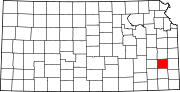 | |
|
Unincorporated communities | ||
| Ghost towns | ||
| Townships | ||
| Footnotes | †This community is designated a
Census-Designated Place (CDP) by the
United States Census Bureau. ‡This community also has portions in an adjacent county or counties. | |
|
| This article about a location in Allen County, Kansas is a stub. You can help Wikipedia by expanding it. |