| Humboldt Glacier | |
|---|---|
| Humboldt Gletscher | |
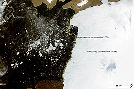
 Satellite image of Humboldt Glacier | |
| Type | Tidewater glacier |
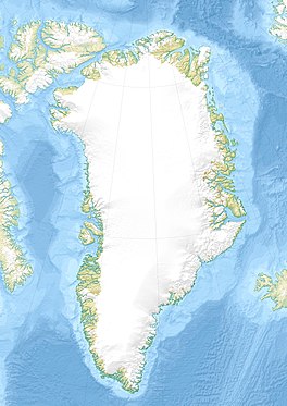
| Location | Greenland |
| Coordinates | 79°30′N 63°00′W / 79.500°N 63.000°W |
| Terminus | Kane Basin |
Humboldt Glacier ( Danish: Humboldt Gletscher) is one of the major glaciers in northern Greenland.
The glacier is named after German naturalist Alexander von Humboldt and is the widest tidewater glacier in the Northern Hemisphere.
Geography
The Humboldt Glacier borders the Kane Basin in North West Greenland. Its front is 110 km (68 mi) wide. It has been retreating in the period of observation spanning 1975–2010. [1]
Humboldt Glacier fringes the coast of Peabody Bay from north to south. The McGary Islands lie off the glacier at the southern end of the bay. [2]
 |
See also
References
- ^ "Humboldt Glacier retreats". Byrd Polar Research Center. Archived from the original on 2008-12-16. Retrieved 2009-08-13.
- ^ Prostar Sailing Directions 2005 Greenland and Iceland Enroute, p. 88
External links
-
 Media related to
Humboldt Glacier at Wikimedia Commons
