Hughes, Arkansas | |
|---|---|
 | |
 Location of Hughes in St. Francis County, Arkansas. | |
| Coordinates: 34°56′59″N 90°28′15″W / 34.94972°N 90.47083°W | |
| Country | United States |
| State | Arkansas |
| County | St. Francis |
| Area | |
| • Total | 2.28 sq mi (5.92 km2) |
| • Land | 2.26 sq mi (5.86 km2) |
| • Water | 0.02 sq mi (0.06 km2) |
| Elevation | 207 ft (63 m) |
| Population (
2020) | |
| • Total | 1,056 |
| • Density | 466.64/sq mi (180.16/km2) |
| Time zone | UTC-6 ( Central (CST)) |
| • Summer ( DST) | UTC-5 (CDT) |
| FIPS code | 05-33760 |
| GNIS feature ID | 0083178 [2] |
Hughes is a city in St. Francis County, Arkansas, United States. As of the 2020 census, it had a population of 1,056. [3]
Geography
According to the United States Census Bureau, the town has a total area of 2.2 square miles (5.7 km2), of which 2.2 square miles (5.7 km2) is land and 0.04 square miles (0.10 km2) (0.92%) is water.
It is about 37 miles (60 km) from Memphis, Tennessee. [4]
Demographics
| Census | Pop. | Note | %± |
|---|---|---|---|
| 1920 | 451 | — | |
| 1930 | 815 | 80.7% | |
| 1940 | 1,004 | 23.2% | |
| 1950 | 1,686 | 67.9% | |
| 1960 | 1,960 | 16.3% | |
| 1970 | 1,872 | −4.5% | |
| 1980 | 1,919 | 2.5% | |
| 1990 | 1,810 | −5.7% | |
| 2000 | 1,867 | 3.1% | |
| 2010 | 1,441 | −22.8% | |
| 2020 | 1,056 | −26.7% | |
| U.S. Decennial Census
[5] 2010 [6] 2020 [7] | |||
2020 census
| Race / Ethnicity | Pop 2010 [6] | Pop 2020 [7] | % 2010 | % 2020 |
|---|---|---|---|---|
| White alone (NH) | 337 | 201 | 23.39% | 19.03% |
| Black or African American alone (NH) | 1,069 | 810 | 74.18% | 76.70% |
| Native American or Alaska Native alone (NH) | 3 | 3 | 0.21% | 0.28% |
| Asian alone (NH) | 8 | 0 | 0.56% | 0.00% |
| Pacific Islander alone (NH) | 0 | 0 | 0.00% | 0.00% |
| Some Other Race alone (NH) | 0 | 1 | 0.00% | 0.09% |
| Mixed Race/Multi-Racial (NH) | 8 | 28 | 0.56% | 2.65% |
| Hispanic or Latino (any race) | 16 | 13 | 1.11% | 1.23% |
| Total | 1,441 | 1,056 | 100.00% | 100.00% |
_01.jpg)
2000 Census
As of the census [8] of 2000, there were 1,867 people, 682 households, and 493 families residing in the town. The population density was 869.8 inhabitants per square mile (335.8/km2). There were 762 housing units at an average density of 355.0 per square mile (137.1/km2). The racial makeup of the city was 29.41% White, 67.76% Black or African American, 0.11% Native American, 1.61% Asian, 0.11% Pacific Islander, 0.43% from other races, and 0.59% from two or more races. 0.70% of the population were Hispanic or Latino of any race.
There were 682 households, out of which 37.1% had children under the age of 18 living with them, 38.1% were married couples living together, 29.5% had a female householder with no husband present, and 27.6% were non-families. 25.5% of all households were made up of individuals, and 10.7% had someone living alone who was 65 years of age or older. The average household size was 2.74 and the average family size was 3.31.
In the town, the population was spread out, with 33.7% under the age of 18, 9.1% from 18 to 24, 25.5% from 25 to 44, 19.4% from 45 to 64, and 12.2% who were 65 years of age or older. The median age was 31 years. For every 100 females, there were 83.4 males. For every 100 females age 18 and over, there were 73.5 males.
The median income for a household in the town was $18,333, and the median income for a family was $22,976. Males had a median income of $25,417 versus $16,641 for females. The per capita income for the city was $10,039. About 31.7% of families and 38.0% of the population were below the poverty line, including 53.3% of those under age 18 and 31.5% of those age 65 or over.
Education
The community is served by the West Memphis School District. Post-2015 most students were transferred to Faulk Elementary School, West Junior High School, and Academies of West Memphis (formerly West Memphis High School). [4]
Typically school bus commute times from Hughes to West Memphis are about one hour each way due to the bus making multiple stops; without stops the commute would take about thirty minutes. In winter periods Hughes students depart from school and/or arrive from home when the sun is not out. [4]
It was formerly served by the Hughes School District, which operated Mildred Jackson Elementary School and Hughes High School. In 2015 the Arkansas Board of Education voted to consolidate the Hughes district into the West Memphis district because of a decline in enrollment in the Hughes district. [9] The West Memphis district took possession of the school buildings, then gave them to the Hughes municipal government in 2016. [4]
Economy
Hughes School District, in its existence, employed the largest number of people in Hughes prior to its 2015 closure. Former Hughes board member Lincoln Barnett stated that several area businesses, as a result of the district closure, encountered financial problems. [4]
Recreation
After 2016 the municipal government, at no charge, leased the Hughes school gymnasium to Deon Lee, an alumnus of Hughes High and the chief of police, who spent $3,000 to revamp the building to make into an after school center for children. [4]
Notable people
- Mark R. Martin, Secretary of State of Arkansas 2011–2019, graduated from Hughes High School in 1986.
References
- ^ "2020 U.S. Gazetteer Files". United States Census Bureau. Retrieved October 29, 2021.
- ^ a b U.S. Geological Survey Geographic Names Information System: Hughes, Arkansas
- ^ "Hughes city, Arkansas". United States Census Bureau. Retrieved December 25, 2022.
- ^
a
b
c
d
e
f Superville, Denisa R. (June 7, 2017).
"When a Community Loses Its Schools".
Education Week. Retrieved April 12, 2020.
A sign welcomes visitors to Hughes, Ark., which is 37 miles from Memphis, Tenn.
- ^ "Decennial Census by Decade". US Census Bureau.
- ^ a b "P2 HISPANIC OR LATINO, AND NOT HISPANIC OR LATINO BY RACE - 2010: DEC Redistricting Data (PL 94-171) - Hughes city, Arkansas". United States Census Bureau.
- ^ a b "P2 HISPANIC OR LATINO, AND NOT HISPANIC OR LATINO BY RACE - 2020: DEC Redistricting Data (PL 94-171) - Hughes city, Arkansas". United States Census Bureau.
- ^ "U.S. Census website". United States Census Bureau. Retrieved January 31, 2008.
- ^ "Hughes Arkansas Schools ordered to merge with West Memphis School District". WREG. April 10, 2015. Retrieved May 14, 2018.
Municipalities and communities of
St. Francis County, Arkansas, United States | ||
|---|---|---|
| Cities | 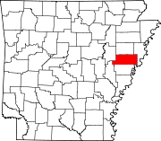 | |
| Towns | ||
| CDP | ||
|
Other unincorporated communities | ||
| Footnotes | ‡This populated place also has portions in an adjacent county or counties | |
| International | |
|---|---|
| National | |
| Geographic | |
| Other | |