Horse Creek, Wyoming | |
|---|---|
 Horse Creek Location within the state of Wyoming  Horse Creek Horse Creek (the United States) | |
| Coordinates: 41°24′54″N 105°10′56″W / 41.41500°N 105.18222°W | |
| Country | United States |
| State | Wyoming |
| County | Laramie |
| Elevation | 6,506 ft (1,983 m) |
| Time zone | UTC-7 ( Mountain (MST)) |
| • Summer ( DST) | UTC-6 (MDT) |
| ZIP codes | 82061 |
| GNIS feature ID | 1589684 [1] |
Horse Creek is an unincorporated community in western Laramie County, Wyoming, United States. It lies between Horse Creek to the north, and the South Fork of Horse Creek to the south, along WYO 211 northwest of the city of Cheyenne, the county seat of Laramie County. [2] Its elevation is 6,506 feet (1,983 m). [1] Although Horse Creek is unincorporated, it has its own ZIP code of 82061. [3] It had a post office until the early 2010s, when it closed due to an emergency operational issue. [4] As of the 2010 census, Horse Creek had an estimated population of 39. [5]
Tony and Marian Schepp operated a general store, bar, and automobile garage in Horse Creek from 1948 until 1981. The bar, known as Schepp's Corner, was a gathering place for workers at the nearby Great Western Limestone Mine until it closed in 1978. Candace and David Kirkman of North Carolina bought the entire town in 1989; their purchase was inspired by Candace's childhood dream of moving to Wyoming. [6] [7]
Public education in the community of Horse Creek is provided by Laramie County School District #1.
Highways
 WYO 211 (Horsecreek Road) - north–south route through Horse Creek,
- County Road #228 (Fisher Canyon Rd.), which becomes County Road #17 (Roger Canyon Rd.), runs west from Horse Creek to Laramie.
References
- ^ a b "Horse Creek, Wyoming". Geographic Names Information System. United States Geological Survey, United States Department of the Interior.
- ^ Rand McNally. The Road Atlas '08. Chicago: Rand McNally, 2008, p. 116.
- ^ Zip Code Lookup Archived 2011-06-15 at the Wayback Machine
- ^ "Post Offices: Things could become clearer this week". Casper Star-Tribune. May 8, 2012. Retrieved July 12, 2023 – via Newspapers.com.
- ^ Community Facts - 2010 Demographic Profile Retrieved 2015-07-06
- ^ Johnson, Maria C. (October 3, 1989). "A town to call their own". News & Record. p. A11. Retrieved July 12, 2023 – via Newspapers.com.
- ^ "Horse Creek to get second life from North Carolinians". Casper Star-Tribune. Associated Press. September 17, 1989. p. B1. Retrieved July 12, 2023 – via Newspapers.com.
Municipalities and communities of
Laramie County, Wyoming, United States | ||
|---|---|---|
| City | 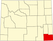 | |
| Towns | ||
| CDPs | ||
|
Unincorporated communities | ||
|
| This article about a location in Wyoming is a stub. You can help Wikipedia by expanding it. |