Holbrook is an unincorporated community in Multnomah County, Oregon, United States. [1] It is located on U.S. Route 30 about 15 miles northwest of Portland between the Tualatin Mountains and the Multnomah Channel south of Sauvie Island. [2] Holbrook's elevation is 135 feet above sea level. [1]
The community was named for pioneer Philo Holbrook, who owned a farm nearby. [3] Holbrook had a post office from 1887 to 1933. [3]
References
- ^ a b "Holbrook". Geographic Names Information System. United States Geological Survey, United States Department of the Interior. November 28, 1980. Retrieved August 2, 2011.
- ^ Oregon Atlas & Gazetteer (7th ed.). Yarmouth, Maine: DeLorme. 2008. p. 22. ISBN 0-89933-347-8.
- ^ a b McArthur, Lewis A.; McArthur, Lewis L. (2003) [1928]. Oregon Geographic Names (7th ed.). Portland, Oregon: Oregon Historical Society Press. p. 472. ISBN 978-0875952772.
45°39′35″N 122°51′48″W / 45.659838°N 122.863436°W
Municipalities and communities of
Multnomah County, Oregon, United States | ||
|---|---|---|
| Cities | 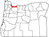 | |
| CDPs | ||
|
Other communities | ||
| Footnotes | ‡This populated place also has portions in an adjacent county or counties | |