| Hiló Formation | |
|---|---|
|
Stratigraphic range:
Late Albian-
Early Cenomanian ~ | |
| Type | Geological formation |
| Unit of | Villeta Group |
| Underlies | Simijaca Formation |
| Overlies | Capotes Formation |
| Thickness | more than 470 metres (1,540 ft) |
| Lithology | |
| Primary | Shale |
| Other | Sandstone, limestone, siltstone |
| Location | |
| Coordinates | 4°47′28″N 74°30′49″W / 4.79111°N 74.51361°W |
| Region |
Altiplano Cundiboyacense Eastern Ranges, Andes |
| Country | |
| Type section | |
| Named for | Caserío Boquerón de Hiló |
| Named by | Hubach |
| Location | Apulo- Anapoima |
| Year defined | 1931 |
| Coordinates | 4°47′28″N 74°30′49″W / 4.79111°N 74.51361°W |
| Approximate paleocoordinates | 0°36′N 45°18′W / 0.6°N 45.3°W |
| Region | Cundinamarca, Tolima |
| Country | |
| Thickness at type section | 470 m (1,540 ft) |
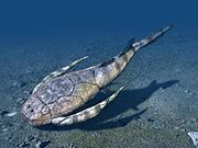
 Paleogeography of Northern South America 105 Ma, by Ron Blakey | |
The Hiló Formation ( Spanish: Formación Hiló, Kih) is a geological formation of the Altiplano Cundiboyacense, Eastern Ranges of the Colombian Andes. The predominantly shale formation dates to the Middle Cretaceous period; Late Albian to Early Cenomanian epochs and has a measured thickness at its type section of 470 metres (1,540 ft). The fossiliferous formation has provided a great abundance of ammonites and other marine species.
Etymology
The formation was defined and named in 1931 by Hubach after the Caserío Boquerón de Hiló in Anapoima. [1]
Description
Lithologies
The Hiló Formation with a measured thickness of 470 metres (1,540 ft), is characterised by a sequence of pyritic organic shales, limestones and siltstones, with sandstone banks intercalated in the formation.
Stratigraphy and depositional environment
The Hiló Formation overlies the Capotes Formation and is overlain by the Simijaca Formation. The age has been estimated to be Late Albian to Early Cenomanian. Stratigraphically, the formation is time equivalent with the Une and Pacho Formations. [2] The formation has been deposited in an open platform setting. The deposition is represented by a maximum flooding surface and pelagic to hemipelagic conditions. [1] [3]
Fossil content
Fossils of Actinoceramus munsoni, Actinoceramus aff. subsulcatiformis, Beudanticeras cf. rebouli, Desmoceras latidorsatum, Eubrancoceras cf. aegoceratoides, Exogyra aff. texana, Goodhallites aguilerae, Inoceramus anglicus, Inoceramus cf. cadottensis, Inoceramus aff. dunveganensis, Inoceramus aff. etheridgei, Inoceramus cf. ewaldi, Inoceramus aff. irenensis, Inoceramus prefragilis, Inoceramus cf. richensis, Lyelliceras pseudolyelli, Mojsisovicsia evansi, Mortoniceras arietiforme, Neocomiceramus neocomiensis, Neoharpoceras hugardianum, Oxytropidoceras intermedium, Oxytropidoceras karsteni, Oxytropidoceras laraense, Oxytropidoceras multicostatum, Oxytropidoceras nodosum, Oxytropidoceras peruvianum, ?Oxytropidoceras robustum, Oxytropidoceras venezolanum, Prolyelliceras gevreyi, Prolyelliceras prorsocurvatum, Puzio media, Tegoceras mosense, Acompsoceras sp., ?Bositra sp., Camptonectes sp., Entolium sp., Hamites sp., Hysteroceras sp., Mariella sp., Ostrea sp., Phelopteria sp., and ?Syncyclonema sp. have been found in the Hiló Formation. [4] [5] [6] [7] [8] [9] [10] [11] [12] [13] [14] [15] [16] [17] [18] [19] [20] [21] [22] [23] [24] [25]
Outcrops

The Hiló Formation is apart from its type locality along the road from Apulo to Anapoima, found just east of Viotá, Cundinamarca, [26] and in the department of Tolima. [4] [5] [6] [7] [8] [9] [10] [11] [12] [13] [14] [15] [16] [17] [18] [19] [20] [21] [22] [23] [24] [25] West of Guayabal de Síquima, the formation is offset by the Vianí Fault. [27]
Regional correlations


See also
References
- ^ a b Acosta & Ulloa, 2002, p.44
- ^ Acosta & Ulloa, 2001, p.16
- ^ Villamil, 2012, p.164
- ^ a b Olini Creek 1 at Fossilworks.org
- ^ a b Olini Creek 3 at Fossilworks.org
- ^ a b Olini Creek 6 at Fossilworks.org
- ^ a b Olini Creek 8 at Fossilworks.org
- ^ a b Olini Creek 9 at Fossilworks.org
- ^ a b Olini Creek 13 at Fossilworks.org
- ^ a b Olini Creek 15 at Fossilworks.org
- ^ a b Olini Creek 34 at Fossilworks.org
- ^ a b Olini Creek 39 at Fossilworks.org
- ^ a b Olini Creek 40 at Fossilworks.org
- ^ a b Olini Creek 47 at Fossilworks.org
- ^ a b Olini Creek 48 at Fossilworks.org
- ^ a b Olini Creek 54 at Fossilworks.org
- ^ a b Olini Creek 58 at Fossilworks.org
- ^ a b Olini Creek 59 at Fossilworks.org
- ^ a b Olini Creek 65 at Fossilworks.org
- ^ a b Olini Creek 100 at Fossilworks.org
- ^ a b Olini Creek 101 at Fossilworks.org
- ^ a b Olini Creek 106 at Fossilworks.org
- ^ a b Olini Creek 108 at Fossilworks.org
- ^ a b Olini Creek 115 at Fossilworks.org
- ^ a b Olini Creek 122 at Fossilworks.org
- ^ Plancha 246, 1998
- ^ Plancha 227, 1998
Bibliography
- Acosta Garay, Jorge E., and Carlos E. Ulloa Melo. 2002. Mapa Geológico del Departamento de Cundinamarca - 1:250,000 - Memoria explicativa, 1–108. INGEOMINAS. Accessed 2017-04-26.
- Acosta Garay, Jorge, and Carlos E. Ulloa Melo. 2001. Geología de la Plancha 208 Villeta - 1:100,000, 1-84. INGEOMINAS. Accessed 2017-04-04.
- Villamil, Tomas. 2012. Chronology Relative Sea Level History and a New Sequence Stratigraphic Model for Basinal Cretaceous Facies of Colombia, 161–216. Society for Sedimentary Geology (SEPM).
Maps
- Ulloa, Carlos, and Jorge Acosta. 1998. Plancha 208 - Villeta - 1:100,000, 1. INGEOMINAS. Accessed 2017-06-06.
- Ulloa, Carlos E.; Erasmo Rodríguez, and Jorge E. Acosta. 1998. Plancha 227 - La Mesa - 1:100,000, 1. INGEOMINAS. Accessed 2017-06-06.
- Acosta, Jorge E., and Carlos E. Ulloa. 1998. Plancha 246 - Fusagasugá - 1:100,000, 1. INGEOMINAS. Accessed 2017-06-06.


- Geologic formations of Colombia
- Cretaceous Colombia
- Lower Cretaceous Series of South America
- Upper Cretaceous Series of South America
- Albian Stage
- Cenomanian Stage
- Shale formations
- Open marine deposits
- Fossiliferous stratigraphic units of South America
- Paleontology in Colombia
- Altiplano Cundiboyacense
- Geography of Cundinamarca Department
- Geography of Tolima Department