You can help expand this article with text translated from
the corresponding article in Hungarian. (January 2019) Click [show] for important translation instructions.
|

Controlled-access highways in Hungary are dual carriageways, grade separated with controlled-access, designed for high speeds. The legislation amendments define two types of highways: motorways ( Hungarian: autópálya) and expressways ( Hungarian: autóút).
The main differences are that motorways feature emergency lanes and the maximum allowed speed limit is 130 km/h (81 mph), while expressways may be built without them and the speed limit is 110 km/h (68 mph).
According to Magyar Közút Nonprofit Zrt. (Hungarian Public Roads Ltd.; a state-owned enterprise responsible for the operation and maintenance of public roads in the country), the total length of the Hungarian highway system was 1,855 kilometers in 2022. [1] The construction of the Hungarian highway system started in 1964 with M7, which connected Budapest with Lake Balaton by 1975. The total length of the system reached a milestone of 200 km in 1980, surpassed 500 km in 1998 and 1000 km in 2007.
As of July 2022, the Hungarian highway network comprises 26 highways (13 motorways and 13 expressways), 12 of which (M1, M5, M7, M15, M19, M25, M30, M31, M35, M43, M51 and M70) have reached their total planned length.
Road categories


Road signs are white shield on blue and the abbreviation for both types of highways is M. There are 2 main categories of state-owned roads in Hungary: motorways (autópálya – pl. autópályák) and highways (autóút – pl. autóutak).
Motorways (Autópálya)
- Motorways are public roads with controlled access which are designated for motor vehicles only, and feature two carriageways with at least two continuous lanes each with paved emergency lanes, divided by a median. They have no one-level intersections with any roads or other forms of land and water transport. They are equipped with roadside rest areas, which are intended only for the users of the motorway.
Epressways (Autóút)
- Expressways are public roads with limited-access which share most of the characteristics of motorways, differing mainly in that: [2]
- Expressways may be built without paved emergency lanes.
- Expressways are designated for lower speed than motorways. For example, the road curvature can be higher and the lanes are usually narrower (3.5 m vs 3.75 m).
- Expressways can have a single carriageway on sections with low traffic density.
Speed limits
| Maximum speed (km/h) | ||
|---|---|---|
| Vehicle | |
|
|
130 | 110 |
|
100 | 70 |
|
80 | 70 |
| Not allowed on motorways: pedestrians, bikes, mopeds, agricultural vehicles. Minimal speed on motorways is 60 km/h unless there are any extraordinary circumstances (e.g., snow, ice, or a car broken down). It is forbidden to stop except extraordinary situations, or travel backwards. Roads are protected from animals crossing the road. | ||
History

First plans for automobile roads
The first domestic design for the creation of automobile roads (autómobil utak, autómobil-pályák) was the work of Boldizsár Vásárhelyi, who prepared the first professional concept in 1941 as his doctoral dissertation. [3] It was made in 1941, and in some respects it was more careful than today. Although this draft would not have eliminated the radial structure starting from Budapest, it would have emphasized the highway in places where there is no main road.
For example: to the east between Main roads 3 and 4 as the crow flies towards Debrecen, to the south between Highway 5 and the Danube straight towards Újvidék and Belgrade, to Zagreb further south from Highway 7, thus avoiding Lake Balaton further away, Tab and in the area of Marcali, and also towards Vienna by straightening Main road 1 towards the southern bypass of Tata. The project envisaged the construction of 2,000 km of automobile roads on the then twice the national area, essentially including today's outer ring. Out of all of these, only the relocation of the Main road 1 was realized: then the motorway being built followed the route of the relocated main road here as well.
At the beginning of the 1960s, the development of Highway 80, which was later developed into the M1 motorway, into a highway began specifically as a reconstruction work. At the same time, there were sharp professional discussions about the plans for the M7, which was to be built for the first time in the section between the capital and Székesfehérvár: the position that a large city like Székesfehérvár cannot be bypassed by the highway gained significant emphasis. In this case, the delay in construction had the beneficial effect of allowing the views to improve. A similar type of debate took place a decade later about the avoidance of Győr – here only the northern or southern avoidance was at stake – where time also helped to finally build a more modern network solution. [4]
From the late of 1960s

The 1968 transport policy concept considered the eight single-digit main roads as the backbone of road traffic. However, following the settlement network development concept of 1971, an official highway network concept emerged, which, in addition to the eight radial main roads and the complementary Sopron and north Balaton roads, contained important ring elements: the southern and eastern sectors of the Budapest Ring, a Győr– Veszprém– Székesfehérvár– Dunaföldvár– Kecskemét– Szolnok– Eger "inner" ring, and some elements from an "outer" ring, Sopron– Szombathely– Nagykanizsa, Balatonlelle– Kaposvár– Pécs– Baja– Szeged– Békéscsaba– Gyula, and Berettyóújfalu– Debrecen– Nyíregyháza sections. Within this, the concept envisaged the construction of roads 1, 3, 5, and 7 as Highways. A total of 500 kilometers of highways were expected to be built by 1985. However, the rigid way of thinking of the concept makers of the era left the spatial structure of Hungary unchanged in essential points: the outlined highway network is centered on Budapest, and the roads cross the major rivers (e.g. Danube and Tisza) exactly where bridges already stood at the time the plan was prepared.
In essence, the above was confirmed by the fact that in 1978, the transformation of the radial structure of the main road network into a ring-radial system was already included as a directive in the new transport policy concept. This concept accepts the raison d'être of routes bypassing Budapest, but even this plan only gives space to transversal routes by maintaining the centrality of the capital.
After the fall of communism

In 1988, the need to create European-standard connections to the north–south and east–west transit traffic flow directions already appeared among the priority tasks. This is also reflected in the maturing changes in the international situation, the logical consequence of which in the high-speed network is the adoption of an opening grid structure. The National Road Network Development Program for the years 1991–2000, adopted in 1991, supported the development of radial and transverse roads, but did not consider the southern highway (Déli autópálya), which is increasingly emerging thanks to the activities of lobbyists, to be feasible. [4]
In terms of national borders, the M1 motorway was the first to reach the Austrian border in 1996, followed by the M15 at the Slovak border in 1998, and the M70 motorway reaching the Slovenian border in 2005. In March 2006, the M5 reached the Serbian border. With the completion of the Zrínyi Miklós Bridge over the Mura at the Croatian border, the M7 motorway also joined the neighboring country's motorway system in 2008. In 2015 and 2020, the M43 motorway and M4 stretched to the Romanian border. In the future, the M3, M34, M6, M60, M8, M85, M87 motorways may also reach the Hungarian border.
Plans were made to connect Szombathely with an expressway from 1995, and then its implementation took 10 years from 2006 to 2016. The construction was carried out in 9 stages and cost 158 billion forints, with 85% support from the European Union. [5] The bypass section of the city of Csorna, handed over in 2015, became a unique solution in domestic road construction, as it was the first construction of an interweaving and diverging expressway, with the intersection of two roads in different directions. The merging and distribution of the M85 and M86 expressways into a common route was achieved with a 3.5 km expressway with a 2×3 lane track, while two railway lines are crossed together with an overpass.
From the 2020s
Network size
| Year | Length (km) | Year | Length (km) | Year | Length (km) | ||
|---|---|---|---|---|---|---|---|
| 1964 | 7 | 2003 | 667 | 2013 | 1,361 | ||
| 1970 | 85 | 2004 | 717 | 2014 | 1,370 | ||
| 1975 | 132 | 2005 | 803 | 2015 | 1,447 | ||
| 1980 | 213 | 2006 | 967 | 2016 | 1,481 | ||
| 1985 | 302 | 2007 | 1,037 | 2017 | 1,490 | ||
| 1990 | 347 | 2008 | 1,113 | 2018 | 1,524 | ||
| 1995 | 384 | 2009 | 1,118 | 2019 | 1,600 | ||
| 2000 | 531 | 2010 | 1,290 | 2020 | 1,740 | ||
| 2002 | 638 | 2011 | 1,321 | 2021 | 1,851 | ||
| IEA-PVPS [6] | |||||||
Hungarian highways network since 1964
Highway system
The following is a list of all existing, under construction and/or planned highways in Hungary.
| Sign | Class | Map | Route | Total length | Existing | Years of construction | |
|---|---|---|---|---|---|---|---|
| (km) | % | ||||||
|
|
 |
Budapest Ring (Budapesti körgyűrű) Biatorbágy (M1) – Törökbálint (M7) – Bp., Budafok-Tétény (M6) – Dunaharaszti (M51) – Gyál (M5) – Vecsés (M4) – Nagytarcsa (M31) – Bp., Újpalota (M3) – Bp., Újpest (M2) – Budakalász – Üröm – Budakeszi – Biatorbágy Planned section: Budakalász – Biatorbágy (M1) |
109 km (68 mi) | 76.82 | 71% | 1988 – | |
|
|
 |
Budapest –
Budaörs (M7) –
Biatorbágy (M0) –
Bicske –
Tatabánya –
Komárom –
Győr (M19, M85) –
Mosonmagyaróvár –
Levél (M15) –
Hegyeshalom /
|
160.16 km (99.52 mi) | 160.16 | 100% | 1964–1996 | |
|
|
 |
Budapest (M0) –
Dunakeszi (M1) –
Vác-
Rétság –
Hont (Parassapuszta) /
Planned section: Vác – Rétság – Hont (Parassapuszta) / |
70 km (43 mi) | 30.73 | 44% | 1996 – | |
|
|
 |
Budapest –
Gödöllő (M31) –
Hatvan –
Gyöngyös –
Füzesabony (M25) –
Mezőcsát (M30) –
Polgár –
Görbeháza (M35) –
Nyíregyháza –
Vaja (M49) –
Vásárosnamény –
Beregdaróc /
Planned section: Vásárosnamény – Beregdaróc / |
297 km (185 mi) | 269.67 | 91% | 1978 – | |
|
|
 |
Budapest –
Üllő (M0) –
Cegléd –
Szolnok –
Törökszentmiklós –
Karcag –
Püspökladány –
Berettyóújfalu –
Nagykereki /
Under construction section: Törökszentmiklós – Kisújszállás Planned section: Kisújszállás – Berettyóújfalu |
222.48 km (138.24 mi) | 128.76 | 58% | 2005 – | |
|
|
 |
Budapest –
Gyál (M0) –
Lajosmizse –
Kecskemét (M44) –
Kiskunfélegyháza –
Szeged (M43) –
Röszke /
|
160.92 km (99.99 mi) | 160.92 | 100% | 1985–2006 | |
|
|
 |
Budapest (M0) –
Érd –
Dunaújváros (M8) –
Paks –
Szekszárd –
Bóly (M60) –
Ivándárda /
Under construction section: Bóly (M60) – Ivándárda / |
198 km (123 mi) | 176.08 | 89% | 2006 – | |
|
|
 |
Budapest –
Budaörs (M1) –
Érd (M0) –
Székesfehérvár –
Siófok –
Balatonboglár –
Balatonkeresztúr –
Hollád (M76) –
Nagykanizsa –
Letenye /
|
226.52 km (140.75 mi) | 226.52 | 100% | 1964–2008 | |
|
|
 |
Balatonfőkajár (M7) –
Dunaújváros (M6) –
Dunavecse –
Kecskemét (M5, M44) –
Abony (M4) Planned section: Balatonfőkajár – Dunaújváros, Dunavecse – Abony |
approx. 161 km (100 mi) | 9.77 | 6% | 2007 – | |
|
|
 |
Szekszárd (M6) – Dusnok | approx. | 20.48 | 2003 – | ||
 |
Üröm (M0) – Pilisvörösvár – Dorog (M100) | approx. 24 km (15 mi) | under planning | / | |||
|
|
 |
Levél (M1) –
Rajka /
|
14.74 km (9.16 mi) | 14.74 | 100% | 1996 – 1998 2018–2019 | |
|
|
 |
Introductory road of Győr (M1 – Main road 1) | 9.65 km (6.00 mi) | 9.65 | 100% | 1975 | |
|
|
 |
Introductory road of Eger (M3 – Main road 252) | 17.41 km (10.82 mi) | 17.41 | 100% | 2017–2020 | |
|
|
 |
Part of
Via Carpathia Mezőcsát (M3) – Miskolc – Szikszó – Encs – Tornyosnémeti / |
88.54 km (55.02 mi) | 88.54 | 100% | 2002–2021 | |
|
|
 |
Part of the
Budapest bypass (M0 – M3) |
12.41 km (7.71 mi) | 12.41 | 100% | 2009–2010 | |
|
|
 |
Abony (M4) – Jászapáti – Füzesabony (M3, M25) | approx. 63 km (39 mi) | under planning | / | ||
|
|
 |
Vásárosnamény (M3) –
Záhony /
|
approx. 36 km (22 mi) | under planning | / | ||
|
|
 |
Part of
Via Carpathia Görbeháza (M3) – Hajdúböszörmény – Debrecen – Berettyóújfalu (M4) |
67.79 km (42.12 mi) | 67.79 | 100% | 2006–2018 | |
|
|
 |
Szeged (M5) –
Makó –
Csanádpalota /
|
57.72 km (35.87 mi) | 57.72 | 100% | 2005–2015 | |
|
|
 |
Kecskemét (M5) –
Lakitelek –
Kunszentmárton –
Szarvas –
Békéscsaba –
Sarkad /
Under construction section: Kecskemét (M5) – Lakitelek Planned section: Békéscsaba – Sarkad |
approx. 117 km (73 mi) | 88.7 | 76% | 2016 – | |
|
|
 |
Vaja (M3) –
Mátészalka –
Csenger /
|
45 km (28 mi) | under construction | 2023 – | ||
|
|
 |
Part of the old
Budapest bypass (M0 – M5) |
3.6 km (2.2 mi) | 3.6 | 100% | 1988 | |
|
|
 |
Bóly (M6) –
Pécs –
Szigetvár –
Barcs /
Planned section: Pécs – Barcs / |
97 km (60 mi) | 30.94 | 32% | 2007 – | |
|
|
 |
Letenye (M7) –
Tornyiszentmiklós /
|
21.26 km (13.21 mi) | 21.26 | 100% | 2002 – 2005 2017–2019 | |
|
|
 |
Hollád (M7) –
Sármellék –
Zalaegerszeg –
Körmend Planned section: Sármellék – Körmend |
approx. 82.3 km (51.1 mi) | 8.48 | 10% | 2018 – | |
|
|
 |
Körmend –
Szentgotthárd (Rábafüzes) /
|
28.12 km (17.47 mi) | 28.12 | 100% | 2018–2021 | |
|
|
 |
Komárom (M1) – Kisbér – Mór – Székesfehérvár – Sárbogárd (M8) | approx. 114 km (71 mi) | under planning | / | ||
|
|
 |
Győr (M1) –
Csorna –
Kapuvár –
Sopron /
Under construction section: Sopron – border section |
95 km (59 mi) | 89 | 94% | 2008 – | |
|
|
 |
Körmend –
Szombathely –
Répcelak –
Csorna (M85) –
Mosonmagyaróvár Planned section: Körmend – Szombathely, Csorna – Mosonmagyaróvár |
approx. 115 km (71 mi) | 70.96 | 62% | 2008 – | |
|
|
 |
Szombathely (M86) –
Kőszeg /
|
22 km (14 mi) | under planning | / | ||
|
|
|
 |
Hollád (M7-M76) –
Kaposvár –
Szigetvár (M60) + Bóly (M60) – Mohács – Tompa – Szeged (M5/M43) |
approx. 90 km (56 mi) + 131 km (81 mi) | under planning | / | |
|
|
 |
Bicske (M1) –
Esztergom /
|
approx. 41 km (25 mi) | under planning | / | ||
Main highways

M1 motorway
The M1 motorway is one of the oldest motorway of Hungary. It connects the Hungarian capital with the northwester part of Transdanubia, ( Tatabánya, Győr) towards to Vienna. The motorway is part of the Pan-European Corridor IV, and European route E60, E65 and E75. Average daily traffic is 75,510 near Budapest and 56,421 vehicles/day near Győr. [7] The construction of the motorway began 1964, it took more than thirty years to reach Hegyeshalom and the Austrian border. Its significance has increased since the change of regime in 1990, and today it is the most important western connection in Hungary.
- M19 expressway is a branch of the M1 motorway. This is an introductory road of Győr and the old part of the M1.
- M85 expressway is a branch of the M1 motorway, connecting it with the border of Slovakia, toward to Bratislava.
- M15 motorway is a branch of the M1 motorway, connecting it with the city of Csorna, toward to Szombathely (M86) or Sopron and the border of Austria.
M2 expressway
The M2 expressway is connects the northern part of Hungary (western part of North Hungarian Mountains), towards to Banská Bystrica and Kraków. The highway is part of the European route E77. This is one an important route of the Hungarian highway and road network, the northern diagonal main line of traffic forming part of Budapest.
M3 motorway

The M3 motorway is connects the northeaster part of Hungary ( North Hungarian Mountains and northeastern part of Great Hungarian Plain), towards to Carpathian Ruthenia. The motorway is part of the Venice- Trieste- Ljubljana-Budapest- Lviv- Kyiv line Central-East Europe Corridor V, and European route E71, E79, E573 and E579. This is one of the most important route of the Hungarian motorway and road network, the southwest–north-eastern diagonal main line of traffic forming part of Budapest. Through Ukraine, Eastern Europe, and through Slovakia, creates a highway connection to the countries of north-eastern Europe.
- M31 motorway is a branch of the M3 motorway. This is an important transit road between the M3 motorway and bypass of Budapest ( M0 expressway)
- M25 expressway is a branch of the M3 motorway. This is an introductory road of Eger.
- M30 motorway is another branch of the M3 motorway, connecting it with the city of Miskolc and the border of Slovakia, towards to Košice. This route is fully part of the Via Carpathia.
- M35 motorway is a branch of the M3 motorway, connecting it with the city of Debrecen towards to M4 motorway and Romania. This route is fully part of the Via Carpathia.
- M49 expressway is a future branch of the M3 motorway, connecting it with the city of Mátészalka, and the border of Romania, toward to Satu Mare.
M4 expressway/motorway
The M4 expressway/motorway is connects the eastern part of Hungary (eastern part of Great Hungarian Plain), towards to Romania ( Oradea and Cluj Napoca). The motorway is part of the and European route E60 and E79. Through Romania, Eastern Europe creates a highway connection to the countries of eastern Europe.
M5 motorway

The M5 motorway starts from Budapest, it connects the Hungarian capital with Szeged and southeast part of Hungary, towards Belgrade. It was the third motorway in Hungary that reached the border. The motorway is part of the Pan-European Corridor X, and European route E75. The motorway was built in the 1980s and reached the Serbian border in March 2006.
- M44 expressway is a future branch of the M5 motorway, connecting it with the city of Békéscsaba, and the border of Romania, toward to Salonta.
- M43 motorway is a branch of the M5 motorway, connecting it with the city of Makó and the border of Romania, towards to Arad and Timișoara.
M6 motorway

The M6 motorway starts from Budapest (M0-M6 Interchange), it connects the Hungarian capital with Dunaújváros, Szekszárd and Mohács, on the right bank of the Danube, towards Osijek and Sarajevo. The motorway is part of the European route E73. The final section reaching the border is currently under construction with a planned opening date in 2024. The connecting Croatian section is scheduled to be delivered a year earlier.
Main junctions:
- M8 motorway is a branch of the M6 motorway, connecting it with the Dunavecse, this will be the future plan for connecting the city of Veszprém, Dunaújváros, Kecskemét and Szolnok.
- M60 motorway is a branch of the M6 motorway, connecting it with the city of Pécs and the border of Croatia, towards to Zagreb in the future.
M7 motorway

The M7 motorway starts from Budapest, it connects the Hungarian capital with Lake Balaton and southwestern part of Transdanubia, towards to Zagreb. The motorway is part of the Pan-European Corridor V, and European route E71. Average daily traffic is 62,779 near Budapest and 49,273 vehicles/day near Székesfehérvár. [7] The motorway was built in the 1960s and reached the Croatian border in October 2008.
Main junctions:
- M70 motorway is a branch of the M7 motorway, connecting it with the border of Slovenia, towards to Maribor, Ljuljana and Venice.
Gallery
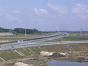
-
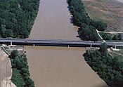
 Pentele Bridge in M8
 -
 M15 near Rajka
 -
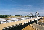
 Sajó Bridge in M30
 -
 M35 near Derecske
 -
 M43 near Szeged-Sándorfalva
 -
 M60 near Kozármisleny
 -
 Eastern section of M0
 -
 M2 near Vác
 -
 The end of M9 near Dusnok
 -
 Korongi Bridge in M70
 -
 M85-M86 near Csorna
 -
 M86 near Szombathely

.jpg)


Main roads with 2x2 traffic lanes
There are several dual carriageway main road sections in Hungary, which are similar in most technological respects to expressways but allow at-grade intersections. Speed limit at designated sections of these roads is 110 km/h or 70 mph.
-
 Main road 3: Introductory road of
Gyöngyös; between
M3 motorway and Gyöngyös (7 km)
Main road 3: Introductory road of
Gyöngyös; between
M3 motorway and Gyöngyös (7 km) - Several parts of
 Main road 4: between Budapest and
Püspökladány (40 km) (The way between
Budapest and
Püspökladány is about 165 km/103miles)
Main road 4: between Budapest and
Püspökladány (40 km) (The way between
Budapest and
Püspökladány is about 165 km/103miles) -
 Main road 5: Introductory road of
Kecskemét; between
M5 motorway and Kecskemét (8 km)
Main road 5: Introductory road of
Kecskemét; between
M5 motorway and Kecskemét (8 km) -
 Main road 6: between
Szekszárd and
Tolna (4 km)
Main road 6: between
Szekszárd and
Tolna (4 km) -
 Main road 8: between
M7 motorway (
Székesfehérvár) and
Veszprém (50 km),
Veszprém and
Herend (11 km)
Main road 8: between
M7 motorway (
Székesfehérvár) and
Veszprém (50 km),
Veszprém and
Herend (11 km) -
 Main road 11: between Budapest and
Szentendre (4 km and 9 km within the city limit of Budapest)
Main road 11: between Budapest and
Szentendre (4 km and 9 km within the city limit of Budapest) -
 Main road 21: between
M3 motorway (
Hatvan) and
Salgótarján (50 km)
Main road 21: between
M3 motorway (
Hatvan) and
Salgótarján (50 km) -
 Main road 26: between
Miskolc and
Sajóbábony (10 km)
Main road 26: between
Miskolc and
Sajóbábony (10 km) -
 Main road 37: between
M30 motorway (
Felsőzsolca) and
Szerencs (27 km)
Main road 37: between
M30 motorway (
Felsőzsolca) and
Szerencs (27 km) -
 Main road 44: between
Békéscsaba and
Gyula (11 km)
Main road 44: between
Békéscsaba and
Gyula (11 km) -
 Main road 47: between
Szeged and
Hódmezővásárhely (14 km)
Main road 47: between
Szeged and
Hódmezővásárhely (14 km) -
 Main road 54: Southern bypass of
Kecskemét, between
M5 mototway and
Main road 5, Mercedes-Benz factory (8 km)
Main road 54: Southern bypass of
Kecskemét, between
M5 mototway and
Main road 5, Mercedes-Benz factory (8 km) -
 Main road 58: between
Pécs and
Pécs-Pogány International Airport (10 km)
Main road 58: between
Pécs and
Pécs-Pogány International Airport (10 km) -
 Main road 67: between
M7 mototway and
Kaposvár (50 km)
Main road 67: between
M7 mototway and
Kaposvár (50 km) -
 Main road 83: between
M1 motorway (
Győr) and
Pápa (36 km)
Main road 83: between
M1 motorway (
Győr) and
Pápa (36 km) - A section of
 Main road 84: between
Sopron and the border with
Austria (4 km)
Main road 84: between
Sopron and the border with
Austria (4 km) - A section of
 Main road 86: between
Egyházasrádóc and
Körmend (3.5 km)
Main road 86: between
Egyházasrádóc and
Körmend (3.5 km) -
 Main road 471: between
Debrecen and
Hajdúsámson (5 km)
Main road 471: between
Debrecen and
Hajdúsámson (5 km)
Planned routes: [8]
-
Main road 4: between
M35 motorway (
Debrecen) and
Hajdúszoboszló
-
Main road 8: between
Herend and
Devecser (15,5 km)
-
 Main road 32: between
M3 motorway (
Hatvan) and
Jászberény
Main road 32: between
M3 motorway (
Hatvan) and
Jászberény -
 Main road 354 and
4: between
M35 motorway (
Debrecen) and
M3 motorway (
Nyíregyháza)
Main road 354 and
4: between
M35 motorway (
Debrecen) and
M3 motorway (
Nyíregyháza) -
 Main road 74: between
Zalaegerszeg and
Nagykanizsa (50 km)
Main road 74: between
Zalaegerszeg and
Nagykanizsa (50 km)
Opening of new highways
Construction of new motorways in recent years has been hampered due to corruption scandals and austerity measures as well as owing to new European rules under which old EIA assessments lapsed. In the coming years, the highway network expansion focuses on connecting all major cities into the highway network, and on the completion of highways in the border region of Hungary. Construction of non-radial roads continues to be slow.
Contracted segments with estimated openings: [9]
- 2024
- M6: Bóly (M60 Interchange) – exit Villány (13.9 km) (Q1)
- M85: Sopron Tunnel, section between Sopron-észak – border of Austria (4 km) (Q3)
- 2025
- M44: Kecskemét-észak (M5 Interchange) – Szentkirály (32.2 km) (Q2)
- M6: exit Villány – border of Croatia, towards to A5 motorway (6 km) (Q3)
- M80: Szentgotthárd – border of Austria, towards to S7 expressway (1.7 km) (Q3)
- 2026
- M4: Törökszentmiklós-nyugat – Kisújszállás-kelet (34.3 km) (Q2)
- M49: Vaja (M3 Interchange) – Ököritófülpös (28.2 km) (Q3)
Toll requirements

Motorcars up to 3.5 tonnes
The Hungarian system has 2 main type in terms of salary (for motorcycles, passenger cars, buses, trailers, vans up to 3.5 t):
- time-based fee vignettes ( E-vignette system)
- regional vignettes (annual vignette for Hungarian counties)
Time-based fee vignettes
All vehicles must have an electronic vignette to use the motorways and expressways in Hungary. Cars, vans and motorbikes up to 3.5 tonnes only need to buy a single vignette which costs 6,400 Hungarian forint (Ft) for 10 days, 10,360 Ft for 1 month and 57,260 Ft for a year, from 1 January 2024. [10] The e-vignette user charge system applies to motorcycles, passenger cars and their trailers, as well as cargo vehicles with a maximum permissible gross weight of 3.5 tonnes, campers and buses, and their trailers. These vehicles are authorized to use the Hungarian toll speedway network's roads exclusively with pre-purchased –purchased prior to entering a toll speedway section– road use authorization, i.e. electronic vignettes (e-vignettes). The amount of toll charges depends on the category of the vehicle and the type of the e-vignette. The category of the motor vehicles must be determined according to the official entry that appears in the vehicle registration certificate, based on the maximum permissible gross weight of the motor vehicle and the number of persons it is allowed to transport. [11]
Electronic vignettes replaced the windscreen toll vignette (autópálya matrica) in 2008. [12]
A blue motorway or expressway road sign means that a paid e-vignette toll is obligatory unless stated otherwise (usually sections from the border to the closest exit). Only sections not subject to e-vignette are designated with an additional road sign (see below).
All vignettes are checked via ANPR cameras or the police will pull a driver over and the driver will have to show a vignette via the E-vignette app or the driver will print out a sheet with the payment. If failing to buy a e-vignette the driver will face fines from 18,750 Ft to 74,970 Ft. [13]
Regional vignettes
Valid for the toll expressways of the specific county with annual validity, that is from the time of purchase (from the first day of the current year in case of pre-purchase) until midnight on 31 January of the year following the reference year. [10]
Weekly and monthly vignettes are valid from the time of purchase (the payment taking effect), unless the customer specifies the start of the validity period (starting date) of the e-vignette.
The vignette is valid until the exit after the county border. The table below shows which sections can be used with which county vignettes: [14]
| Type of regional vignette | Usable sections | Length (in 2024) |
|---|---|---|
| Bács-Kiskun | 93 km | |
| Baranya | 60 km | |
| Békés | 67 km | |
| Borsod-Abaúj-Zemplén | 149 km | |
| Csongrád-Csanád | 108 km | |
| Fejér | 169 km | |
| Győr-Moson-Sopron | 241 km | |
| Hajdú-Bihar | 156 km | |
| Heves | 108 km | |
| Jász-Nagykun-Szolnok | 65 km | |
| Komárom-Esztergom | 70 km | |
| Pest | 357 km | |
| Somogy | 119 km | |
| Szabolcs-Szatmár-Bereg | 77 km | |
| Tolna | 98 km | |
| Veszprém | 18 km | |
| Vas | 44 km | |
| Zala | 76 km |
-
 A road sign indicating the beginning of the motorway electronic vignette (paid on a specific license plate of a vehicle) duty for cars ≤ 3.5t (placed under the road sign for motorway or expressway)
 -
 A road sign indicating that a motorway sections is not subject to electronic vignette. ≤ 3.5t (placed under the road sign for motorway or expressway)


Vehicles over 3.5 tonnes
Lorries have to buy an e-toll Via E-toll app to use the highways and expressways. There are different fares for lorries below 3.5 tonnes and lorries above 3.5 tonnes.
Operators
The network is managed by 6 operators, of which one is under full government control and other fiveare operated by joint ventures. [15]
| Operator | Highway | Length (in 2022) [15] | Notes |
|---|---|---|---|
| MKIF Magyar Koncessziós Infrastruktúra Fejlesztő Zrt. |
M1,
M7 (from
M0 to the border) M3, M4, M8, M15, M30, M35, M44, M70, M85, M86 |
1,273 km (791 mi) | Under concession until 2057. [16] |
| Magyar Közút |
M1,
M5,
M7 (from
Budapest to
M0) M6 (from M0 to Érd) M0, M2, M9, M31, M43, M80 |
291 km (181 mi) | Ownership by Hungary (100%). |
| AKA Alföldi Koncessziós Autópálya Zrt. | M5 (from M0 to the border) | 156.5 km (97.2 mi) | Ownership by Strabag. [17] Under concession until 2031. [18] |
| M6 Duna Autópálya Koncessziós Zrt. |
M6 (from
Érd to
Dunaújváros) M8 (from M6 to Kisapostag) |
59 km (37 mi) | Ownership by Aberdeen Asset Management, EBRD and Intertoll. [15] Under concession until 2026. [16] |
| M6 Tolna Autópálya Koncessziós Zrt. | M6 (from Dunaújváros to Tolna) | 63 km (39 mi) | Ownership by Aberdeen Asset Management, EBRD and Intertoll. [15] Under concession until 2038. [16] |
| Mecsek Autópálya Koncessziós Zrt. |
M6 (from
Tolna to
Bóly) M60 (until Pécs) |
83 km (52 mi) | Ownership by Strabag, Colas, Bouygues, John Laing Group, Intertoll. [15] Under concession until 2038. [16] |
European routes
The following European routes pass through Hungary:
Class A
 E60: (France, Switzerland,
Austria, Germany, Austria) –
Hegyeshalom –
Mosonmagyaróvár –
Győr –
Tatabánya –
Budapest –
Szolnok –
Püspökladány –
Ártánd – (
Romania, Georgia,
Azerbaijan,
Turkmenistan,
Uzbekistan,
Tajikistan,
Kyrgyzstan, China)
[19]
E60: (France, Switzerland,
Austria, Germany, Austria) –
Hegyeshalom –
Mosonmagyaróvár –
Győr –
Tatabánya –
Budapest –
Szolnok –
Püspökladány –
Ártánd – (
Romania, Georgia,
Azerbaijan,
Turkmenistan,
Uzbekistan,
Tajikistan,
Kyrgyzstan, China)
[19] E65: (Sweden,
Poland,
Czech Republic,
Slovakia) –
Rajka –
Csorna –
Szombathely –
Körmend –
Zalaegerszeg –
Nagykanizsa –
Letenye – (
Croatia,
Bosnia and Herzegovina, Croatia,
Montenegro,
Kosovo,
North Macedonia,
Greece)
E65: (Sweden,
Poland,
Czech Republic,
Slovakia) –
Rajka –
Csorna –
Szombathely –
Körmend –
Zalaegerszeg –
Nagykanizsa –
Letenye – (
Croatia,
Bosnia and Herzegovina, Croatia,
Montenegro,
Kosovo,
North Macedonia,
Greece) E66: (Italy,
Austria) –
Rábafüzes –
Körmend –
Ajka –
Veszprém –
Székesfehérvár –
Dunaújváros –
Kecskemét –
Cegléd
E66: (Italy,
Austria) –
Rábafüzes –
Körmend –
Ajka –
Veszprém –
Székesfehérvár –
Dunaújváros –
Kecskemét –
Cegléd E68:
Szeged –
Makó –
Csanádpalota – (
Romania)
E68:
Szeged –
Makó –
Csanádpalota – (
Romania) E71: (
Slovakia) –
Tornyosnémeti –
Miskolc –
Füzesabony –
Hatvan –
Budapest –
Székesfehérvár –
Siófok –
Nagykanizsa –
Letenye – (
Croatia)
E71: (
Slovakia) –
Tornyosnémeti –
Miskolc –
Füzesabony –
Hatvan –
Budapest –
Székesfehérvár –
Siófok –
Nagykanizsa –
Letenye – (
Croatia) E73:
Budapest –
Dunaújváros –
Paks –
Szekszárd –
Mohács –
Udvar – (
Croatia,
Bosnia and Herzegovina)
E73:
Budapest –
Dunaújváros –
Paks –
Szekszárd –
Mohács –
Udvar – (
Croatia,
Bosnia and Herzegovina) E75: (
Norway,
Finland,
Poland,
Czech Republic,
Slovakia) –
Rajka –
Győr –
Tatabánya –
Budapest –
Kecskemét –
Szeged –
Röszke – (
Serbia,
North Macedonia,
Greece)
E75: (
Norway,
Finland,
Poland,
Czech Republic,
Slovakia) –
Rajka –
Győr –
Tatabánya –
Budapest –
Kecskemét –
Szeged –
Röszke – (
Serbia,
North Macedonia,
Greece) E77: (Russia,
Estonia,
Latvia,
Lithuania, Russia,
Poland,
Slovakia) –
Parassapuszta –
Vác –
Budapest
E77: (Russia,
Estonia,
Latvia,
Lithuania, Russia,
Poland,
Slovakia) –
Parassapuszta –
Vác –
Budapest E79:
Miskolc –
Polgár –
Debrecen –
Berettyóújfalu –
Ártánd – (
Romania,
Bulgaria,
Greece)
E79:
Miskolc –
Polgár –
Debrecen –
Berettyóújfalu –
Ártánd – (
Romania,
Bulgaria,
Greece)
Class B
 E573:
Püspökladány –
Debrecen –
Nyíregyháza –
Záhony – (
Ukraina)
E573:
Püspökladány –
Debrecen –
Nyíregyháza –
Záhony – (
Ukraina) E575: (
Slovakia) –
Vámosszabadi –
Győr
E575: (
Slovakia) –
Vámosszabadi –
Győr E579:
Görbeháza –
Nyíregyháza –
Vásárosnamény –
Beregdaróc
E579:
Görbeháza –
Nyíregyháza –
Vásárosnamény –
Beregdaróc E653: (
Slovenia) –
Tornyiszentmiklós –
Letenye
E653: (
Slovenia) –
Tornyiszentmiklós –
Letenye E661:
Balatonkeresztúr –
Nagyatád –
Barcs – (
Croatia,
Bosnia and Herzegovina)
E661:
Balatonkeresztúr –
Nagyatád –
Barcs – (
Croatia,
Bosnia and Herzegovina)
See also
- Transport in Hungary
- Roads in Hungary
- List of controlled-access highway systems
- Evolution of motorway construction in European nations
References
- ^ Magyar Közút Zrt. (2022). "Az állami közúthálózatról". www.kozut.hu. Archived from the original on 23 March 2015. Retrieved 18 July 2022.
- ^ This list contains the limited-access roads (expressways) in Hungary with (at least) four traffic lanes and median.
- ^ "Vásárhelyi Boldizsár" (in Hungarian). Archived from the original on 6 March 2016. Retrieved 22 August 2014.
- ^ a b Fleischer Tamás (12 September 1993). "Tanulmány az autópályákról" (PDF) (in Hungarian). Retrieved 6 March 2009.
- ^ "Kétszer kétsávos álom". Archived from the original on 21 January 2021. Retrieved 26 October 2016.
- ^ http://www.irena.org/DocumentDownloads/Publications/IRENA_RE_Capacity_Statistics_2017.pdf [ bare URL PDF]
- ^ a b "Az autópálya-hálózat forgalmi menedzsment tervének elõkészítõ vizsgálatai – forgalmi elemzések" (PDF) (in Hungarian). ktenet.hu.
- ^ "Projektek". beruhazas.gov.hu (in Hungarian). Építési és Közlekedési Minisztérium - Beruházási Portál. 16 January 2024.
- ^ "Ezek az autópályák épülhetnek meg 2024-ben Magyarországon – nem kell sokat várni az első átadóra". www.vg.hu (in Hungarian). Világgazdaság. 5 January 2024.
- ^ a b "National Toll Payment Services PLC – E-vignette rates from 1 January 2024". toll-charge.hu.
- ^ "National Toll Payment Services PLC". toll-charge.hu.
- ^ "Több autópálya-matrica fogy". hvg.hu (in Hungarian). 8 July 2008.
- ^ "National Toll Payment Services PLC – Surcharges". toll-charge.hu.
- ^ "E-vignette country map, Valid from January 1, 2024". toll-charge.hu. 2 January 2024. Retrieved 2 January 2024.
- ^ a b c d e "Szeptember 1-től új koncessziós társaság végzi 1237 kilométernyi autópálya üzemeltetését". kozut.hu (in Hungarian). 25 August 2022. Retrieved 30 December 2023.
- ^ a b c d "Felháborító az ezer milliárdos extraprofit a multiknál, Mészároséknál örvendetes". g7.hu (in Hungarian). 31 January 2023. Retrieved 1 January 2024.
- ^ "Négy szerződéssel annyit dobott ki az állam, mint a nyugdíjpénztári vagyon". g7.hu (in Hungarian). 23 July 2019. Retrieved 30 December 2023.
- ^ "Kiemelt nemzetgazdasági döntés, de mi az a koncesszió?". index.hu (in Hungarian). 6 May 2022. Retrieved 30 December 2023.
- ^ "UNECE document ECE/TRANS/SC.1/2016/03/Rev1 "European Agreement On Main International Traffic Arteries (AGR)"" (PDF). The United Nations Economic Commission for Europe. 1 November 2016. Retrieved 16 May 2020.
- General
- Magyarország autóatlasz (Road atlas of Hungary), Dimap-Szarvas, Budapest, 2004
- Magyarország autóatlasz (Road atlas of Hungary), Dimap-Szarvas, Budapest, 2013
External links
- National Toll Payment Services Plc (in Hungarian, some information also in English)
- Home page of the National Toll Payment Services Plc.
- Detailed map of the Hungarian motorway system (2021)
| Motorways
|  | |
|---|---|---|
| Expressways
| ||
| under construction or planned | ||
| former projects | ||