Hermeskeil | |
|---|---|
 | |
 Coat of arms | |
Location of Hermeskeil within Trier-Saarburg district 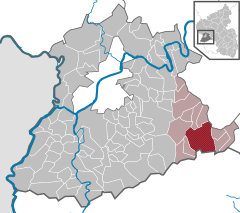 | |
 Hermeskeil  Hermeskeil | |
| Coordinates: 49°39′26″N 6°56′56″E / 49.65722°N 6.94889°E | |
| Country | Germany |
| State | Rhineland-Palatinate |
| District | Trier-Saarburg |
| Municipal assoc. | Hermeskeil |
| Subdivisions | 3 |
| Government | |
| • Mayor (2019–24) | Lena Weber [1] ( SPD) |
| Area | |
| • Total | 30.85 km2 (11.91 sq mi) |
| Elevation | 540 m (1,770 ft) |
| Population (2022-12-31)
[2] | |
| • Total | 8,013 |
| • Density | 260/km2 (670/sq mi) |
| Time zone | UTC+01:00 ( CET) |
| • Summer ( DST) | UTC+02:00 ( CEST) |
| Postal codes | 54411 |
| Dialling codes | 06503 |
| Vehicle registration | TR |
| Website | www.hermeskeil.de |
Hermeskeil (German pronunciation: [ˈhɛʁməskaɪl]) is a city in the Trier-Saarburg district, in Rhineland-Palatinate, Germany. It is situated in the Hunsrück, approx. 25 km southeast of Trier. Its population is about 5,900.
Data
Hermeskeil is the seat of the Verbandsgemeinde ("collective municipality") Hermeskeil.
The old locomotive depot, Bahnbetriebswerk Hermeskeil is now a museum housing German steam engines.
The Flugausstellung aircraft museum displays more than 100 aircraft and is the largest private museum of that kind in Europe.
A Gaulish burial of the 1st century AD was discovered in a field near Hermeskeil in 2009. [3]
A Roman castrum has been identified in 2015: it is the only castrum created by Julius Caesar inside Magna Germania, when he crossed the Rhine river in 53 BC [4]
Wikipedia links
- (in German) Link to German page Hermeskeil
- (in German) Link to information page about Flugausstellung aircraft museum
- (in German) de:Römerlager Hermeskeil
References
- ^ Direktwahlen 2019, Landkreis Trier-Saarburg, Landeswahlleiter Rheinland-Pfalz, accessed 2 August 2021.
- ^ "Bevölkerungsstand 2022, Kreise, Gemeinden, Verbandsgemeinden" (PDF) (in German). Statistisches Landesamt Rheinland-Pfalz. 2023.
- ^ Axel Munsteiner, Sensationeller Fund im Ringgraben, 30 September 2009.
- ^ Archaeologists find oldest Roman fort inside Germany
External links

| International | |
|---|---|
| National | |
| Geographic | |
|
| This Trier-Saarburg location article is a stub. You can help Wikipedia by expanding it. |