Havlíčkův Brod Airport Letiště Havlíčkův Brod | |||||||||||
|---|---|---|---|---|---|---|---|---|---|---|---|
 | |||||||||||
| Summary | |||||||||||
| Airport type | Public, no public international airport | ||||||||||
| Operator | Aeroport Havlickuv Brod | ||||||||||
| Serves | Havlíčkův Brod | ||||||||||
| Location | 1 kilometre (0.62 mi) SW from Havlíčkův Brod | ||||||||||
| Opened | September 1935 | ||||||||||
| Elevation AMSL | 1,519 ft / 465 m | ||||||||||
| Coordinates | 49°35′50″N 15°32′57″E / 49.59722°N 15.54917°E | ||||||||||
| Website |
www | ||||||||||
| Runways | |||||||||||
| |||||||||||
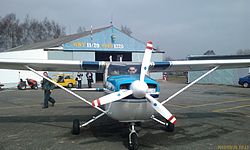
Havlíčkův Brod Airport ( Czech: Letiště Havlíčkův Brod) ( ICAO: LKHB [1] [2]) is a public aerodrome and no public international airport with civil traffic. It is situated approximately 1 kilometre (1 mi) southwest of Havlíčkův Brod in the Vysočina Region of the Czech Republic. The airport is plentifully used for sport flying and sightseeing flights above the Bohemian-Moravian Highlands.
References
- ^ Airport information for LKHB at Great Circle Mapper.
- ^ Accident history for LKHB at Aviation Safety Network