Harriet, Arkansas | |
|---|---|
 Harriet  Harriet | |
| Coordinates: 35°59′36″N 92°31′14″W / 35.99333°N 92.52056°W | |
| Country | United States |
| State | Arkansas |
| County | Searcy |
| Elevation | 896 ft (273 m) |
| Time zone | UTC-6 ( Central (CST)) |
| • Summer ( DST) | UTC-5 (CDT) |
| ZIP code | 72639 |
| Area code | 870 |
| GNIS feature ID | 77126 [1] |
Harriet is an unincorporated community in Searcy County, Arkansas, United States. Harriet is located at the junction of Arkansas highways 14 and 27, 8.5 miles (13.7 km) northeast of Marshall. Harriet has a post office with ZIP code 72639. [2]Harriet is only 6.4 miles from the Buffalo National River, and an industry of river guiding and canoeing supplies has cropped up around the whitewater river. The community is also very close to the Ozark-St. Francis National Forest. The Blanchard Springs Caverns are only 25 miles to the east.
Education
Harriet is within the Searcy County School District. [3] [4]
Harriet had been in what was the Marshall School District. [5] On July 1, 2004, the Marshall School District and the Leslie School District consolidated to form the Searcy County School District, [6] with the Marshall district annexing Leslie. [7] [8]
References
- ^ U.S. Geological Survey Geographic Names Information System: Harriet, Arkansas
- ^ ZIP Code Lookup
- ^ " SCHOOL DISTRICT REFERENCE MAP (2010 CENSUS): Searcy County, AR." U.S. Census Bureau. Retrieved on June 17, 2018.
- ^ "General Highway Map Searcy County, Arkansas" (PDF). Arkansas Department of Transportation. Retrieved March 17, 2021. - See Harriet on the map, compare to the school district map.
- ^ "Arkansas Department of Education school district maps, 1952-1954 Searcy County, 1952-1954". Arkansas Digital Archives. Arkansas State Archives. ( Download)
- ^ " ConsolidationAnnex_from_1983.xls." Arkansas Department of Education. Retrieved on October 13, 2017.
- ^ " Searcy County School District No. 17 Searcy County, Arkansas Regulatory Basis Financial Statements and Other Reports June 30, 2005." Legislative Joint Auditing Committee, State of Arkansas. p. 15 (PDF p. 17/26). "[...]Leslie School District which was annexed into the Marshall School District, now known as the Searcy County School District."
-
^ Lair, Dwain (January 21, 2008).
"Standing before the firing squad".
Harrison Daily Times. Retrieved June 17, 2018.
If you remember, the Marshall School District became the Searcy County School District after it annexed the Leslie School District.
Municipalities and communities of
Searcy County, Arkansas, United States | ||
|---|---|---|
| Cities | 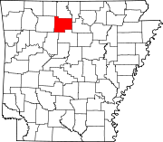 | |
| Towns | ||
| Townships | ||
| CDP | ||
|
Other unincorporated communities | ||
| Footnotes | ‡This populated place also has portions in an adjacent county or counties | |
|
| This article about a location in Searcy County, Arkansas is a stub. You can help Wikipedia by expanding it. |