Harperville, Mississippi | |
|---|---|
 Harperville, Mississippi  Harperville, Mississippi | |
| Coordinates: 32°29′40″N 89°29′22″W / 32.49444°N 89.48944°W | |
| Country | United States |
| State | Mississippi |
| County | Scott |
| Area | |
| • Total | 1.44 sq mi (3.72 km2) |
| • Land | 1.44 sq mi (3.72 km2) |
| • Water | 0.00 sq mi (0.00 km2) |
| Elevation | 407 ft (124 m) |
| Population (
2020) | |
| • Total | 250 |
| • Density | 173.97/sq mi (67.15/km2) |
| Time zone | UTC-6 ( Central (CST)) |
| • Summer ( DST) | UTC-5 (CDT) |
| ZIP code | 39080 |
| Area code(s) | 601 & 769 |
| GNIS feature ID | 693419 [2] |
Harperville is a census-designated place and unincorporated community in rural Scott County, Mississippi, United States. Harperville is located on Mississippi Highway 35, 9 miles (14 km) north of Forest. Harperville has a post office with ZIP code 39080. [3] [4] It was first named as a CDP in the 2020 Census which listed a population of 250. [5]
History
Harperville was named for G. W. Harper, a European-American settler. [6]
In October 1898, a white mob retaliated for African Americans resisting arrest. The county sheriff gathered a posse, and the governor asked for National Guard support. Governor Anselm J. McLaurin went by train to Forest to assess the situation. [7] After arresting several blacks, the sheriff took them to the county seat at Forest for their safety. [8] The New Orleans Picayune reported that 11 blacks and one white had been killed." [8]
Demographics
| Census | Pop. | Note | %± |
|---|---|---|---|
| 2020 | 250 | — | |
| U.S. Decennial Census
[9] 2020 [10] | |||
2020 census
| Race / Ethnicity | Pop 2020 [10] | % 2020 |
|---|---|---|
| White alone (NH) | 180 | 72.00% |
| Black or African American alone (NH) | 51 | 20.40% |
| Native American or Alaska Native alone (NH) | 0 | 0.00% |
| Asian alone (NH) | 1 | 0.40% |
| Pacific Islander alone (NH) | 0 | 0.00% |
| Some Other Race alone (NH) | 1 | 0.40% |
| Mixed Race/Multi-Racial (NH) | 6 | 2.40% |
| Hispanic or Latino (any race) | 11 | 4.40% |
| Total | 250 | 100.00% |
Note: the US Census treats Hispanic/Latino as an ethnic category. This table excludes Latinos from the racial categories and assigns them to a separate category. Hispanics/Latinos can be of any race.
Education
It is in the Scott County School District. [11]
References
- ^ "2020 U.S. Gazetteer Files". United States Census Bureau. Retrieved July 24, 2022.
- ^ "Harperville". Geographic Names Information System. United States Geological Survey, United States Department of the Interior.
- ^ United States Postal Service (2012). "USPS - Look Up a ZIP Code". Retrieved February 15, 2012.
- ^ "Postmaster Finder - Post Offices by ZIP Code". United States Postal Service. Archived from the original on April 28, 2019. Retrieved June 7, 2013.
- ^ "Harperville CDP, Mississippi". United States Census Bureau. Retrieved March 13, 2022.
- ^ Gannett, Henry (1905). The Origin of Certain Place Names in the United States. Govt. Print. Off. pp. 150.
- ^ "Fierce Race War in Mississippi", San Francisco Call, Volume 84, Number 146, 24 October 1898; California Digital Newspaper Collection; accessed 19 March 2017
- ^ a b Associated Press, "Mississippi Race War/ Counting Its Victims by the Dozen", Los Angeles Herald, Volume 26, Number 25, 25 October 1898; California Digital Newspaper Collection; accessed 20 March 2017
- ^ "Decennial Census of Population and Housing by Decades". US Census Bureau.
- ^ a b "P2 HISPANIC OR LATINO, AND NOT HISPANIC OR LATINO BY RACE - 2020: DEC Redistricting Data (PL 94-171) - Harperville CDP, Mississippi". United States Census Bureau.
- ^ "2020 CENSUS - SCHOOL DISTRICT REFERENCE MAP: Scott County, MS" (PDF). U.S. Census Bureau. Retrieved August 6, 2022. - Text list
Municipalities and communities of
Scott County, Mississippi, United States | ||
|---|---|---|
| Cities | 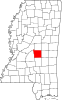 | |
| Towns | ||
| CDPs | ||
|
Other communities | ||
| Indian reservation | ||
| Footnotes | ‡This populated place also has portions in an adjacent county or counties | |
|
| This Scott County, Mississippi state location article is a stub. You can help Wikipedia by expanding it. |