You can help expand this article with text translated from
the corresponding article in Japanese. (February 2009) Click [show] for important translation instructions.
|
Hakuchō Bridge Hakuchō Ō-hashi (白鳥大橋) | |
|---|---|
 Hakuchō Bridge at Shukuzu, Muroran | |
| Coordinates | 42°21′10″N 140°57′07″E / 42.35278°N 140.95194°E |
| Carries | two lanes of roadway |
| Crosses | Muroran bay |
| Locale | Jin-ya, Muroran and Shukuzu, Muroran |
| Characteristics | |
| Design | Suspension bridge |
| Total length | 720 meters (2,360 ft) |
| Height | 140 meters (460 ft) (pylons) |
| Longest span | 1,380 meters (4,530 ft) |
| Clearance below | 54.45 meters (178.6 ft) |
| History | |
| Construction start | 1985 |
| Construction end | 1998 |
| Opened | 13 June 1998 |
| Statistics | |
| Toll | None |
| Location | |
|
| |
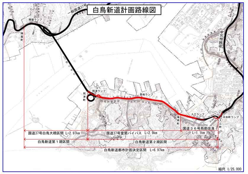
The Hakuchō Bridge (白鳥大橋, Hakuchō Ō-hashi) is a suspension bridge in Muroran, Hokkaido, Japan. Opened on 17 April 1998, it has a main span of 720 meters (2,360 ft). It is the first section of the Hakuchō Shindō that is signed as an alternate route of Japan National Route 37. [1]
Several windmills line the bridge which provide lighting at night to the park golf link nearby. The winds are extremely high on the bridge, so pedestrians, bikes, and motorbikes are prohibited from crossing.
See also
References
- ^ "白鳥新道計画路線図" [Hakuchō Shindō Plan Route Map] (in Japanese). City of Muroran. 21 February 2014. Retrieved 1 October 2020.
External links
| Authority control databases: Geographic |
|---|
|
| This Hokkaidō location article is a stub. You can help Wikipedia by expanding it. |
|
| This article about a bridge in Japan is a stub. You can help Wikipedia by expanding it. |