Hackley, Louisiana | |
|---|---|
 Hackley, Louisiana  Hackley, Louisiana | |
| Coordinates: 30°58′34″N 90°05′08″W / 30.97611°N 90.08556°W | |
| Country | United States |
| State | Louisiana |
| Parish | Washington |
| Elevation | 341 ft (104 m) |
| Time zone | UTC-6 ( Central (CST)) |
| • Summer ( DST) | UTC-5 (CDT) |
| Area code | 985 |
| GNIS feature ID | 535479 [1] |
| FIPS code | 22-32440 |
Hackley is an unincorporated community in Washington Parish, Louisiana, United States. The community is located 9 miles (14.48 kilometres) N of Franklinton, Louisiana.
Etymology
It is speculated that the name of the community is derived from the surname of Charles Hackley a timber baron that owned over 200,000 acres of land in Louisiana. [2]
Old railroad
Between 1892 and 1922 there was a 26.5 miles (42.65 kilometres) railroad built by the Brooks-Scanlon Lumber Company that ran from Kentwood, Louisiana and terminated at Hackley. [3] The railroad was leased and operated by the Kentwood and Eastern Railway.
References
- ^ U.S. Geological Survey Geographic Names Information System: Hackley, Louisiana
- ^ Keagan LeJeune (2010). Always for the Underdog: Leather Britches Smith and the Grabow War. University of North Texas Press. pp. 65–. ISBN 978-1-57441-288-8.
- ^ Tony Howe; David S. Price. "Mississippi Rails". msrailroads.com. Retrieved August 21, 2019.
Municipalities and communities of
Washington Parish, Louisiana, United States | ||
|---|---|---|
| City | 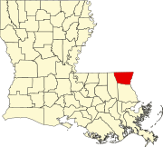 | |
| Town | ||
| Villages | ||
| CDP | ||
|
Other communities | ||
|
| This Louisiana state location article is a stub. You can help Wikipedia by expanding it. |