Greentown, Pennsylvania | |
|---|---|
Village | |
 Greentown Greentown's location within Pennsylvania.  Greentown Greentown (the United States) | |
| Coordinates: 41°19′18″N 75°18′20″W / 41.3218°N 75.3055°W | |
| Country | United States |
| State | Pennsylvania |
| U.S. Congressional District | PA-8 |
| School District | Wallenpaupack Area |
| County | Pike |
| Magisterial District | Greene |
| Elevation | 1,668 ft (508 m) |
| ZIP code | 18426 |
| Area code(s) | 570 and 272 |
| Major Roads |
|
Greentown is a village in Greene Township, Pike County, Pennsylvania, United States. It had a population of 4,526 in the 2000 US Census. [1]
Greentown is home to the Ledgedale Recreational Area and parts of Lake Wallenpaupack. It is served by the Wallenpaupack Area School District.
Housing
Housing in the village is mostly restricted to communities, including: The Escape, Lake Paupack Club, Tanglwood Lakes, Paupack Hills, White Pines, Tranquility Falls, Sand Spring Acres, and Lake Wallenpaupack Estates (not to be confused with Wallenpaupack Lake Estates in Wayne County, Pennsylvania).
-
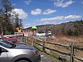
 84 Country Store
 -
 View toward Interstate 84
 -
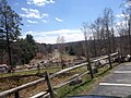 View away from Interstate 84


References
- ^ [ Greentown, PA] entry at zip-codes.com
External links
- [ The Escape Property Owners Association]
- [ Lake Wallenpaupack Estates]
Municipalities and communities of
Pike County, Pennsylvania, United States | ||
|---|---|---|
| Boroughs |  | |
| Townships | ||
| CDPs | ||
|
Unincorporated communities | ||
| Footnotes | ‡This populated place also has portions in an adjacent county or counties. | |
41°19′18″N 75°18′20″W / 41.32167°N 75.30556°W
|
| This Pike County, Pennsylvania state location article is a stub. You can help Wikipedia by expanding it. |