Garrisonville | |
|---|---|
 Aerial view of Garrisonville (foreground) and
Aquia Harbour (center) with Aquia Creek and the Potomac River in the background | |
 Garrisonville Location within the state of Virginia  Garrisonville Garrisonville (Virginia)  Garrisonville Garrisonville (the United States) | |
| Coordinates: 38°28′57″N 77°25′36″W / 38.48250°N 77.42667°W | |
| Country | United States |
| State | Virginia |
| County | Stafford |
| Time zone | UTC−5 ( Eastern (EST)) |
| • Summer ( DST) | UTC−4 (EDT) |
| ZIP code | 22463
[1] |
| GNIS feature ID | 1499463 [2] |
Garrisonville is an unincorporated community in Stafford County in the U.S. state of Virginia. [3]
Geography
Garrisonville is located at an elevation of 282 ft (86 m), [2] south of Marine Corps Base Quantico.
Transportation
_in_Garrisonville,_Stafford_County,_Virginia.jpg)
Garrisonville is served by State Route 610 (Garrisonville Road), which passes east—west through the community, and Interstate 95 and U.S. Route 1, which run north—south to the east.
References
- ^ "Garrisonville ZIP Code". zipdatamaps.com. 2022. Retrieved November 30, 2022.
- ^ a b "Garrisonville". Geographic Names Information System. United States Geological Survey, United States Department of the Interior.
- ^ Dodd, Anita L.; Lee, M. Amanda (2007). Stafford County. Arcadia Publishing. p. ix. ISBN 9780738544106.
Wikimedia Commons has media related to
Garrisonville, Virginia.
Municipalities and communities of
Stafford County, Virginia, United States | ||
|---|---|---|
| CDPs | 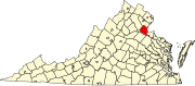 | |
|
Unincorporated communities |
| |
| Footnotes | ‡This populated place also has portions in an adjacent county or counties | |
|
| This Stafford County, Virginia state location article is a stub. You can help Wikipedia by expanding it. |