Gandasi | |
|---|---|
Village | |
| Gandasi | |
 Gandasi Location in Karnataka, India | |
| Coordinates: 13°09′34″N 76°18′18″E / 13.159393°N 76.305024°E | |
| Country | |
| State | Karnataka |
| District | Hassan |
| Taluk | Arsikere |
| Government | |
| • Body | Grama Panchayath |
| Area | |
| • Total | 6.58 km2 (2.54 sq mi) |
| Elevation | 930 m (3,050 ft) |
| Population (2011) | |
| • Total | 3,729 [1] |
| Languages | |
| • Official | Kannada |
| Time zone | UTC+5:30 ( IST) |
| PIN | 573119 |
| Vehicle registration | KA-13 |
Gandasi is a "hobli" in Hassan district of India. As per census survey of India 2011, the location code number of Gandasi is 615799.
Location
Gandasi village is located in Arsikere Taluk of Hassan district, Karnataka state, India. The village is located on State Highway 7 between Mysuru and Arsikere. [2]
Postal code
There is a post office in Gandasi and the postal code is 573119. [3]
Image gallery
-
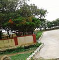 Bus Station
 -
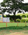 School
.jpg)
.jpg)
See also
References
- ^ "Census Data Handbook 2011" (PDF). Retrieved 1 September 2023.
- ^ "13°10'03.1"N 76°17'36.9"E". Google.co.in. Retrieved 23 February 2019.
- ^ "GANDASI Pin Code, Search GANDASI HASSAN PinCode". Citypincode.in. Retrieved 23 February 2019.
|
| This article related to a location in Hassan district, Karnataka, India is a stub. You can help Wikipedia by expanding it. |