Gália | |
|---|---|
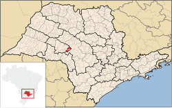
 Location in São Paulo state | |
| Coordinates: 22°17′29″S 49°33′10″W / 22.29139°S 49.55278°W | |
| Country | Brazil |
| Region | Southeast |
| State | São Paulo |
| Area | |
| • Total | 356 km2 (137 sq mi) |
| Population (2020
[1]) | |
| • Total | 6,482 |
| • Density | 18/km2 (47/sq mi) |
| Time zone | UTC−3 ( BRT) |
Gália is a municipality in the state of São Paulo in Brazil. The population is 6,482 (2020 est.) in an area of 356 km2. [2] The elevation is 561 m.
The municipality contains 80% of the 2,176 hectares (5,380 acres) Caetetus Ecological Station, created in 1976. [3]
References
- ^ IBGE 2020
- ^ Instituto Brasileiro de Geografia e Estatística
- ^ ESEC dos Caetetus "Olavo Amaral Ferraz" (in Portuguese), ISA: Instituto Socioambiental, retrieved 2017-02-20


