Fränkisch-Crumbach | |
|---|---|
 Coat of arms | |
Location of Fränkisch-Crumbach within Odenwaldkreis district 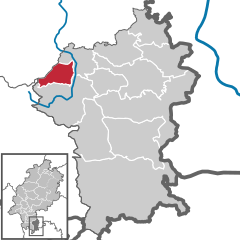 | |
 Fränkisch-Crumbach  Fränkisch-Crumbach | |
| Coordinates: 49°45′N 08°52′E / 49.750°N 8.867°E | |
| Country | Germany |
| State | Hesse |
| Admin. region | Darmstadt |
| District | Odenwaldkreis |
| Government | |
| • Mayor (2023–29) | Matthias Horlacher [1] ( SPD) |
| Area | |
| • Total | 16.1 km2 (6.2 sq mi) |
| Highest elevation | 500 m (1,600 ft) |
| Lowest elevation | 190 m (620 ft) |
| Population (2022-12-31)
[2] | |
| • Total | 3,078 |
| • Density | 190/km2 (500/sq mi) |
| Time zone | UTC+01:00 ( CET) |
| • Summer ( DST) | UTC+02:00 ( CEST) |
| Postal codes | 64407 |
| Dialling codes | 06164 |
| Vehicle registration | ERB |
| Website | www.fraenkisch-crumbach.de |
Fränkisch-Crumbach is a municipality in the Odenwaldkreis (district) in Hesse, Germany.
Geography
Location
Fränkisch-Crumbach lies in the middle Odenwald on the Gersprenz, which empties into the Main near Stockstadt am Main.
Neighbouring communities
Fränkisch-Crumbach borders in the northeast on the community of Brensbach, in the southeast on the community of Reichelsheim (both in the Odenwaldkreis), in the west on the town of Lindenfels ( Kreis Bergstraße), in the northwest on the community of Fischbachtal and in the north on the town of Groß-Bieberau (both in Darmstadt-Dieburg).
Politics
This section needs to be updated. (July 2021) |
The municipal election held on 26 March 2006 yielded the following results:
| Parties and voter communities | % 2006 |
Seats 2006 |
% 2001 |
Seats 2001 | |
| CDU | Christian Democratic Union of Germany | 38.6 | 9 | 34.9 | 8 |
| SPD | Social Democratic Party of Germany | 54.9 | 13 | 50.1 | 12 |
| GREENS | Bündnis 90/Die Grünen | 6.5 | 1 | 7.7 | 2 |
| ULF | Unabhängige Liste Fränkisch-Crumbach | – | – | 4.8 | 1 |
| FDP | Free Democratic Party | – | – | 2.6 | 0 |
| Total | 100.0 | 23 | 100.0 | 23 | |
| Voter turnout in % | 64.3 | 73.6 | |||
Mayor
Mayor Matthias Horlacher (SPD) was elected on 12 March 2023.
Culture and sightseeing
Buildings
- The Evangelical Church of Saint Lawrence (Kirche St. Laurentius) is built in the Romanesque style. It was given a steeple and a quire with rib vaulting in 1485. Worthy of note are the epitaphs, some of which come from the Renaissance.
- The Rodenstein Castle ruins, built about 1250
- The tomb of the Barons of Gemmingen on the main street
- The Schnellerts Castle ruins a few kilometres away.
Economy and infrastructure
Transport
The community is linked to the long-distance road network by Bundesstraße 38 ( Weinheim– Roßdorf).
References
- ^ "Ergebnisse der jeweils letzten Direktwahl von Landrätinnen und Landräte sowie (Ober-)Bürgermeisterinnen und (Ober-)Bürgermeister in Hessen, Stand 13.04.2023" (XLS) (in German). Hessisches Statistisches Landesamt.
- ^ "Bevölkerung in Hessen am 31.12.2022 nach Gemeinden" (XLS) (in German). Hessisches Statistisches Landesamt. June 2023.
External links
- Fränkisch-Crumbach at Curlie (in German)
Towns and municipalities in
Odenwaldkreis district | ||
|---|---|---|
 | ||
| International | |
|---|---|
| National | |
| Geographic | |