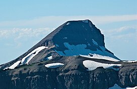
| Fossil Mountain | |
|---|---|
 South aspect | |
| Highest point | |
| Elevation | 10,921 ft (3,329 m) [1] |
| Prominence | 756 ft (230 m) [1] |
| Coordinates | 43°39′13″N 110°55′08″W / 43.65361°N 110.91889°W [2] |
| Geography | |
| Parent range | Teton Range |
| Topo map | USGS Mount Bannon |
Fossil Mountain (10,921 feet (3,329 m)) is located in the Teton Range, within the Jedediah Smith Wilderness of Caribou-Targhee National Forest, U.S. state of Wyoming. [3]
References
- ^ a b "Fossil Mountain, Wyoming". Peakbagger.com. Retrieved 2011-09-18.
- ^ "Fossil Mountain". Geographic Names Information System. United States Geological Survey, United States Department of the Interior. Retrieved 2011-09-18.
- ^ Mount Bannon, WY (Map). TopoQwest (United States Geological Survey Maps). Retrieved 2011-09-18.
