This article has multiple issues. Please help
improve it or discuss these issues on the
talk page. (
Learn how and when to remove these template messages)
|
Fort Dick, California | |
|---|---|
 Location of Fort Dick in Del Norte County, California. | |
| Coordinates: 41°52′04″N 124°08′56″W / 41.86778°N 124.14889°W | |
| Country | United States |
| State | California |
| County | Del Norte |
| Government | |
| • State Senate | Mike McGuire ( D) |
| • State Assembly | Jim Wood ( D) |
| • U.S. House of Representatives | Jared Huffman ( D) |
| Elevation | 52 ft (16 m) |
| Population (2020) | |
| • Total | 912 |
| Time zone | UTC-8 ( Pacific (PST)) |
| • Summer ( DST) | UTC-7 (PDT) |
| ZIP codes | 95538 (homes - 95531) |
| Area code | 707 |
| GNIS feature ID | 223696 |

Fort Dick ( Tolowa: Mvn-des-chuu-dvn) [1] is a small unincorporated community and census-designated place (CDP) in rural Del Norte County, California. Fort Dick is around five miles (eight kilometers) north of Crescent City, California, and around 15 mi (24 km) south of the California–Oregon state line. Its population is 912 as of the 2020 census, up from 588 from the 2010 census. It is located on the U.S. Route 101 corridor on the Redwood Coast. [2] A post office was set up in 1917. [3] [4]
Etymology
Fort Dick Landing dates back to the Civil War era and was named after a settler's log house "fort" built by Whites to defend from the Indians. [5] In 1888 a shake and shingle mill was moved there and the place renamed Newburg by the Bertsch brothers who owned the mill. [5] With the establishment of the post office in 1896, the old name was revived. [5] [3]
History
Pre-Settler contact
The heavily forested coast territory surrounding Fort Dick was occupied and used by the Tolowa and Yurok tribes of Native Americans. [6]
Jedediah Smith's party reaches Lake Earl
Historical records state that a party travelling with Jedediah Smith entered the area of Fort Dick and skirted the eastern edge of Lake Earl between June 14 to 16, 1828. [7] During this time, not only did they explore the area, but they made clear contact, including trading and engaging in commerce with the Tolowa Indians on the 15th. [7] Jedidiah Smith's party "skirted" the eastern shore of Lake Earl. [7] Since his party was there in 1828, it predates the events that led the settler or farmer who owned the land called "Russell's Prairie" (later Fort Dick) by about twenty-five to thirty years.
"On June 14 the company pushed up the beach until they struck a 'low neck of land running into the sea where there was plenty of clover and grass for our horses' and camped. The trappers, during the day's march, had been compelled to take to the sea for several hundred yards at a time, 'the swells some times would be as high as the horses backs.' The company remained on the south bank of Elk Creek on the 15th, while several hunters went out. One of them killed a buck elk 'weighing 695 lbs. neat weight.' A number of Tolowa came in bringing fish, clams, strawberries, and camas roots, which were purchased. The company rode out early on the 16th. Striking to the north northwest, they crossed a neck of land skirting the ocean. Considerable difficulty was encountered in getting the horses across Elk Creek, and they were compelled 'to make a pen on the bank to force them across.' The Mountain Men on the 16th camped on the wooded flats south of Lake Earl. Skirting the eastern margin of Lake Earl, the trappers camped three nights in Section 27, between the lake and Kings Valley." [7]
The camp site of June 14 was on Elk Creek, one-fourth of a mile west of the junction of U.S. 101 and the Elk Valley road. [7] Exactly one month later, while eating breakfast the morning of July 14, 1828, Jedediah's party was attacked by at least one hundred Native American Indians. Everyone in the party except for Jedediah and two companions died in the ambush. They escaped and headed directly to Fort Vancouver. [7]
Shipwrecks near Fort Dick and Crescent City
The coastal waters near Crescent City and north are notoriously treacherous. Over the years, there have been many ships sunk in the ocean close to Fort Dick and Crescent City.[ citation needed]
- 1850 - Paragon sunk
- 1851 - Tarquin
- 1855 - Steamer America burned in the harbor at Crescent City en route to Oregon and Washington [8]
- 1865 - The Steamer Brother Jonathan hit an uncharted reef near Point St. George.
- 1941 - SS Emidio, an oil tanker, was shelled and torpedoed by a Japanese submarine. This was the first ship sunk by the Japanese off the American Pacific coast in World War II. [9]
Fort Dick Road (1862)
A civil war era letter indicates the existence of several roads heading to Crescent City; however, there is specific mention of a "Fort Dicks Road"[ where?]. The Union Quartermaster Swasey, who had written the letter, suggested it as the preferred path to travel north. Apparently, other roads existed at the time but were fraught with peril during times when the rivers were high.[ citation needed] The southern terminus of the Fort Dick Road was Camp Lincoln, which was strategically located at the junction of two pioneer roads leading north from Crescent City; the Fort Dick Road heading up the Coast, and the Crescent City Plank Road and Turnpike leading inland to the mining communities of Southern Oregon.
As recently as 1948, the Metzger Map for Del Norte County still showed the now-abandoned portion of the Fort Dick Road that followed the high ground south of Younkers Creek, before crossing the creek near the current crossing of Lake Earl Drive. From there it continued overland to join up with what are now Lower Lake Road, Sarina Road, and Oceanview Drive and into southern Oregon.
When the coastal Roosevelt Highway serving the Oregon Coast was built in the 1920s, the original settlement of Fort Dick was relocated from the west end of Moorehead Road and moved to the east end of Moorehead Road in order for the community to remain on the primary route to the north.
Fort Dick during the Civil War
Perhaps it is best noted that the area now known as Fort Dick was once used by indigenous peoples of the region in the normal way they used any land.[ citation needed] There were several tribes in the Humboldt region, but by the time Crescent City was founded, the Caucasians were having battles with the Tolowa nation, as well as other Native American tribes. Many of these tribes were frequently in a state of conflict or involved in minor battles with the individuals who came to settle the parcel of land.[ citation needed]
Due to continuous unrest between the white settlers and the Native Americans, the military was eventually called in, at the bequest of the Department of Indian Affairs, in 1862 to establish a military presence on the site known as Fort Dick in 1862.[ citation needed] It appears from historical documents published by the US War Department in the 1890s that thirty years earlier, the west was abuzz with Union troops.[ citation needed] The letters written during the Civil War were compiled and published in the 1890s by the Secretary of War.
While the civil war raged in the eastern United States, there was a very active military presence of Union Soldiers building and summarily dismantling rough military outputs, camps, and forts that dotted northern California. It is in this context that there was an order sent out to establish a military settlement to keep peace between the settlers at Crescent City and the Native American populations in a reservation near the city.[ citation needed] Ultimately, the military did not listen to the suggestions, and selected a site at what is now known as Camp Lincoln. Camp Lincoln is 3 1/2 miles (5 km) south southeast of Fort Dick and roughly six miles north of Crescent City. The original buildings of Camp Lincoln were still standing during the 1950s and 1960s.[ citation needed]
Native American claim to Fort Dick
Two nations that are currently the closest are the Tolowa and the Yurok Nations. The federal government forced the large band of Yurok peoples onto a reservation they formed in 1855.[ citation needed] The Yurok were moved around a few times for a variety of reasons. After a flood in 1862, the Yurok were relocated to the Smith River Reservation; however, it was closed down in July 1867. At that point, the American government relocated several of the coastal tribes onto the newly established Hoopa Valley Reservation. Among them were the Tolowa, Yurok, Mad River, and Eel River Indians. Presently, the Tolowa are the only tribe that have their ceremonial headquarters in Fort Dick; however, the Yurok, on their website, show a very vast region of land that included dozens of cities up and down that portion of the California coast.[ citation needed]
Demographics
| Census | Pop. | Note | %± |
|---|---|---|---|
| U.S. Decennial Census [10] | |||
Government
Fort Dick has very few autonomous governmental services and is largely under the rule of Del Norte County. The remainder of the unincorporated city is subject to various county, state, and federal agencies.
Education
Educational services in Fort Dick are provided by the Del Norte County Unified School District, in conjunction with the Del Norte County Office of Education. At 1,008 square miles (2,610 km2), with over 4000 students, they accomplish this by utilizing an elaborate public school busing network. The many district buses service eleven schools: eight elementary, one middle school, one high school, and one alternative high school. [11] Fort Dick is the home to only one of the district's eight elementary schools. Redwood Elementary is equipped to educate students from the K to 8th grades. The school has a student population of 425 students, with a 21.8 student to teacher ratio. [12] People living in Fort Dick must use education facilities in neighboring Crescent City for anything higher than the elementary school level. [11]
Climate
This region experiences mild and dry summers, with no average monthly temperatures above 71.6 °F. According to the Köppen Climate Classification system, Fort Dick has a warm-summer Mediterranean climate ( Csb).
| Climate data for Fort Dick, California 141ft(43m) (1981-2010) | |||||||||||||
|---|---|---|---|---|---|---|---|---|---|---|---|---|---|
| Month | Jan | Feb | Mar | Apr | May | Jun | Jul | Aug | Sep | Oct | Nov | Dec | Year |
| Mean daily maximum °F (°C) | 53.7 (12.1) |
55.4 (13.0) |
56.5 (13.6) |
58.4 (14.7) |
61.4 (16.3) |
63.8 (17.7) |
65.8 (18.8) |
66.2 (19.0) |
66.2 (19.0) |
63.4 (17.4) |
57.1 (13.9) |
53.3 (11.8) |
60.1 (15.6) |
| Daily mean °F (°C) | 47.5 (8.6) |
48.7 (9.3) |
49.3 (9.6) |
50.9 (10.5) |
53.9 (12.2) |
58.4 (14.7) |
58.6 (14.8) |
59.0 (15.0) |
57.9 (14.4) |
55.2 (12.9) |
50.7 (10.4) |
47.2 (8.4) |
53.1 (11.7) |
| Mean daily minimum °F (°C) | 41.2 (5.1) |
41.9 (5.5) |
42.2 (5.7) |
43.4 (6.3) |
46.3 (7.9) |
49.0 (9.4) |
51.4 (10.8) |
51.9 (11.1) |
49.7 (9.8) |
47.0 (8.3) |
44.2 (6.8) |
41.1 (5.1) |
45.8 (7.7) |
| Average precipitation inches (mm) | 10.84 (275) |
9.59 (244) |
9.24 (235) |
5.94 (151) |
3.71 (94) |
2.03 (52) |
0.35 (8.9) |
0.56 (14) |
1.11 (28) |
4.66 (118) |
10.23 (260) |
13.86 (352) |
72.12 (1,831.9) |
| Average relative humidity (%) | 78.7 | 77.0 | 78.8 | 78.3 | 78.3 | 78.0 | 81.9 | 82.3 | 77.2 | 76.1 | 79.5 | 78.6 | 78.7 |
| Average dew point °F (°C) | 41.2 (5.1) |
41.8 (5.4) |
43.0 (6.1) |
44.4 (6.9) |
47.3 (8.5) |
50.3 (10.2) |
53.1 (11.7) |
53.6 (12.0) |
50.8 (10.4) |
47.8 (8.8) |
44.6 (7.0) |
40.9 (4.9) |
46.6 (8.1) |
| Source: [13] | |||||||||||||
References
- ^ Wee-ya’-dvn: Tolowa Dee-ni’ Language Resource Center - Dee-ni' Wee-ya' Lhetlh-xat 1
- ^ "Where is Fort Dick?". Fort Dick Fire Department. Fort Dick Fire Protection District. 2012. Archived from the original on February 22, 2012. Retrieved April 5, 2012.
- ^ a b Durham, David L. (1998). California's Geographic Names: A Gazetteer of Historic and Modern Names of the State. Clovis, Calif.: Word Dancer Press. p. 61. ISBN 1-884995-14-4.
- ^ Durham, David L. (November 2000). California North Coast: Del Norte, Humbolt, Lake, Mendocino & Trinity Counties. Word Dancer Press. p. 368. ISBN 978-1884995262. [ sic] title.
- ^ a b c Gudde, Erwin Gustav (1974). California Place Names: The Origin and Etymology of Current Geographical Names. University of California Press. p. 416. ISBN 978-0520242173.
- ^ "History and Heritage". Explore Del Norte. Crescent City/Del Norte County Visitors Bureau. 2012. Archived from the original on September 23, 2010. Retrieved April 5, 2012.
- ^ a b c d e f Bearss, Edwin C. (September 1, 1969). Redwood National Park, Del Norte and Humboldt Counties, California. Washington, D.C.: U.S. Department of the Interior National Park Service Division of History Office of Archeology and Historic Preservation. p. 433. ASIN: B0007FIU3W.
- ^ Bancroft, Hubert Howe (902). West American History. Vol. 30, Part II (Autograph ed.). New York City, New York: The Bancroft Company. p. 341. Retrieved March 11, 2011.
- ^ Hoover, Mildred Brooke; Kyle, Douglas E.; Rensch, Ethel Grace (2002). Historic Spots in California. Stanford, California: Stanford University Press. p. 72. ISBN 0-8047-4482-3.
- ^ "Census of Population and Housing". Census.gov. Retrieved June 4, 2016.
- ^ a b "DNCUSD Schools".
- ^ "ZIP code : 95538". www.uszip.com.
- ^ "PRISM Climate Group, Northwest Alliance for Computational Science and Engineering (Time Series Values for Individual Locations)". Retrieved February 21, 2021.
Further reading
- The War of the Rebellion: a compilation of the official records of the Union, United States Department of War, Washington, 1880.
External links
- Tolowa Nation
- Yurok Tribe
- County of Del Norte website
- Historic Book: Redwood National Forest
- Del Norte County Tourism and Travel website
- Brother Jonathan Shipwreck
- Brother Johnathan Cemetery
Municipalities and communities of
Del Norte County, California, United States | ||
|---|---|---|
| City | 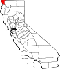 | |
| CDPs | ||
|
Unincorporated communities | ||
|
Indian reservations | ||
|
Ghost towns | ||