PhotosLocation


Flat_Top_(Georgia) Latitude and Longitude:

34°57′04″N 83°18′56″W / 34.95111°N 83.31556°W / 34.95111; -83.31556
From Wikipedia, the free encyclopedia
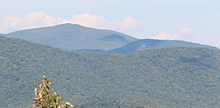
Rabun Bald (left) and Flat Top (right), viewed from Black Rock Mountain State Park

Flat Top, with an elevation of 4,142 feet, is the 20th-highest peak in Georgia, United States. It is located in Rabun County, Georgia and is within the boundaries of the Chattahoochee National Forest. There is a view of the rock face of Flat Top from the Bartram Trail.

See also

References

External links

34°57′04″N 83°18′56″W / 34.95111°N 83.31556°W / 34.95111; -83.31556