Original file (1,453 × 968 pixels, file size: 797 KB, MIME type: image/jpeg)
| This is a file from the
Wikimedia Commons. Information from its
description page there is shown below. Commons is a freely licensed media file repository. You can help. |
Summary
| Description |
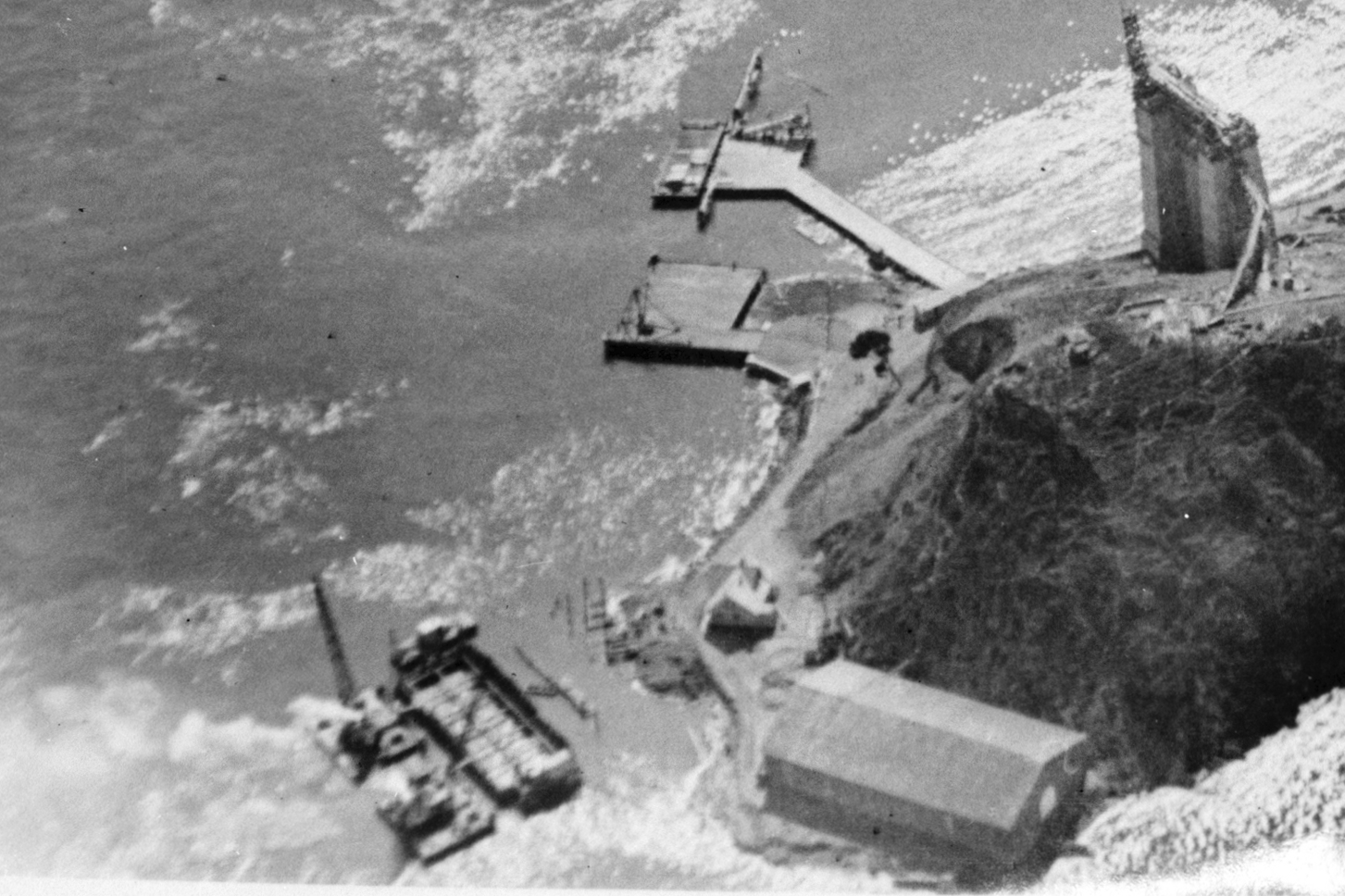
English: Cropped version of YerbaBuena a 016085pu.jpg using the Library of Congress TIFF file.
Historic American Buildings Survey photo from 1936. Entitled "1936 YERBA BUENA ISLAND LOOKING SOUTH DURING BRIDGE AND TUNNEL CONSTRUCTION", specific photographer not given. Shows Yerba Buena Island in San Francisco Bay during the early construction of the Bay Bridge, which now essentially covers the east (left) side of the island. Of particular interest here is the NRHP-listed building at the bottom of the photo. It is called the "Torpedo Storehouse-Torpedo (Mine) Assembly Building & Long Range Accuracy Storage Building" listed on June 11, 2008 at East Point; North Shore of Yerba Buena Island coordinates 37°48′53″N 122°21′33″W. Yerba Buena Island 1891 torpedo assembly building built for the US Army by architect Ernest Leslie Ransome |
|||||
| Date | ||||||
| Source | http://hdl.loc.gov/loc.pnp/hhh.ca0751 | |||||
| Author |
|

| Camera location |
| View this and other nearby images on: OpenStreetMap |
|
|---|
|
This is an image of a place or building that is listed on the
National Register of Historic Places in the
United States of America. Its reference number is
08000086. |
Licensing
This work is in the
public domain in the United States because it is a
work prepared by an officer or employee of the United States Government as part of that person’s official duties under the terms of
Title 17, Chapter 1, Section 105 of the
US Code.
Note: This only applies to original works of the Federal Government and not to the work of any individual
U.S. state,
territory, commonwealth, county, municipality, or any other subdivision. This template also does not apply to postage stamp designs published by the
United States Postal Service
since 1978. (See §
313.6(C)(1) of Compendium of U.S. Copyright Office Practices). It also does not apply to certain US coins; see
The US Mint Terms of Use.
|
 | |
| This file has been identified as being free of known restrictions under copyright law, including all related and neighboring rights. | ||
File history
Click on a date/time to view the file as it appeared at that time.
| Date/Time | Thumbnail | Dimensions | User | Comment | |
|---|---|---|---|---|---|
| current | 19:04, 6 December 2012 |
| 1,453 × 968 (797 KB) | Smallbones | User created page with UploadWizard |