
Size of this preview:
800 × 361 pixels. Other resolutions:
320 × 144 pixels |
640 × 289 pixels |
1,024 × 462 pixels |
1,890 × 852 pixels.
Original file (1,890 × 852 pixels, file size: 740 KB, MIME type: image/jpeg)
| This is a file from the
Wikimedia Commons. Information from its
description page there is shown below. Commons is a freely licensed media file repository. You can help. |
_Filene_Center_outside.jpg)
| Camera location |
| View this and other nearby images on: OpenStreetMap |
|
|---|
_Filene_Center_outside.jpg¶ms=038.937314_N_-077.265794_E_globe:Earth_type:camera_scale:100_&language=en)
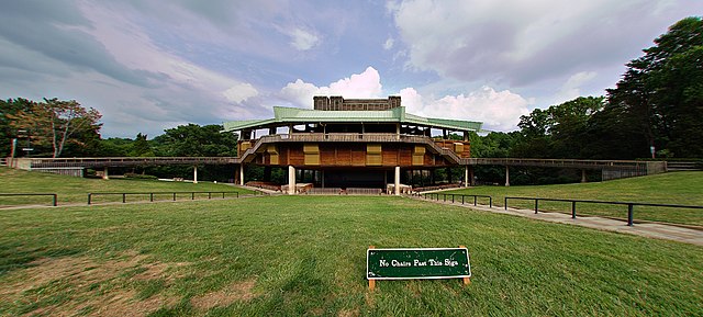
| Description | Filene Center at Wolf Trap National Park in Vienna, Virginia. |
| Date | UTC |
| Source | By uploader. |
| Author | Gregory F. Maxwell < gmaxwell@gmail.com> PGP: 0xB0413BFA |
| Permission ( Reusing this file) |
GFDL 1.2 only |
Equipment
- Canon 5D
- 15mm fisheye
- F14, 1/30th (1/120th and 1/8th) of second, ISO100.
- Tonemapped to LDR
- Reprojected to rectilinear.
I, the copyright holder of this work, hereby publish it under the following license:

|
Permission is granted to copy, distribute and/or modify this document under the terms of the GNU Free Documentation License, Version 1.2 only as published by the Free Software Foundation; with no Invariant Sections, no Front-Cover Texts, and no Back-Cover Texts. A copy of the license is included in the section entitled GNU Free Documentation License. | 1.2 only |
File history
Click on a date/time to view the file as it appeared at that time.
| Date/Time | Thumbnail | Dimensions | User | Comment | |
|---|---|---|---|---|---|
| current | 05:34, 6 July 2006 |
| 1,890 × 852 (740 KB) | Gmaxwell | {{Location dec|38.937314|-77.265794|scale:100}} {{Information |Description=Filene Center at Wolf Trap National Park in Vienna, Virginia. |Source=By uploader. |Date=2006-06-24 21:19:24 UTC |Author=Gregory F. Maxwell |Permission=GFDL 1.2 only }} ==Equipme |
File usage
The following pages on the English Wikipedia use this file (pages on other projects are not listed):
Global file usage
The following other wikis use this file:
- Usage on ceb.wikipedia.org
- Usage on en.wikivoyage.org
- Usage on fr.wikipedia.org
- Usage on it.wikipedia.org
- Usage on www.wikidata.org
_Filene_Center_outside.jpg)