I, Master son, the creator of this image, hereby release it into the public domain. If that cannot be done for any reason, including the nonexistence of a way to release a work into the public domain, I release it (or my changes in the case of a derivative work) under the following license:
Copyleft: this work of art is free, you can redistribute it and/or modify it according to terms of the Free Art License. You will find a specimen of this license on the site Copyleft Attitude
http://artlibre.org/licence/lal/en/ as well as on other sites.
The copyright holder of this image allows anyone to use it for any purpose including unrestricted redistribution, commercial use, and modification.
Permission is granted to copy, distribute and/or modify this document under the terms of the GNU Free Documentation License, Version 1.2 or any later version published by the
Free Software Foundation; with no Invariant Sections, no Front-Cover Texts, and no Back-Cover Texts. A copy of the license is included in the section entitled GNU Free Documentation License.http://www.gnu.org/copyleft/fdl.htmlGFDLGNU Free Documentation Licensetruetrue
to share – to copy, distribute and transmit the work
to remix – to adapt the work
Under the following conditions:
attribution – You must give appropriate credit, provide a link to the license, and indicate if changes were made. You may do so in any reasonable manner, but not in any way that suggests the licensor endorses you or your use.
share alike – If you remix, transform, or build upon the material, you must distribute your contributions under the
same or compatible license as the original.
This licensing tag was added to this file as part of the GFDL
licensing update.http://creativecommons.org/licenses/by-sa/3.0/CC BY-SA 3.0Creative Commons Attribution-Share Alike 3.0truetrue
Information
Captions
Add a one-line explanation of what this file represents
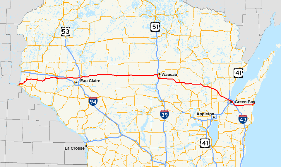
{{Information| |Description= Map of
WIS 29 |Source=Own work - using Quantum GIS 0.8.1 based on data collected from [http://www.census.gov/geo/www/cob/co2000.html the Census Bureau] (the county outlines) and [http://www.fhwa.dot
File usage
No pages on the English Wikipedia use this file (pages on other projects are not listed).


