Size of this preview:
800 × 480 pixels. Other resolutions:
320 × 192 pixels |
1,024 × 614 pixels |
1,280 × 768 pixels |
2,500 × 1,500 pixels.
Original file (2,500 × 1,500 pixels, file size: 633 KB, MIME type: image/jpeg)
| This is a file from the
Wikimedia Commons. Information from its
description page there is shown below. Commons is a freely licensed media file repository. You can help. |
Summary
| Description |
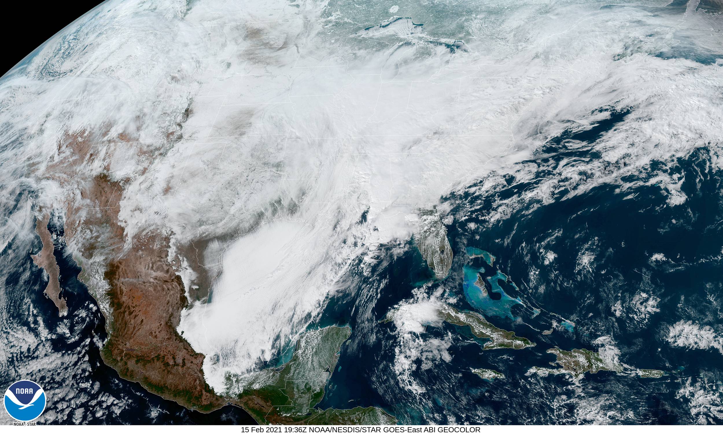
English: Geocolor satellite imagery of
a large and historic winter storm covering the eastern third of the United States on February 15, 2021. |
| Date | |
| Source | https://www.star.nesdis.noaa.gov/GOES/conus.php?sat=G16 |
| Author | NOAA |
Licensing
| This file is in the public domain in the United States because it was solely created by NASA. NASA copyright policy states that "NASA material is not protected by copyright unless noted". (See Template:PD-USGov, NASA copyright policy page or JPL Image Use Policy.) | ||
 |
Warnings:
|
File history
Click on a date/time to view the file as it appeared at that time.
| Date/Time | Thumbnail | Dimensions | User | Comment | |
|---|---|---|---|---|---|
| current | 19:51, 15 February 2021 |
| 2,500 × 1,500 (633 KB) | Wikicanada1127 | Uploaded a work by NOAA from https://www.star.nesdis.noaa.gov/GOES/conus.php?sat=G16 with UploadWizard |
File usage
The following pages on the English Wikipedia use this file (pages on other projects are not listed):
Global file usage
The following other wikis use this file:
- Usage on pt.wikinews.org