
Size of this preview:
800 × 600 pixels. Other resolutions:
320 × 240 pixels |
640 × 480 pixels |
1,024 × 768 pixels |
1,280 × 960 pixels |
2,560 × 1,920 pixels |
4,320 × 3,240 pixels.
Original file (4,320 × 3,240 pixels, file size: 6.62 MB, MIME type: image/jpeg)
| This is a file from the
Wikimedia Commons. Information from its
description page there is shown below. Commons is a freely licensed media file repository. You can help. |
Summary
| Description |
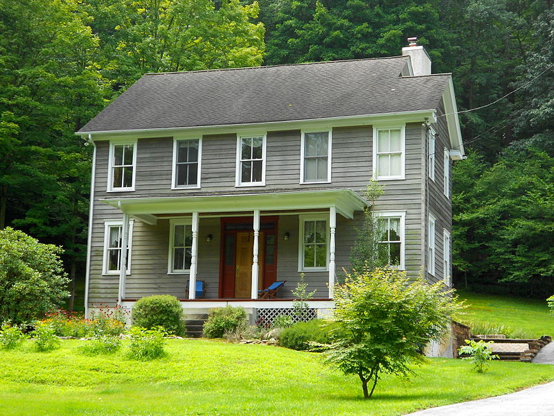
English: Wilkinson House on the NRHP since September 16, 1985. On Pennsylvania Route 842, just west of the bridge across the Brandywine and just south of the railroad. In Pocopson Township, Chester County. The house has been extensively changed since it was listed on the NRHP - a new roof, with the distinctive cross-gable now gone. A tall shed structure at the rear of the house is gone. New siding and the wooden "quoins" are gone. But the basic window structure is the same, as well as the structure of the porch. A stable has been destroyed but its foundation is in the right place. The configuration of the bridge, railroad, road and river (as well as the stable foundation) identifies this as the unique place.
|
||
| Date | |||
| Source | Own work | ||
| Author | Smallbones |
| Camera location |
| View this and other nearby images on: OpenStreetMap |
|
|---|
Licensing
I, the copyright holder of this work, hereby publish it under the following license:
This file is licensed under the
Creative Commons
Attribution-Share Alike 3.0 Unported license.
- You are free:
- to share – to copy, distribute and transmit the work
- to remix – to adapt the work
- Under the following conditions:
- attribution – You must give appropriate credit, provide a link to the license, and indicate if changes were made. You may do so in any reasonable manner, but not in any way that suggests the licensor endorses you or your use.
- share alike – If you remix, transform, or build upon the material, you must distribute your contributions under the same or compatible license as the original.
File history
Click on a date/time to view the file as it appeared at that time.
| Date/Time | Thumbnail | Dimensions | User | Comment | |
|---|---|---|---|---|---|
| current | 01:03, 24 July 2013 |
| 4,320 × 3,240 (6.62 MB) | Smallbones | User created page with UploadWizard |
File usage
The following pages on the English Wikipedia use this file (pages on other projects are not listed):
Global file usage
The following other wikis use this file:
- Usage on cy.wikipedia.org
- Usage on es.wikipedia.org
- Usage on fr.wikipedia.org
- Usage on tl.wikipedia.org
- Usage on uk.wikipedia.org
- Usage on vi.wikipedia.org
- Usage on www.wikidata.org