Size of this preview:
800 × 529 pixels. Other resolutions:
320 × 212 pixels |
640 × 423 pixels |
1,024 × 677 pixels |
1,500 × 992 pixels.
Original file (1,500 × 992 pixels, file size: 737 KB, MIME type: image/jpeg)
| This is a file from the
Wikimedia Commons. Information from its
description page there is shown below. Commons is a freely licensed media file repository. You can help. |
| Description |
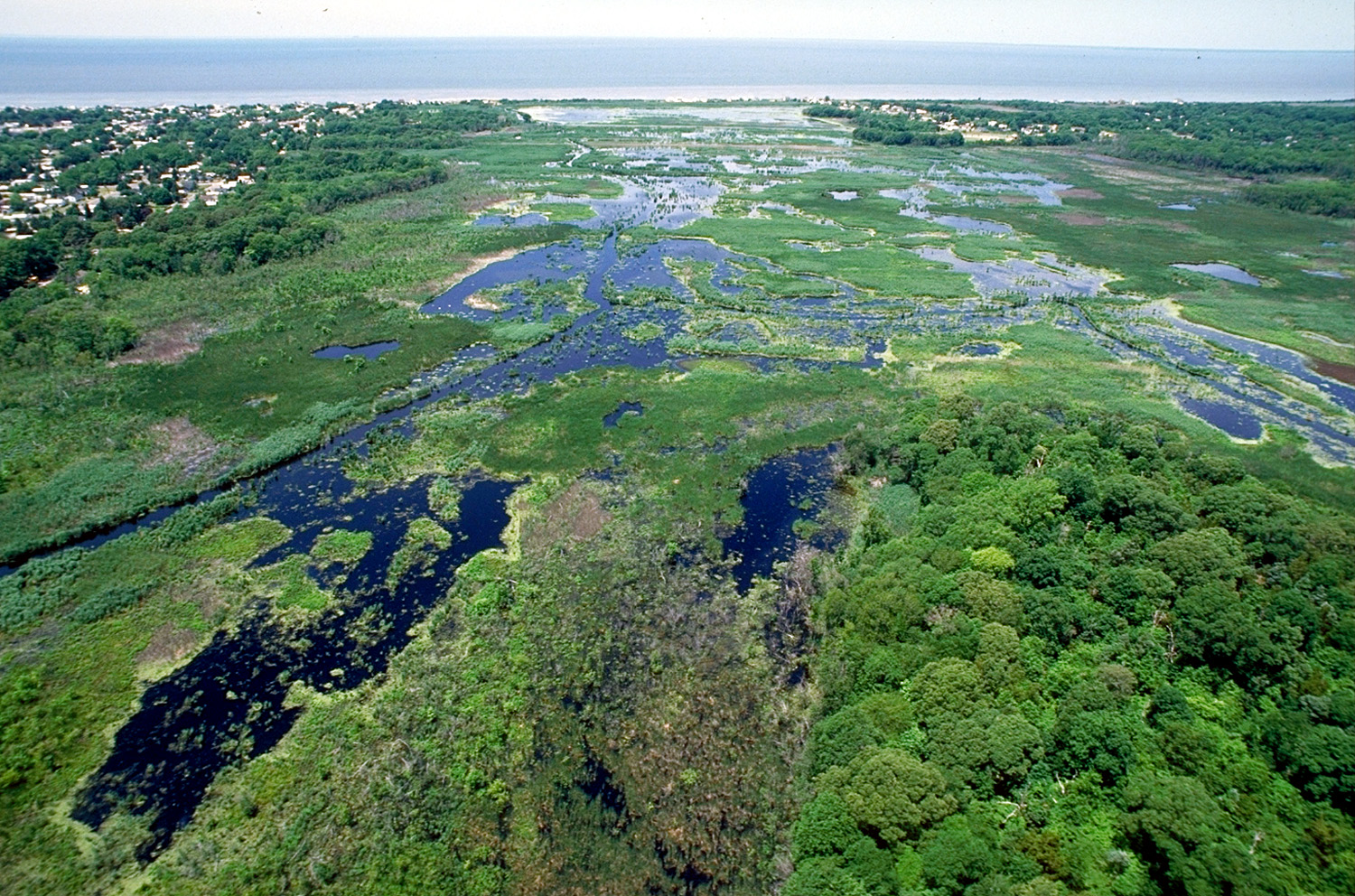
English: Wetlands in Cape May, New Jersey, USA.
View of Fishing Creek Marsh with Miami Beach, New Jersey on the left. A managed by Cape May County Park system.
[1] |
|||
| Date | not specified or unknown | |||
| Source |
U.S. Army Corps of Engineers Digital Visual Library Image page Image description page Digital Visual Library home page |
|||
| Author | Anthony Bley, U.S. Army Corps of Engineers | |||
| Permission ( Reusing this file) |
|
|||
| Location | Cape May, New Jersey, USA |
| Camera location |
| View this and other nearby images on: OpenStreetMap |
|
|---|
File history
Click on a date/time to view the file as it appeared at that time.
| Date/Time | Thumbnail | Dimensions | User | Comment | |
|---|---|---|---|---|---|
| current | 01:59, 8 April 2007 |
| 1,500 × 992 (737 KB) | DanMS | {{Information | Description = {{en|Wetlands on Cape May, New Jersey, USA.}} | Source = U.S. Army Corps of Engineers Digital Visual Library<br />[http://images.usace.army.mil/images/Hires/4171-10.Jpg Image page]<br />[http://images.usace.army.mi |
File usage
The following pages on the English Wikipedia use this file (pages on other projects are not listed):
Global file usage
The following other wikis use this file:
- Usage on ca.wikipedia.org
- Usage on cy.wikipedia.org
- Usage on es.wikipedia.org
- Usage on fr.wikipedia.org
- Usage on fr.wikiversity.org
- Usage on he.wikipedia.org
- Usage on pl.wikipedia.org
- Usage on ro.wikipedia.org
- Usage on www.wikidata.org