Original file (3,994 × 4,000 pixels, file size: 7.51 MB, MIME type: image/jpeg)
| This is a file from the
Wikimedia Commons. Information from its
description page there is shown below. Commons is a freely licensed media file repository. You can help. |
Summary
| Description |
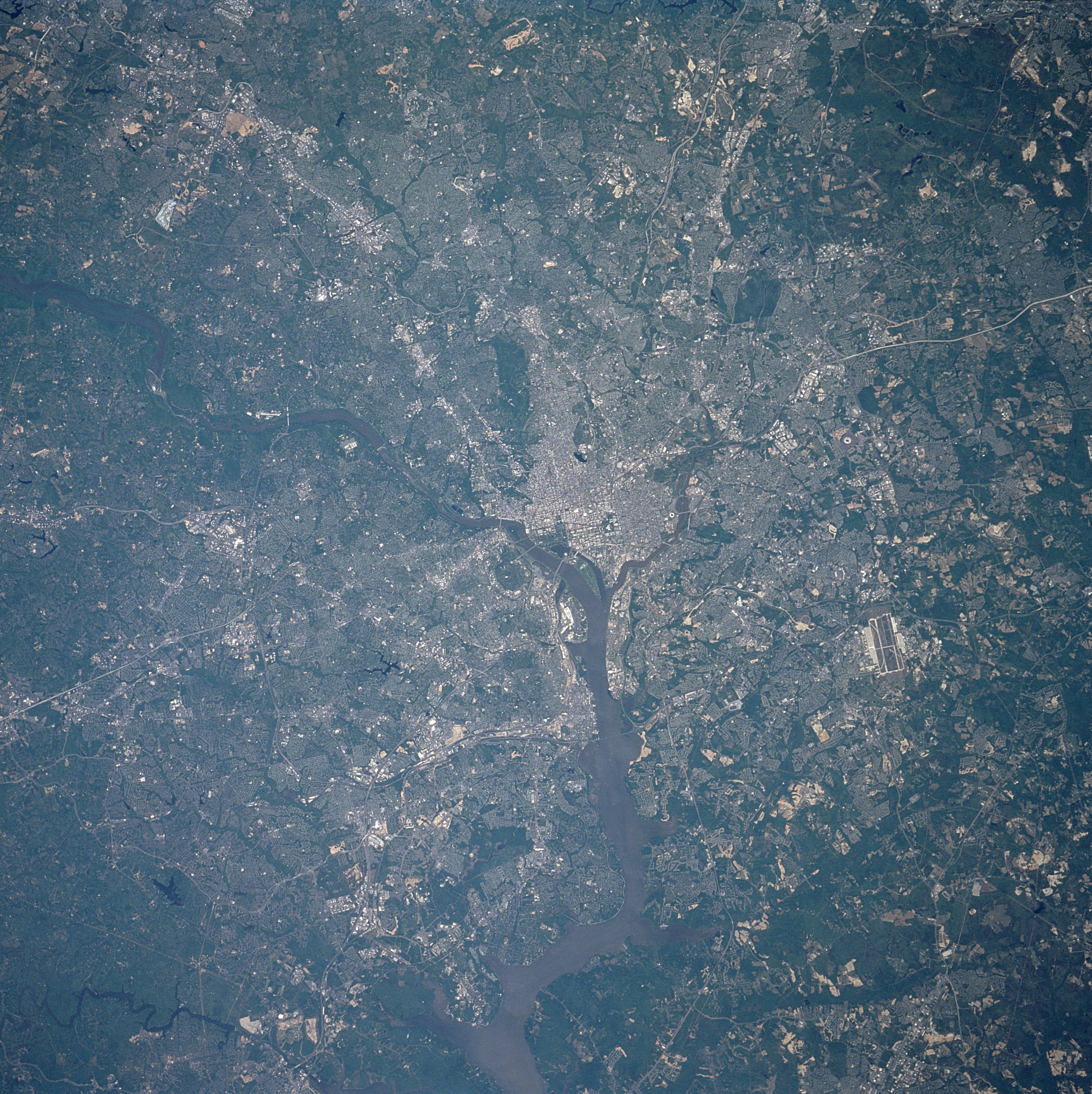
English: View of Washington D.C. from Space Shuttle Columbia, mission STS-90, early spring 1998.
Washington D.C., the capital of the United States, is located on the Potomac and Anacostia Rivers. The Potomac River enters the scene midway between the left center and upper left of the image and exits the scene at the bottom center of the image. The state of Virginia lies to the west of the Potomac River, the state of Maryland to the north and east of the Potomac River. The runways of Andrews Air Force Base are visible east-southeast of Washington D. C. near the right center of the image. |
| Date | |
| Source | Washington from space |
| Author | Kamlesh P. Lulla Ph.D. Chief, Earth Sciences Branch |
Fonte
Earth.Jonhson Space Center.National Aeronautic and Space Administration.government/Space Shuttle Earth Observations Photography/Earth From Space/low resolution.
Washington from space
View from Space Shuttle Columbia, mission STS-90, early spring 1998.
Washington DC STS090-712-040
Washington District of Columbia April 1998 Washington D.C., the capital of the United States, is located on the Potomac and Anacostia Rivers. The Potomac River enters the scene midway between the left center and upper left of the image and exits the scene at the bottom center of the image. The state of Virginia lies to the west of the Potomac River, the state of Maryland to the north and east of the Potomac River. The runways of Andrews Air Force Base are visible east-southeast of Washington D. C. near the right center of the image.
Content Provider
Kamlesh P. Lulla Ph.D. Chief, Earth Sciences Branch
Responsible NASA Official: Ed Wilson
Curator: Jaime Powell
Last Update: 06/17/2002
Licensing
| This file is in the public domain in the United States because it was solely created by NASA. NASA copyright policy states that "NASA material is not protected by copyright unless noted". (See Template:PD-USGov, NASA copyright policy page or JPL Image Use Policy.) | ||
 |
Warnings:
|
File history
Click on a date/time to view the file as it appeared at that time.
| Date/Time | Thumbnail | Dimensions | User | Comment | |
|---|---|---|---|---|---|
| current | 06:26, 1 September 2005 |
| 3,994 × 4,000 (7.51 MB) | Roger469 | Washington from space |
File usage
Global file usage
The following other wikis use this file:
- Usage on eo.wikipedia.org