
Size of this preview:
703 × 599 pixels. Other resolutions:
282 × 240 pixels |
563 × 480 pixels |
901 × 768 pixels |
1,201 × 1,024 pixels |
2,307 × 1,967 pixels.
Original file (2,307 × 1,967 pixels, file size: 1.86 MB, MIME type: image/png)
| This is a file from the
Wikimedia Commons. Information from its
description page there is shown below. Commons is a freely licensed media file repository. You can help. |
Summary
| Description |
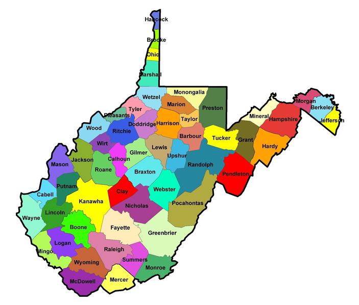
English: Map of the
Counties in West Virginia. |
| Date | 22 April 2008 (original upload date) |
| Source | Own work (Original text: self-made) |
| Author | Jm0371 ( talk) / Jm0371 at English Wikipedia |
Licensing
| This work has been released into the
public domain by its author,
Jm0371 at
English Wikipedia. This applies worldwide. In some countries this may not be legally possible; if so: Jm0371 grants anyone the right to use this work for any purpose, without any conditions, unless such conditions are required by law. |
Original upload log
Transferred from en.wikipedia to Commons by C messier using CommonsHelper.
The original description page was
here. All following user names refer to en.wikipedia.
- 2008-04-22 19:23 Jm0371 2307×1967× (1953697 bytes) {{Information |Description= |Source=self-made |Date= |Author=~~~ |other_versions= }}
File history
Click on a date/time to view the file as it appeared at that time.
| Date/Time | Thumbnail | Dimensions | User | Comment | |
|---|---|---|---|---|---|
| current | 23:38, 25 December 2013 |
| 2,307 × 1,967 (1.86 MB) | File Upload Bot (Magnus Manske) | Transfered from en.wikipedia by User:C messier using CommonsHelper |
File usage
The following pages on the English Wikipedia use this file (pages on other projects are not listed):
Global file usage
The following other wikis use this file:
- Usage on bs.wikipedia.org
- Usage on el.wikipedia.org
- Usage on es.wikipedia.org
- Usage on it.wikipedia.org
- Usage on pt.wikipedia.org