No higher resolution available.
WA01_109.png (635 × 379 pixels, file size: 31 KB, MIME type: image/png)
| This is a file from the
Wikimedia Commons. Information from its
description page there is shown below. Commons is a freely licensed media file repository. You can help. |
Summary
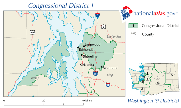
| Description | Map of the 1st Congressional District of Washington after the 2000 U.S. Census. |
| Date | |
| Source | http://www.nationalatlas.gov |
| Author | nationalatlas.gov, United States Department of the Interior |
| Permission ( Reusing this file) |
"Nearly all information collected by the Federal Government is in the public domain and use of raw data produced under this project is not restricted in any way." [1] |
Licensing
This map was obtained from an edition of the
National Atlas of the United States. Like almost all works of the U.S. federal government, works from the National Atlas are in the
public domain in the United States.
Online access: NationalAtlas.gov | 1970 print edition: Library of Congress, Perry-Castañeda Library
|
File history
Click on a date/time to view the file as it appeared at that time.
| Date/Time | Thumbnail | Dimensions | User | Comment | |
|---|---|---|---|---|---|
| current | 16:16, 25 April 2006 |
| 635 × 379 (31 KB) | PHenry | {{Information| |Description=Map of the 1st Congressional District of Washington after the 2000 U.S. Census. |Source=http://www.nationalatlas.gov |Date=March 13, 2006 |Author=nationalatlas.gov, [[w:United States Department |
File usage
The following pages on the English Wikipedia use this file (pages on other projects are not listed):
- 2002 United States House of Representatives elections in Washington
- 2004 United States House of Representatives elections in Washington
- 2006 United States House of Representatives elections in Washington
- 2008 United States House of Representatives elections in Washington
- 2010 United States House of Representatives elections in Washington
- Washington's 1st congressional district