
Size of this preview:
800 × 462 pixels. Other resolutions:
320 × 185 pixels |
640 × 369 pixels |
1,024 × 591 pixels |
1,280 × 739 pixels |
2,560 × 1,477 pixels |
4,352 × 2,511 pixels.
Original file (4,352 × 2,511 pixels, file size: 4.95 MB, MIME type: image/jpeg)
| This is a file from the
Wikimedia Commons. Information from its
description page there is shown below. Commons is a freely licensed media file repository. You can help. |
Summary
| Description | |
| Date | |
| Source | Own work |
| Author | ToucanWings |
| Object location |
| View this and other nearby images on: OpenStreetMap |
|
|---|
|
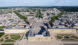
This building is classé au titre des
monuments historiques de la France. It is indexed in the
base Mérimée, a database of architectural heritage maintained by the
French Ministry of Culture, under the reference
PA00087673
|
Licensing
I, the copyright holder of this work, hereby publish it under the following license:
This file is licensed under the
Creative Commons
Attribution-Share Alike 3.0 Unported license.
- You are free:
- to share – to copy, distribute and transmit the work
- to remix – to adapt the work
- Under the following conditions:
- attribution – You must give appropriate credit, provide a link to the license, and indicate if changes were made. You may do so in any reasonable manner, but not in any way that suggests the licensor endorses you or your use.
- share alike – If you remix, transform, or build upon the material, you must distribute your contributions under the same or compatible license as the original.
The making of this document was supported by
Wikimédia France. (
Submit your project!)
|
File history
Click on a date/time to view the file as it appeared at that time.
| Date/Time | Thumbnail | Dimensions | User | Comment | |
|---|---|---|---|---|---|
| current | 08:18, 6 October 2013 |
| 4,352 × 2,511 (4.95 MB) | Paris 16 |
File usage
The following pages on the English Wikipedia use this file (pages on other projects are not listed):
Global file usage
The following other wikis use this file:
- Usage on ast.wikipedia.org
- Usage on bg.wikipedia.org
- Usage on ca.wikipedia.org
- Usage on cs.wikipedia.org
- Usage on de.wikipedia.org
- Usage on es.wikipedia.org
- Usage on fi.wikipedia.org
- Usage on fi.wikibooks.org
- Usage on gl.wikipedia.org
- Usage on ja.wikipedia.org
- Usage on pl.wikipedia.org
- Usage on ro.wikipedia.org
- Usage on sk.wikipedia.org
- Usage on www.wikidata.org