
Size of this preview:
465 × 599 pixels. Other resolutions:
186 × 240 pixels |
373 × 480 pixels |
596 × 768 pixels |
795 × 1,024 pixels |
1,590 × 2,048 pixels |
3,264 × 4,203 pixels.
Original file (3,264 × 4,203 pixels, file size: 3.37 MB, MIME type: image/jpeg)
| This is a file from the
Wikimedia Commons. Information from its
description page there is shown below. Commons is a freely licensed media file repository. You can help. |
.jpg)
Summary
| Description |
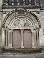
Français : Tympan (externe) de la
Basilique Sainte-Marie-Madeleine_de_Vézelay,
Vézelay
Yonne,
Bourgogne, France. |
| Date | |
| Source | Own work |
| Author | PIERRE ANDRE LECLERCQ |
|
This place is a UNESCO
World Heritage Site, listed as
Basilique et colline de Vézelay.
|
|
This place is a UNESCO
World Heritage Site, listed as
Chemins de Saint-Jacques-de-Compostelle en France.
|
| Object location |
| View this and other nearby images on: OpenStreetMap |
|
|---|
.jpg¶ms=047.466317_N_0003.748461_E_globe:Earth_class:object_type:object_region:FR_&language=en)
|
This building is classé au titre des
monuments historiques de la France. It is indexed in the
base Mérimée, a database of architectural heritage maintained by the
French Ministry of Culture, under the reference
PA00113932
|
Licensing
I, the copyright holder of this work, hereby publish it under the following license:
This file is licensed under the
Creative Commons
Attribution-Share Alike 4.0 International license.
- You are free:
- to share – to copy, distribute and transmit the work
- to remix – to adapt the work
- Under the following conditions:
- attribution – You must give appropriate credit, provide a link to the license, and indicate if changes were made. You may do so in any reasonable manner, but not in any way that suggests the licensor endorses you or your use.
- share alike – If you remix, transform, or build upon the material, you must distribute your contributions under the same or compatible license as the original.

|
This image was uploaded as part of
Wiki Loves Monuments 2016.
|
File history
Click on a date/time to view the file as it appeared at that time.
| Date/Time | Thumbnail | Dimensions | User | Comment | |
|---|---|---|---|---|---|
| current | 09:48, 26 September 2016 |
| 3,264 × 4,203 (3.37 MB) | Pierre André Leclercq | User created page with UploadWizard |
File usage
The following pages on the English Wikipedia use this file (pages on other projects are not listed):
Global file usage
The following other wikis use this file:
- Usage on cs.wikipedia.org
- Usage on fa.wikipedia.org
- Usage on ro.wikipedia.org
- Usage on ru.wikipedia.org
- Usage on zh.wikipedia.org
.jpg)