Size of this preview:
750 × 600 pixels. Other resolutions:
300 × 240 pixels |
600 × 480 pixels |
1,000 × 800 pixels.
Original file (1,000 × 800 pixels, file size: 325 KB, MIME type: image/jpeg)
| This is a file from the
Wikimedia Commons. Information from its
description page there is shown below. Commons is a freely licensed media file repository. You can help. |
Summary
| Description |
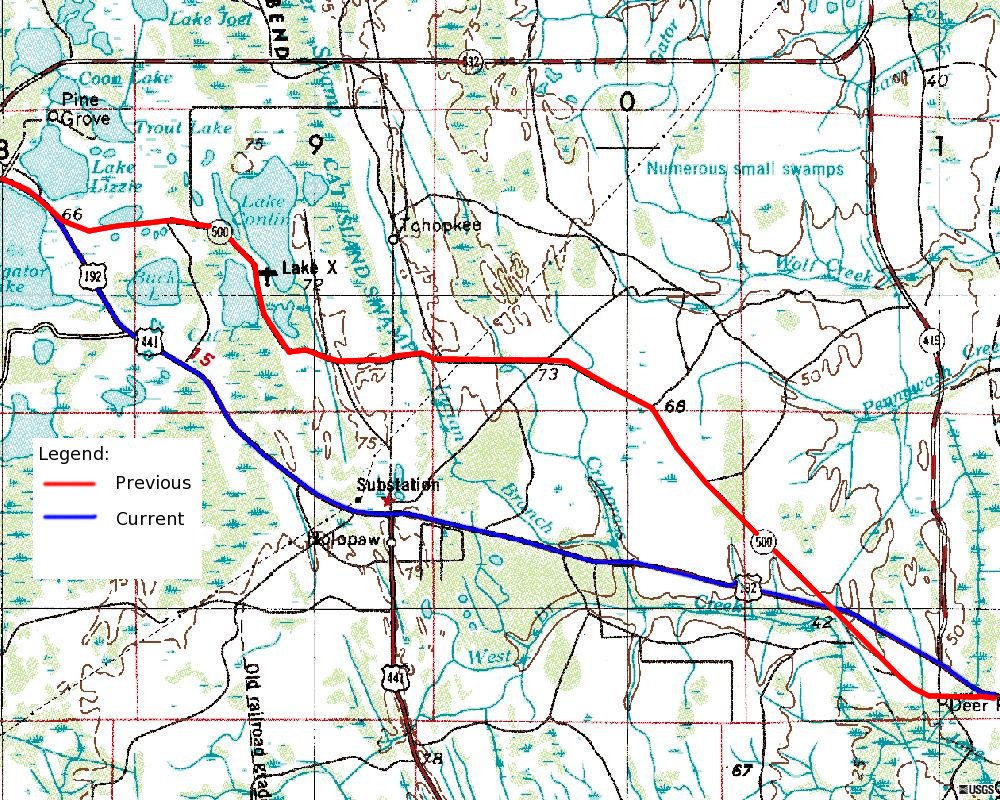
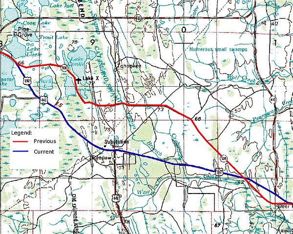
English: Background image composite image of USGS Topography maps dated July 1, 1972. USGS images are public domain. Legend, current and former alignments of U.S. 192 in Osceola County added by Gerald McMillen. Public Domain. |
| Date | 22 October 2005 (original upload date) |
| Source | Google Earth Community Page: http://bbs.keyhole.com/ubb/showflat.php/Cat/0/Number/1079918/an/0/page/2#1079918 |
| Author | USGS, Mcmillen76 at English Wikipedia |
Licensing
| |
This work has been released into the
public domain by its author,
Mcmillen76, at the
English Wikipedia project. This applies worldwide. In case this is not legally possible: |
Original upload log
The original description page was
here. All following user names refer to en.wikipedia.
| Date/Time | Dimensions | User | Comment |
|---|---|---|---|
| 2005-10-22 01:40 | 1000×800× (333064 bytes) | Mcmillen76 | Background image composite image of USGS Topography maps dated July 1, 1972. USGS images are public domain. Legend, current and former alignments of U.S. 192 in Osceola County added by Gerald McMillen. Public Domain. |
File history
Click on a date/time to view the file as it appeared at that time.
| Date/Time | Thumbnail | Dimensions | User | Comment | |
|---|---|---|---|---|---|
| current | 17:16, 8 August 2018 |
| 1,000 × 800 (325 KB) | Innotata | Transferred from en.wikipedia via #commonshelper |
File usage
The following pages on the English Wikipedia use this file (pages on other projects are not listed):
Global file usage
The following other wikis use this file:
- Usage on de.wikipedia.org