Size of this preview:
776 × 600 pixels. Other resolutions:
311 × 240 pixels |
621 × 480 pixels |
994 × 768 pixels |
1,280 × 989 pixels.
Original file (1,280 × 989 pixels, file size: 582 KB, MIME type: image/png)
| This is a file from the
Wikimedia Commons. Information from its
description page there is shown below. Commons is a freely licensed media file repository. You can help. |
Summary
| Description |
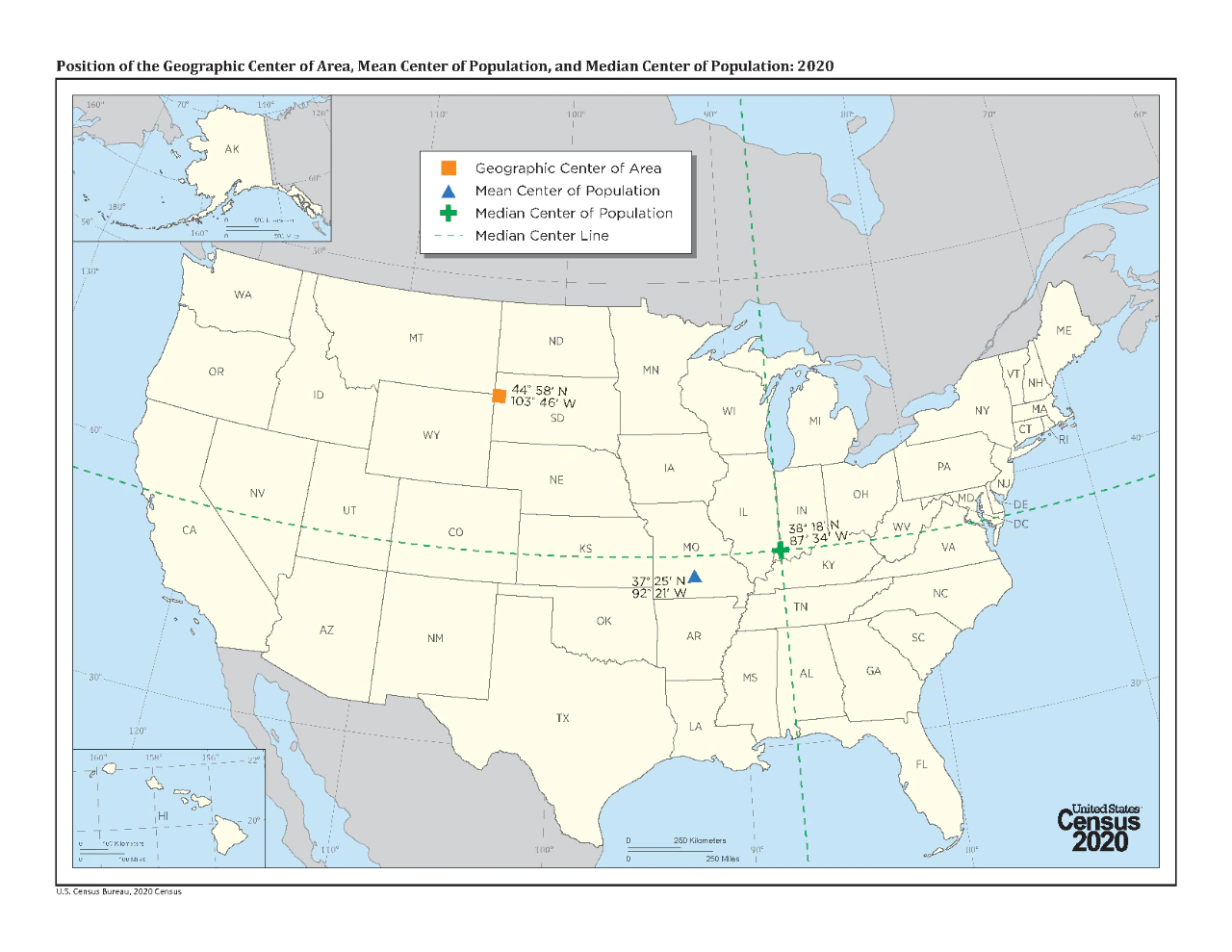
English: Map of the Position of the U.S. Geographic Center of Area, Mean Center of Population, and Median Center of Population, 2020 |
| Date | |
| Source | https://www.census.gov/library/visualizations/2020/geo/geographic-center-2020.html |
| Author | U.S. Census Bureau |
Licensing
This image or file is a work of a
United States Census Bureau employee, taken or made as part of that person's official duties. As a
work of the
U.S. federal government, the image is in the
public domain.
|
 |
File history
Click on a date/time to view the file as it appeared at that time.
| Date/Time | Thumbnail | Dimensions | User | Comment | |
|---|---|---|---|---|---|
| current | 23:16, 28 December 2021 |
| 1,280 × 989 (582 KB) | Bill Williams | Uploaded own work with UploadWizard |
File usage
The following pages on the English Wikipedia use this file (pages on other projects are not listed):