No higher resolution available.
US_west_coast_physiographic_regions_map.jpg (221 × 375 pixels, file size: 26 KB, MIME type: image/jpeg)
| This is a file from the
Wikimedia Commons. Information from its
description page there is shown below. Commons is a freely licensed media file repository. You can help. |
Summary
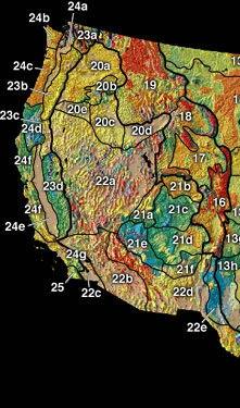
| Description |
English: US West Coast physiographic regions |
|||
| Source | http://tapestry.usgs.gov/physiogr/physio.html | |||
| Author | US Geological Survey | |||
| Permission ( Reusing this file) |
|
Original upload log
The original description page was
here. All following user names refer to en.wikipedia.
- 2003-02-21 05:22 Sfmontyo 221×375×8 (26232 bytes) from http://tapestry.usgs.gov/physiogr/physio.html a public domain map from the USGS. Confirmed through email
File history
Click on a date/time to view the file as it appeared at that time.
| Date/Time | Thumbnail | Dimensions | User | Comment | |
|---|---|---|---|---|---|
| current | 23:17, 20 April 2008 |
| 221 × 375 (26 KB) | File Upload Bot (Magnus Manske) | {{BotMoveToCommons|en.wikipedia}} {{Information |Description={{en|from http://tapestry.usgs.gov/physiogr/physio.html a public domain map from the USGS. Confirmed through email}} |Source=Transferred from [http://en.wikipedia.org en.wikipedia] |Date=2003-0 |
File usage
The following pages on the English Wikipedia use this file (pages on other projects are not listed):
Global file usage
The following other wikis use this file:
- Usage on ca.wikipedia.org
- Usage on cs.wikipedia.org
- Usage on es.wikipedia.org
- Usage on fr.wikipedia.org
- Usage on he.wikipedia.org
- Usage on hu.wikipedia.org
- Usage on ja.wikipedia.org
- Usage on mk.wikipedia.org
- Usage on www.wikidata.org