
Original file (SVG file, nominally 1,850 × 850 pixels, file size: 105 KB)
| This is a file from the
Wikimedia Commons. Information from its
description page there is shown below. Commons is a freely licensed media file repository. You can help. |
| Description |
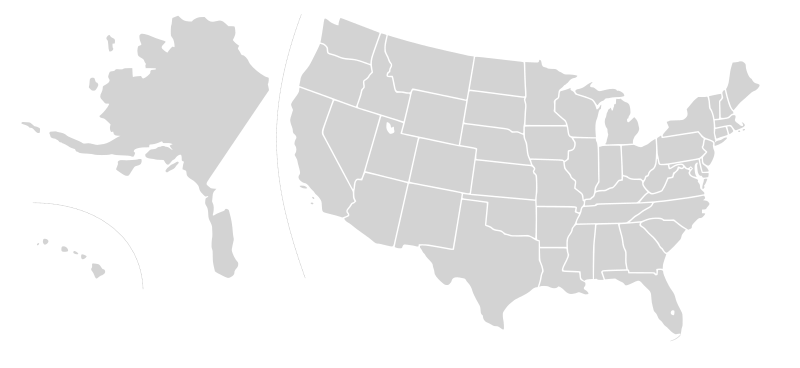
English: Blank SVG map of USA. Alaska and Hawaii have been moved closer to the mainland USA to reduce width of image.
Non-contiguous parts of a states/provinces are "grouped" together with the main area of the state/provinces, so any state/provinces can be coloured in completion with one click anywhere on the state/provinces's area. Also, all states/provinces have a "id" attached to them, making them easy to find. Select "find" and then enter in the state/provinces's ISO 3166-2 code in the "id" field to find it. The codes can be found here (Canada) and here (USA). |
| Date | 03-07-2007 edited 8-Aug-2007 |
| Source |
|
| Author |
Lokal_Profil's image edited to remove Canada and move Alaska and Hawaii closer by
Avenue. Original version by |
| Permission ( Reusing this file) |
This file is licensed under the
Creative Commons
Attribution-Share Alike 2.5 Generic license.
|
| Other versions |
Blank US Map.svg similar map with inset versions of Alaska and Hawaii (as opposed to actual size, which is what appears here), Labelled US map.svg same map with state labels Original blank map of USA and Canada, That image with labels, Original USA/Canada with Hawaii at the natural distance, Original USA/Canada map with labels, Canada blank map.svg blank map of Canada, Canada labelled map.svg labelled map of Canada |
| Annotations | This image is annotated: View the annotations at Commons |
File history
Click on a date/time to view the file as it appeared at that time.
| Date/Time | Thumbnail | Dimensions | User | Comment | |
|---|---|---|---|---|---|
| current | 07:40, 30 December 2008 |
| 1,850 × 850 (105 KB) | Avenue | without white space |
| 07:32, 30 December 2008 |
 | 2,289 × 1,744 (104 KB) | Avenue | New version that keeps Alaskan islands in the right place relative to the mainland | |
| 16:42, 9 August 2007 |
 | 1,730 × 800 (106 KB) | Rfc1394 | {{Information |Description={{en|Blank SVG map of USA. Hawaii has been moved closer to the mainland USA to reduce width of image.}} Non-contiguous parts of a states/provinces are "grouped" together with the main area of the state/provinces, so any state/pr |
File usage
More than 100 pages use this file. The following list shows the first 100 pages that use this file only. A full list is available.
- Talk:2003 California gubernatorial recall election
- Talk:2004 Washington gubernatorial election
- Talk:Adlai Stevenson II
- Talk:Al Smith
- Talk:Alexander Martin
- Talk:Alf Landon
- Talk:Alvan T. Fuller
- Talk:Ambrose Burnside
- Talk:Andrew L. Harris
- Talk:Arne Carlson
- Talk:Benjamin Franklin
- Talk:Benjamin Harrison V
- Talk:Bill Clinton
- Talk:Bill Janklow
- Talk:Bob Kerrey
- Talk:Bob Taft
- Talk:Brigham Young
- Talk:Bruce Babbitt
- Talk:Charles Pinckney (governor)
- Talk:Christine Todd Whitman
- Talk:DeWitt Clinton
- Talk:Earl Long
- Talk:Earl Warren
- Talk:Ed Rendell
- Talk:Francis P. Fleming
- Talk:Fritz Hollings
- Talk:Gary Johnson
- Talk:Gaylord Nelson
- Talk:George Clinton (vice president)
- Talk:George Deukmejian
- Talk:George W. Romney
- Talk:Gifford Pinchot
- Talk:Governor of California
- Talk:Hannibal Hamlin
- Talk:Howard Dean
- Talk:Israel Pickens
- Talk:Jacksonian democracy
- Talk:James Bowdoin
- Talk:James Monroe
- Talk:Jerry Brown
- Talk:Jesse Ventura
- Talk:Jim Guy Tucker
- Talk:Jim McGreevey
- Talk:John A. Burns
- Talk:John Ashcroft
- Talk:John D. Waiheʻe III
- Talk:John Engler
- Talk:John Forsyth (politician)
- Talk:John Hancock
- Talk:John Rutledge
- Talk:Jon Corzine
- Talk:Joseph Ritner
- Talk:Joshua Chamberlain
- Talk:Josiah Bartlett
- Talk:Juan Bautista de Anza
- Talk:Judy Martz
- Talk:Lamar Alexander
- Talk:Leland Stanford
- Talk:List of current United States governors
- Talk:List of governors of Alabama
- Talk:List of governors of California
- Talk:List of governors of Louisiana
- Talk:List of governors of Minnesota
- Talk:List of governors of Mississippi
- Talk:List of governors of New Jersey
- Talk:List of governors of New York
- Talk:List of governors of Tennessee
- Talk:Marcus Morton
- Talk:Martin Van Buren
- Talk:Neil Goldschmidt
- Talk:Nellie Tayloe Ross
- Talk:Nelson A. Rockefeller Center
- Talk:Nelson Rockefeller
- Talk:Oliver Wolcott
- Talk:P. B. S. Pinchback
- Talk:Pat Brown
- Talk:Patrick Henry
- Talk:Pete Wilson
- Talk:Preston Smith (governor)
- Talk:Rawlins Lowndes
- Talk:Ronald Reagan
- Talk:Roswell K. Colcord
- Talk:Salmon P. Chase
- Talk:Sam Houston
- Talk:Samuel Adams
- Talk:Samuel J. Tilden
- Talk:Sid McMath
- Talk:Spiro Agnew
- Talk:Stephen Decatur Miller
- Talk:Strom Thurmond
- Talk:Terry Branstad
- Talk:Thomas Bragg
- Talk:Thomas E. Dewey
- Talk:Thomas Jefferson
- Talk:Tim Pawlenty
- Talk:Tom McCall
- Talk:Tom Vilsack
- Talk:Tony Knowles (politician)
- Talk:Wally Barron
- Talk:William King (governor)
View more links to this file.