
Size of this PNG preview of this SVG file:
535 × 599 pixels. Other resolutions:
214 × 240 pixels |
429 × 480 pixels |
686 × 768 pixels |
914 × 1,024 pixels |
1,829 × 2,048 pixels |
1,400 × 1,568 pixels.
Original file (SVG file, nominally 1,400 × 1,568 pixels, file size: 151 KB)
| This is a file from the
Wikimedia Commons. Information from its
description page there is shown below. Commons is a freely licensed media file repository. You can help. |
Summary
| Description |
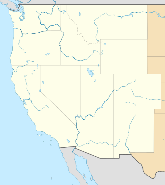
Deutsch: Positionskarte der westlichen Staaten der
USA
Quadratische Plattkarte, N-S-Streckung 130.0 %. Geographische Begrenzung der Karte: Equirectangular projection, N/S stretching 130.0 %. Geographic limits of the map:
|
| Date | |
| Source |
Own work
|
| Author | Alexrk2 |
| Other versions |
|


|
This map has been made or improved in the German
Kartenwerkstatt (Map Lab). You can
propose maps to improve as well.
|
Licensing
I, the copyright holder of this work, hereby publish it under the following license:
This file is licensed under the
Creative Commons
Attribution 3.0 Unported license.
- You are free:
- to share – to copy, distribute and transmit the work
- to remix – to adapt the work
- Under the following conditions:
- attribution – You must give appropriate credit, provide a link to the license, and indicate if changes were made. You may do so in any reasonable manner, but not in any way that suggests the licensor endorses you or your use.
File history
Click on a date/time to view the file as it appeared at that time.
| Date/Time | Thumbnail | Dimensions | User | Comment | |
|---|---|---|---|---|---|
| current | 11:59, 25 April 2010 |
| 1,400 × 1,568 (151 KB) | Alexrk2 | == {{int:filedesc}} == {{Information |Description= {{de|Positionskarte der westlichen Staaten der USA}} Quadratische Plattkarte, N-S-Streckung 130.0 %. Geographische Begrenzung der Karte: {{en|Location map of [[:en:Western United States|Wester |
File usage
The following pages on the English Wikipedia use this file (pages on other projects are not listed):
- 1947 flying disc craze
- 2017 Tournament of Nations
- 2024 Formula Car Challenge
- American West Football Conference
- Arcata–Eureka Airport
- Bellingham International Airport
- Bert Mooney Airport
- Canyonlands Regional Airport
- Casper–Natrona County International Airport
- Central Wyoming Regional Airport
- Cheyenne Regional Airport
- Disappearance of Susan Powell
- Eastern Sierra Regional Airport
- Eastern Washington University
- Elko Regional Airport
- Ernest A. Love Field
- Flight 105 UFO sighting
- Gillette–Campbell County Airport
- History of the Las Vegas Raiders
- Hoover Dam
- Laramie Regional Airport
- Lewiston–Nez Perce County Airport
- Magic Valley Regional Airport
- Mountain West Conference
- Pocatello Regional Airport
- Pullman–Moscow Regional Airport
- Redding Regional Airport
- Roberts Field
- Rogue Valley International–Medford Airport
- Sheridan County Airport
- Southwest Oregon Regional Airport
- Southwest Wyoming Regional Airport
- Topock Fire
- Vernal Regional Airport
- West Coast Hockey League
- Yellowstone Airport
- Yellowstone Regional Airport
- Talk:From the Muddy Banks of the Wishkah
- User:Fuzheado/sandbox/map
- User:Librarianpam/testpage2
- User:SounderBruce
- User:SounderBruce/Travel
- Module:Location map/data/USA West
- Module:Location map/data/USA West/doc
Global file usage
The following other wikis use this file:
- Usage on ar.wikipedia.org
- Usage on az.wikipedia.org
- Usage on ba.wikipedia.org
- Usage on bn.wikipedia.org
- Usage on ceb.wikipedia.org
- Usage on de.wikipedia.org
- Usage on eo.wikipedia.org
- Usage on fa.wikipedia.org
- Usage on fr.wikipedia.org
- Usage on he.wikipedia.org
- Usage on hy.wikipedia.org
- Usage on it.wikipedia.org
- Usage on ja.wikipedia.org
- Usage on kn.wikipedia.org
- Usage on ko.wikipedia.org
View more global usage of this file.