
Size of this preview:
800 × 533 pixels. Other resolutions:
320 × 213 pixels |
640 × 427 pixels |
1,024 × 683 pixels |
1,500 × 1,000 pixels.
Original file (1,500 × 1,000 pixels, file size: 540 KB, MIME type: image/jpeg)
| This is a file from the
Wikimedia Commons. Information from its
description page there is shown below. Commons is a freely licensed media file repository. You can help. |
| Description |
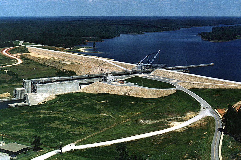
English: Aerial view of the Jamie Whitten Lock and Dam, formerly known as the Bay Springs Lock and Dam, on the Tennessee-Tombigbee Waterway in Tishomingo County, Mississippi, USA. The dam impounds Bay Springs Lake.
Coordinates:
34°31′22.48″N 88°19′25.03″W / 34.5229111°N 88.3236194°W |
|||
| Location | Tishomingo County, Mississippi, USA | |||
| Date | (Caveat: Dates provided by U.S. Army Corps of Engineers Digital Visual Library are not reliable and are often wrong.) | |||
| Source |
U.S. Army Corps of Engineers Digital Visual Library Image page Image description page Digital Visual Library home page |
|||
| Author | Adrien Lamarre, U.S. Army Corps of Engineers | |||
| Permission ( Reusing this file) |
|
File history
Click on a date/time to view the file as it appeared at that time.
| Date/Time | Thumbnail | Dimensions | User | Comment | |
|---|---|---|---|---|---|
| current | 15:00, 28 April 2007 |
| 1,500 × 1,000 (540 KB) | DanMS | {{Information | Description = {{en|Aerial view of the Jamie Whitten Lock and Dam, formerly known as the Bay Springs Lock and Dam, on the Tennessee-Tombigbee Waterway in Tishomingo County, Mississippi, USA. The dam impounds Bay Springs Lake.}} Coordinat |
File usage
The following pages on the English Wikipedia use this file (pages on other projects are not listed):
Global file usage
The following other wikis use this file:
- Usage on arz.wikipedia.org
- Usage on ceb.wikipedia.org
- Usage on www.wikidata.org