
Size of this preview:
672 × 600 pixels. Other resolutions:
269 × 240 pixels |
538 × 480 pixels |
860 × 768 pixels |
1,147 × 1,024 pixels |
2,294 × 2,048 pixels |
4,628 × 4,132 pixels.
Original file (4,628 × 4,132 pixels, file size: 5.86 MB, MIME type: image/jpeg)
| This is a file from the
Wikimedia Commons. Information from its
description page there is shown below. Commons is a freely licensed media file repository. You can help. |
Summary
| Description |
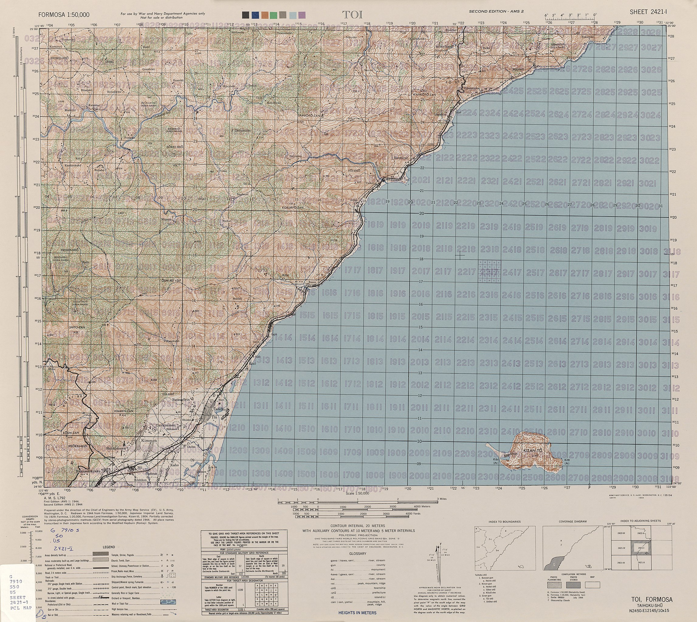
English: Map of
Toucheng (Tōi), Yilan, Taiwan from Formosa (Taiwan) 1:50,000 AMS Series L792 |
| Date | |
| Source | Courtesy of the University of Texas Libraries, The University of Texas at Austin. ( [1]) |
| Author | Army Map Serivce (CV), Corps of Engineers, 1944 |
-
 Index Map

![[1]](http://legacy.lib.utexas.edu/maps/ams/formosa/txu-pclmaps-oclc-6550514-toi-2421-i.jpg)
Licensing
This image or file is a work of a
U.S. Army Corps of Engineers soldier or employee, taken or made as part of that person's official duties. As a
work of the
U.S. federal government, the image is in the
public domain.
|
File history
Click on a date/time to view the file as it appeared at that time.
| Date/Time | Thumbnail | Dimensions | User | Comment | |
|---|---|---|---|---|---|
| current | 07:48, 20 October 2019 |
| 4,628 × 4,132 (5.86 MB) | Geographyinitiative | User created page with UploadWizard |
File usage
The following pages on the English Wikipedia use this file (pages on other projects are not listed):