Size of this preview:
754 × 600 pixels. Other resolutions:
302 × 240 pixels |
604 × 480 pixels |
942 × 749 pixels.
Original file (942 × 749 pixels, file size: 166 KB, MIME type: image/jpeg)
| This is a file from the
Wikimedia Commons. Information from its
description page there is shown below. Commons is a freely licensed media file repository. You can help. |
.jpg)
| Description |
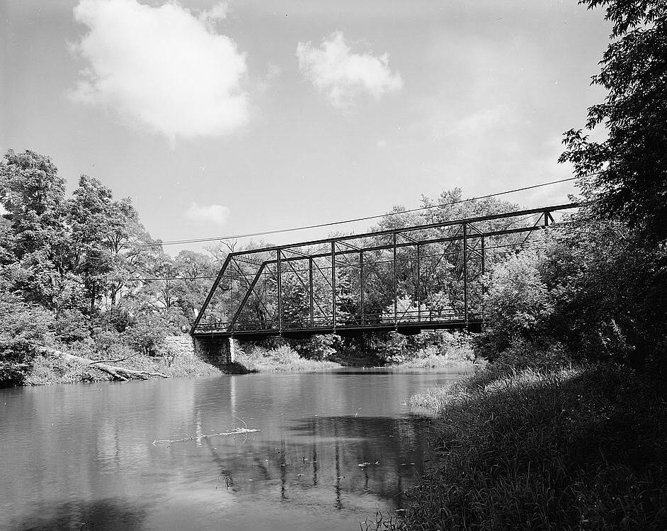
English: Turtleville Iron Bridge, Spanning Turtle Creek, on Lathers Road, Beloit vicinity (Rock County, Wisconsin)
|
||||||
| Date | |||||||
| Source | http://memory.loc.gov/pnp/habshaer/wi/wi0100/wi0133/photos/171480pv.jpg (cropped) | ||||||
| Author | Jeff Dean, Photographer | ||||||
| Permission ( Reusing this file) |
|
.jpg¶ms=042.565556_N_-088.964444_E_globe:Earth_class:object_region:US_type:landmark_scale:1500_&language=en)
File history
Click on a date/time to view the file as it appeared at that time.
| Date/Time | Thumbnail | Dimensions | User | Comment | |
|---|---|---|---|---|---|
| current | 20:13, 22 January 2010 |
| 942 × 749 (166 KB) | KudzuVine | {{Information |Description={{en|1=Turtleville Iron Bridge, Spanning Turtle Creek, on Lathers Road, Beloit vicinity (Rock County, Wisconsin) cropped {{PD-USGov-NPS-HAER|WIS,53-BELO.V,1-1}}}} |Source=http://memory.loc.gov/pnp/habshaer/wi/wi0100/wi0133/photo |
File usage
The following pages on the English Wikipedia use this file (pages on other projects are not listed):
Global file usage
The following other wikis use this file:
- Usage on de.wikipedia.org
- Usage on www.wikidata.org
.jpg)