
Size of this PNG preview of this SVG file:
800 × 523 pixels. Other resolutions:
320 × 209 pixels |
640 × 419 pixels |
1,024 × 670 pixels |
1,280 × 837 pixels |
2,560 × 1,674 pixels |
1,029 × 673 pixels.
Original file (SVG file, nominally 1,029 × 673 pixels, file size: 276 KB)
| This is a file from the
Wikimedia Commons. Information from its
description page there is shown below. Commons is a freely licensed media file repository. You can help. |
| Description |
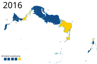
English: Location map of electoral results in the
Turks and Caicos Islands
Equirectangular projection, N/S stretching. Geographic limits of the map:
|
| Date | |
| Source | Map: Turks and Caicos Islands location map.svg, boundaries: [1]. Results from Wikipedia page. |
| Author | RaviC, Carport(original) |
| Permission ( Reusing this file) |
This file is licensed under the
Creative Commons
Attribution-Share Alike 3.0 Unported license.
|
File history
Click on a date/time to view the file as it appeared at that time.
| Date/Time | Thumbnail | Dimensions | User | Comment | |
|---|---|---|---|---|---|
| current | 15:55, 20 March 2021 |
| 1,029 × 673 (276 KB) | RaviC | updated colours |
| 13:07, 17 May 2017 |
 | 1,029 × 673 (277 KB) | RaviC | {{Information |Description= {{en|Location map of electoral results in the {{w|Turks and Caicos Islands}} }} Equirectangular projection, N/S stretching. Geographic limits of the map: * N: 22.10° N * S: 21.14° N * W: 72.60° W * E: 71.00° W |Source=Ma... |
File usage
The following pages on the English Wikipedia use this file (pages on other projects are not listed):