
Size of this PNG preview of this SVG file:
800 × 508 pixels. Other resolutions:
320 × 203 pixels |
640 × 407 pixels |
1,024 × 650 pixels |
1,280 × 813 pixels |
2,560 × 1,626 pixels |
1,483 × 942 pixels.
Original file (SVG file, nominally 1,483 × 942 pixels, file size: 121 KB)
| This is a file from the
Wikimedia Commons. Information from its
description page there is shown below. Commons is a freely licensed media file repository. You can help. |
Summary
| Description |
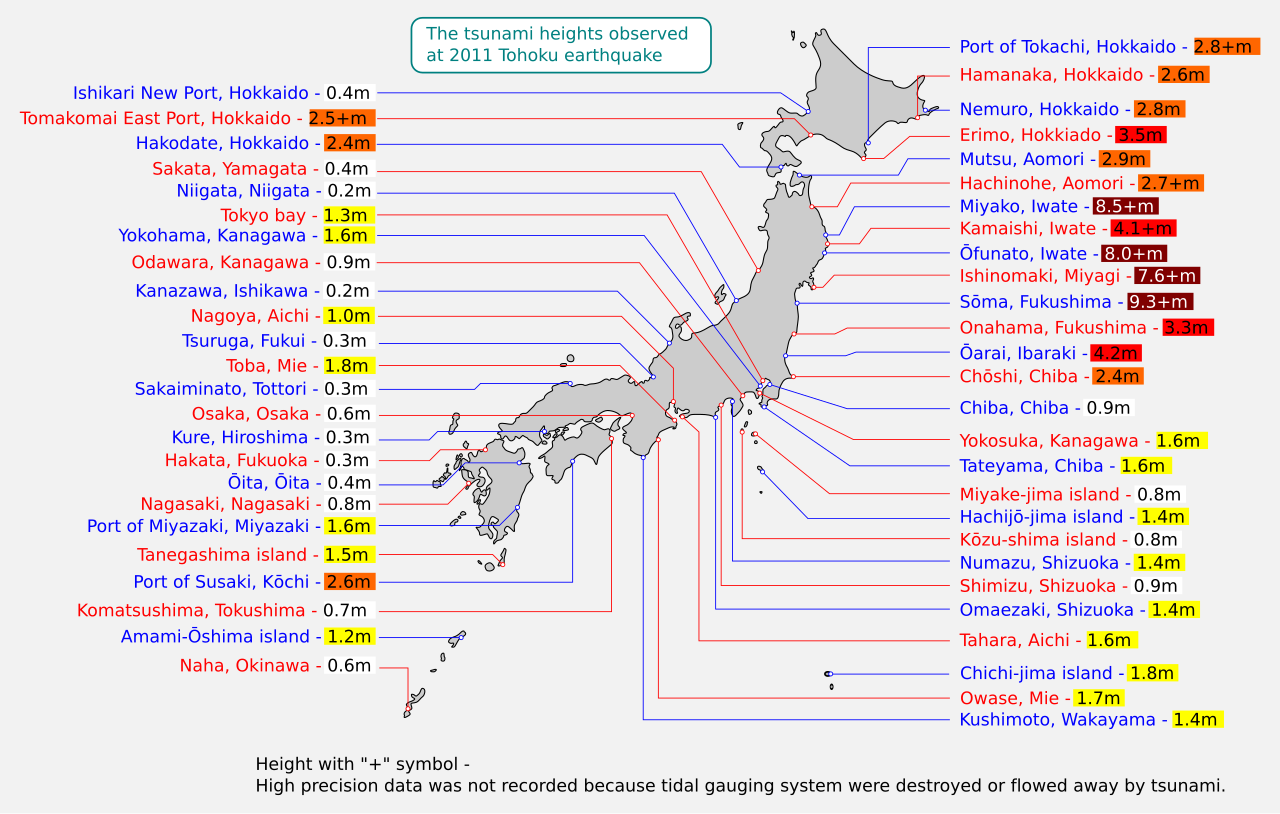
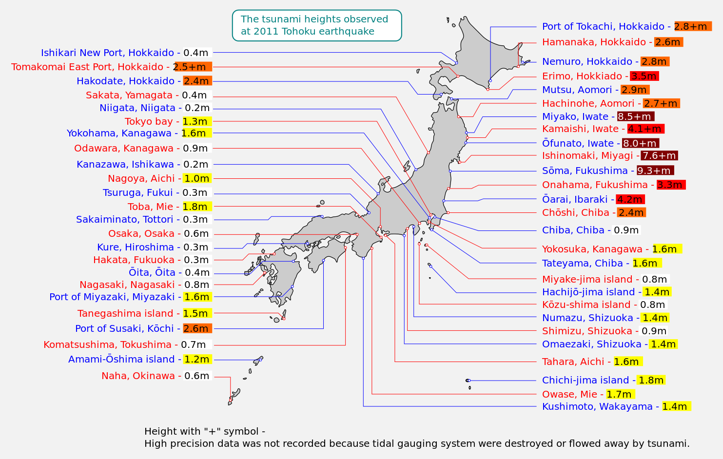
English: Map of 2011 Tohoku(Sendai) earthquake observed tsunami heights in Japan.
日本語: 東北地方太平洋沖地震で観測された、日本各地の津波の高さ(英語版)。 |
||
| Date | |||
| Source | JMA 1, 2, 3, 4 | ||
| Author | Eastwind41 | ||
| Other versions | |||
| Additional information | This file is vectorised version of
File:2011 Tohoku earthquake observed tsunami heights en.png.
This W3C-unspecified
vector image was created with
Inkscape . W3C-validity not checked. |

Licensing
| I, the copyright holder of this work, release this work into the
public domain. This applies worldwide. In some countries this may not be legally possible; if so: I grant anyone the right to use this work for any purpose, without any conditions, unless such conditions are required by law. |
File history
Click on a date/time to view the file as it appeared at that time.
| Date/Time | Thumbnail | Dimensions | User | Comment | |
|---|---|---|---|---|---|
| current | 11:44, 25 June 2013 |
| 1,483 × 942 (121 KB) | Eastwind41 | {{Information |Description ={{en|1=Map of 2011 Tohoku(Sendai) earthquake observed tsunami heights in Japan.}} {{ja|1=東北地方太平洋沖地震で観測された、日本各地の津波の高さ(英語版)。}} |Source =JMA[http://www.jm... |
File usage
The following pages on the English Wikipedia use this file (pages on other projects are not listed):
Global file usage
The following other wikis use this file:
- Usage on si.wikipedia.org