
Size of this PNG preview of this SVG file:
765 × 600 pixels. Other resolutions:
306 × 240 pixels |
612 × 480 pixels |
980 × 768 pixels |
1,280 × 1,004 pixels |
2,560 × 2,007 pixels |
820 × 643 pixels.
Original file (SVG file, nominally 820 × 643 pixels, file size: 1.26 MB)
| This is a file from the
Wikimedia Commons. Information from its
description page there is shown below. Commons is a freely licensed media file repository. You can help. |
Summary
| Description |
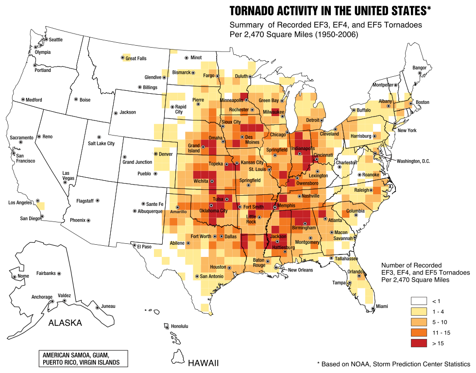
English: A map of the frequency of F3 and greater intensity tornadoes by area. The darker colors highlight the areas typically known as a Tornado Alley. |
| Date | |
| Source | Image from Federal Emergency Management Agency, a United States government agency, booklet FEMA 320 Third Edition, Section 1, Figure 1.1, page 3, titled Taking Shelter from the Storm: Building a Safe Room Inside your House |
| Author | FEMA personnel |
Licensing
This image is a work of a
Federal Emergency Management Agency employee, taken or made as part of that person's official duties. As
works of the
U.S. federal government, all FEMA images are in the
public domain in the United States. Additional media usage information may be found at
https://www.fema.gov/photo-video-audio-use-guidelines
|
File history
Click on a date/time to view the file as it appeared at that time.
| Date/Time | Thumbnail | Dimensions | User | Comment | |
|---|---|---|---|---|---|
| current | 23:31, 20 May 2017 |
| 820 × 643 (1.26 MB) | Qwewqa | Rotate and add margins |
| 23:03, 20 May 2017 |
 | 651 × 801 (1.24 MB) | Qwewqa | Fix background | |
| 22:56, 20 May 2017 |
 | 651 × 801 (1.28 MB) | Qwewqa | User created page with UploadWizard |
File usage
The following pages on the English Wikipedia use this file (pages on other projects are not listed):
Global file usage
The following other wikis use this file:
- Usage on bg.wikipedia.org
- Usage on br.wikipedia.org
- Usage on el.wikipedia.org
- Usage on he.wikipedia.org
- Usage on th.wikipedia.org
- Usage on zh.wikipedia.org