
Size of this preview:
800 × 470 pixels. Other resolutions:
320 × 188 pixels |
640 × 376 pixels |
1,024 × 601 pixels |
1,400 × 822 pixels.
Original file (1,400 × 822 pixels, file size: 747 KB, MIME type: image/jpeg)
| This is a file from the
Wikimedia Commons. Information from its
description page there is shown below. Commons is a freely licensed media file repository. You can help. |
Summary
| Description |
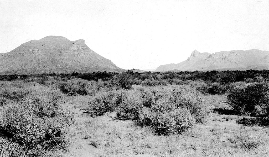
English: Threemile Mountain (on the left) showing Van Horn sandstone overlain by Hueco limestone. Looking northwest. In the mountain at the right Van Horn sandstone is overlain by El Paso limestone. Culberson County, Texas. 1913. Plate 8 in U.S. Geological Survey Folio 194. 1914. |
| Date | |
| Source | Van Horn folio, Texas (1914). U.S. Geological Survey, Folios of the Geologic Atlas 194, Plate 8 |
| Author | George Burr Richardson |
Licensing
This image is in the
public domain in the United States because it only contains materials that originally came from the
United States Geological Survey, an agency of the
United States Department of the Interior. For more information, see
the official USGS copyright policy.
|
File history
Click on a date/time to view the file as it appeared at that time.
| Date/Time | Thumbnail | Dimensions | User | Comment | |
|---|---|---|---|---|---|
| current | 04:38, 31 August 2008 |
| 1,400 × 822 (747 KB) | Leaflet | {{Information |Description={{en|1=Threemile Mountain (on the left) showing Van Horn sandstone overlain by Hueco limestone. Looking northwest. In the mountain at the right Van Horn sandstone is overlain by El Paso limestone. Culberson County, Texas. 1913. |
File usage
The following pages on the English Wikipedia use this file (pages on other projects are not listed):